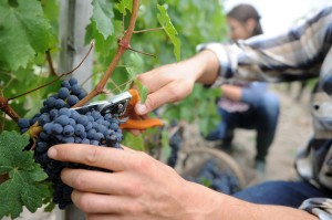
Landsat Thermal Data Provides Insight to Vintners
Landsat thermal bands allow for the measurement of water use and moisture status at the management scale.

Landsat thermal bands allow for the measurement of water use and moisture status at the management scale.
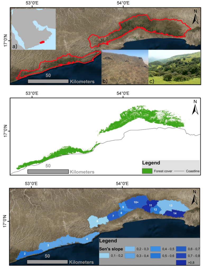
Learn more about this rather unusual seasonal and semi-arid cloud forest.
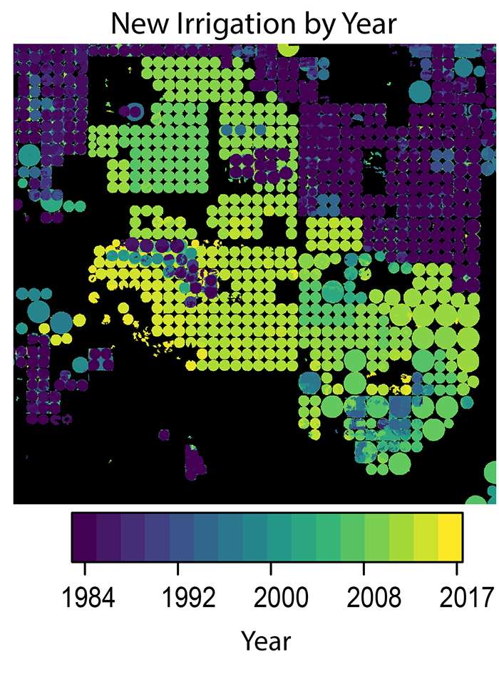
A new method to use the full Landsat archive to produce annual maps of irrigated area over the High Plains Aquifer in the central United States.