
Q&A series conducted by Kate Ramsayer
Bruce Cook
Landsat Next Project Scientist
NASA’s Goddard Space Flight Center
How do you use Landsat?
I use Landsat data as part of a joint U.S. Department of Agriculture/NASA effort to inventory all forest lands in interior Alaska.
We use a combination of ground plot measurements, airborne observations, and Landsat data that allows us to answer questions about large swaths of remote forests based on what we know about smaller segments of it.
Studies like this help us understand how forests are changing in response to climate change, fires, drought and insects, and also examine how the ecosystem supports local communities.
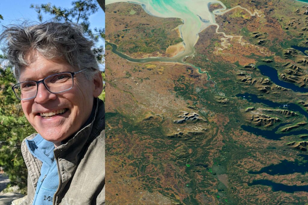
What’s one Landsat image that is significant to you, and why?
Alaska can be very cloudy and the growing season is very short, so acquiring clear Landsat imagery often requires a bit of luck.
When you get cloud-free scenes like this one, though, the images are incredible. They include so much of everything – vegetated/non-vegetated land cover, disturbances due to burning and insect outbreaks, glaciers, meltwater streams, countless lakes (some associated with melting permafrost), meandering streams and oxbows, river deltas and more.
This summer, we’re flying instruments with the G-LiHT (Goddard’s Lidar, Hyperspectral and Thermal infrared imaging) mission over this region around Dillingham, Alaska, seen here with its fall colors.


