
Q&A series conducted by Kate Ramsayer
Jim Irons
Director Emeritus Earth Sciences Division
NASA Goddard Space Flight Center
How do you use Landsat?
I worked at Goddard Space Flight Center for 43 years. A great deal of my career was spent engaged in the Landsat program.
For my master’s thesis I used Landsat 3 data to map surface mines and surface mine recovery in Pennsylvania, and then I was fortunate enough to get a position at Goddard Space Flight Center initially to work on applications of Landsat data.
I spent a few years doing research on other topics, and then I became the project scientist for what’s now Landsat 8, originally called the Landsat Data Continuity Mission, and then went through a series of management positions and ended up the director of Goddard’s Earth Sciences Division before retiring.
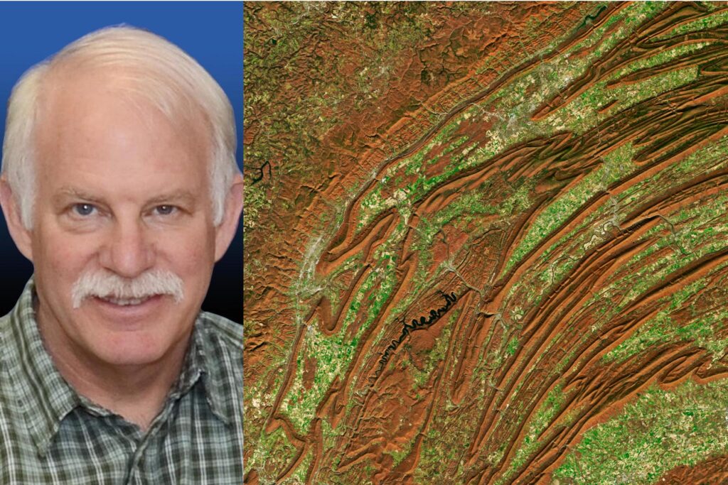
What’s one Landsat image that’s significant to you, and why?
An early image that struck me and got my attention was an image of the ridge and valleys around Harrisburg, Pennsylvania. To look at the folds of those mountains and appreciate how beautiful it was where I lived and went to school at the time.
We’ve spent a lot of time focusing on anthropogenic changes and damage to the Earth using Landsat data, and rightly so because there’s a lot of concerns about that. And sometimes, we forget about the awe of just looking back at Earth from space, observing the natural and intrinsic beauty of our own planet.


