Q&A series conducted by Kate Ramsayer
Morgan A. Crowley
Forest Fire Research Scientist &
WildFireSat Tier 2 Science Lead
Canadian Forest Service
Co-Director of Ladies of Landsat
How do you use Landsat?
In my Ph.D. research at McGill University in Canada, I used Landsat data to map fire progressions for Canadian wildfires. I leveraged the fine spatial scale of Landsat in a multi-sensor data fusion algorithm in Google Earth Engine.
In my current role with the Canadian Forest Service, I use Landsat’s high-quality, fine spatial scale observations to contextualize the sub-daily observations from satellites like MODIS, GOES and VIIRS for active fire monitoring.
What’s one Landsat image that is significant to you, and why?
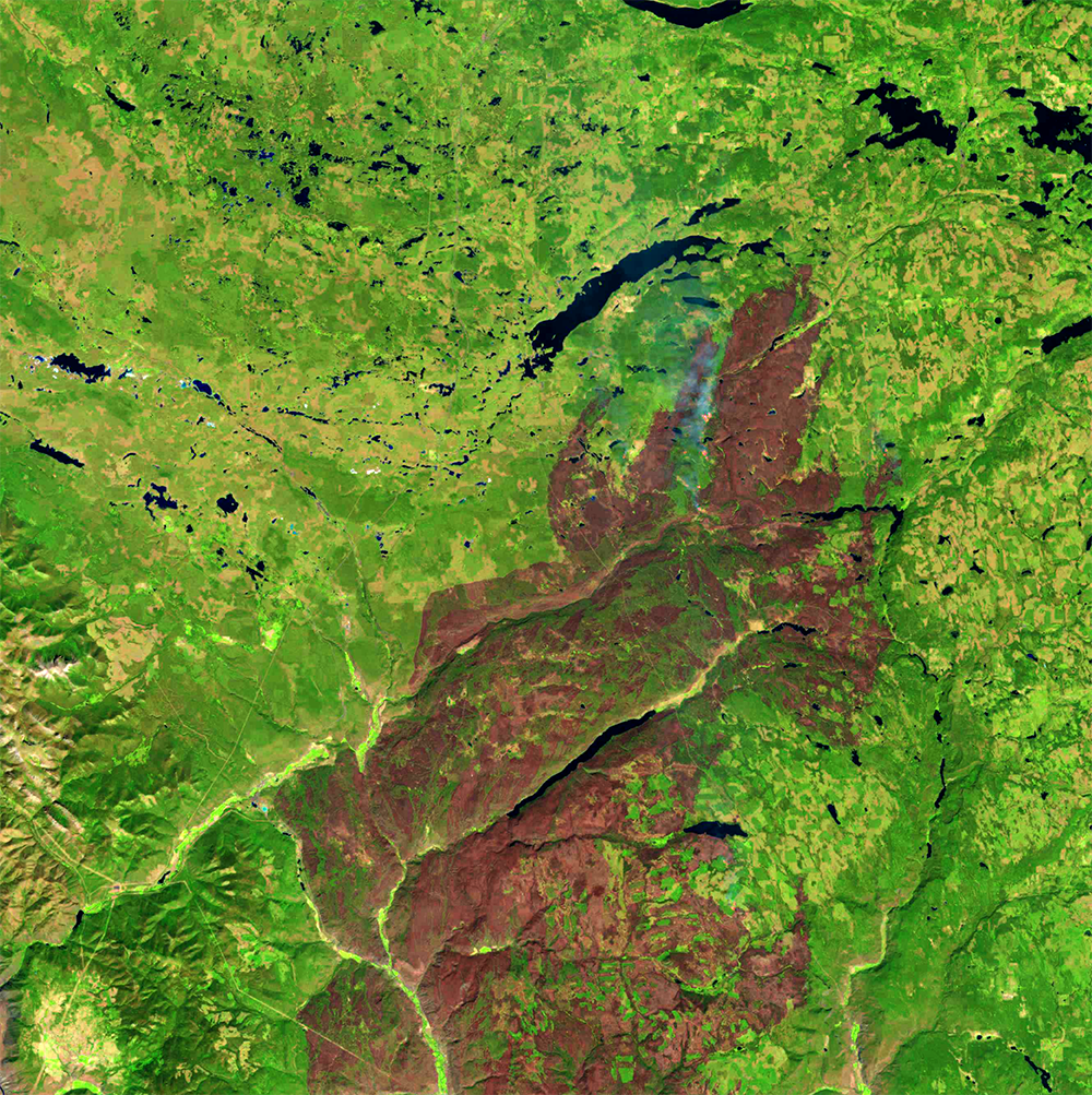
The most significant Landsat image captures the burned area of the Elephant Hill Fire, which burned in the 2017 fire season near Kamloops, British Columbia.
I used this image in my initial prototype using a Bayesian data synthesis approach for data from Landsat-8, Sentinel-2, and MODIS.
This image illustrates the strengths of Landsat-8 as it captures the fire line and smoke when you zoom in on the northern extent of the actively burning fire. Additionally, the fine spatial resolution provided by Landsat can help users identify the unburned regions within the fire boundaries.