

Presentation title:
The USGS Landsat Snow Covered Area Science Data Products
What are the major findings of your research?
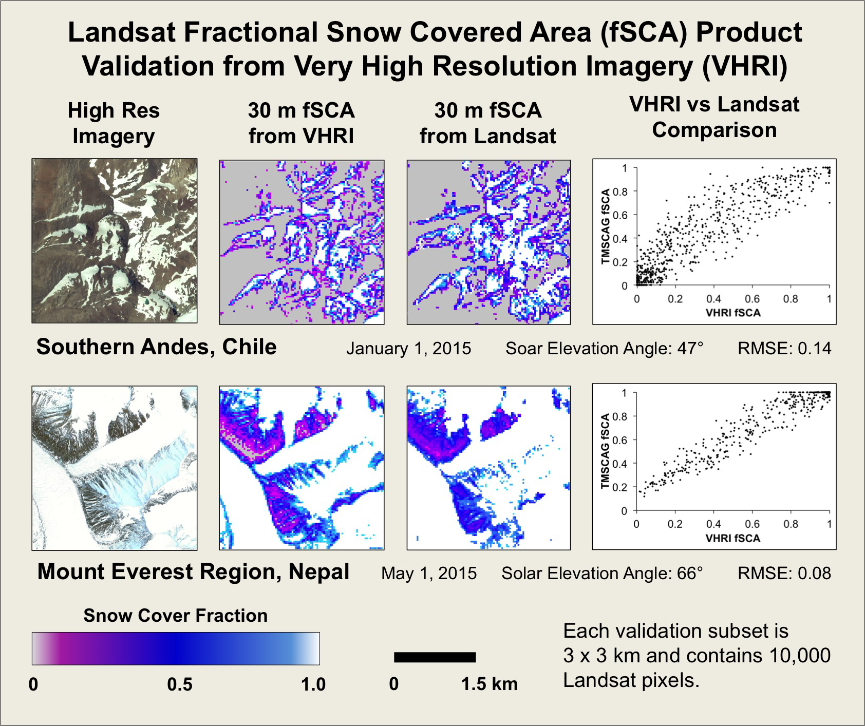
Our major finding is that Landsat TM, ETM+, and OLI data can be used to accurately map fractional snow covered area across a wide range of environments. The snow covered area product can be used to provide current and historical information about snow cover at 30 m spatial resolution.
Who are the major users of the USGS Landsat Snow Covered Area Science Data?
We are currently at the stage where we can process and deliver the product upon request, but don’t yet have a large user base. We expect the users will be primarily hydrologists, glaciologists, and climate scientists. The product may also be helpful for ecologists or wildlife biologists who focus on arctic and alpine ecosystems and species.
What type of user applications does this data set support?
We expect the product will be helpful for historical analysis of snow cover, glacier monitoring, and potentially water supply forecasting (when combined with models).
Do you consider the Landsat data archive an important resource?
The data archive is critical for this product. Unlike most other applications that make use of Landsat data, snow cover extent changes on a daily basis, and consequently the product is most useful when you can look at all available scenes acquired over a period of years, rather than data from a single scene.
Editor’s note: This new snow cover product will be available online in the coming months, in the interim, users can contact Selkowitz directly.
Anyone can freely download Landsat data from the USGS EarthExplorer or LandsatLook.
Further Reading:
+ Landsat at #AGU15


