
Scenes from the Polar Night
Landsat satellites have begun regularly acquiring images of ice at the poles during the winter, with enlightening results.

Landsat satellites have begun regularly acquiring images of ice at the poles during the winter, with enlightening results.
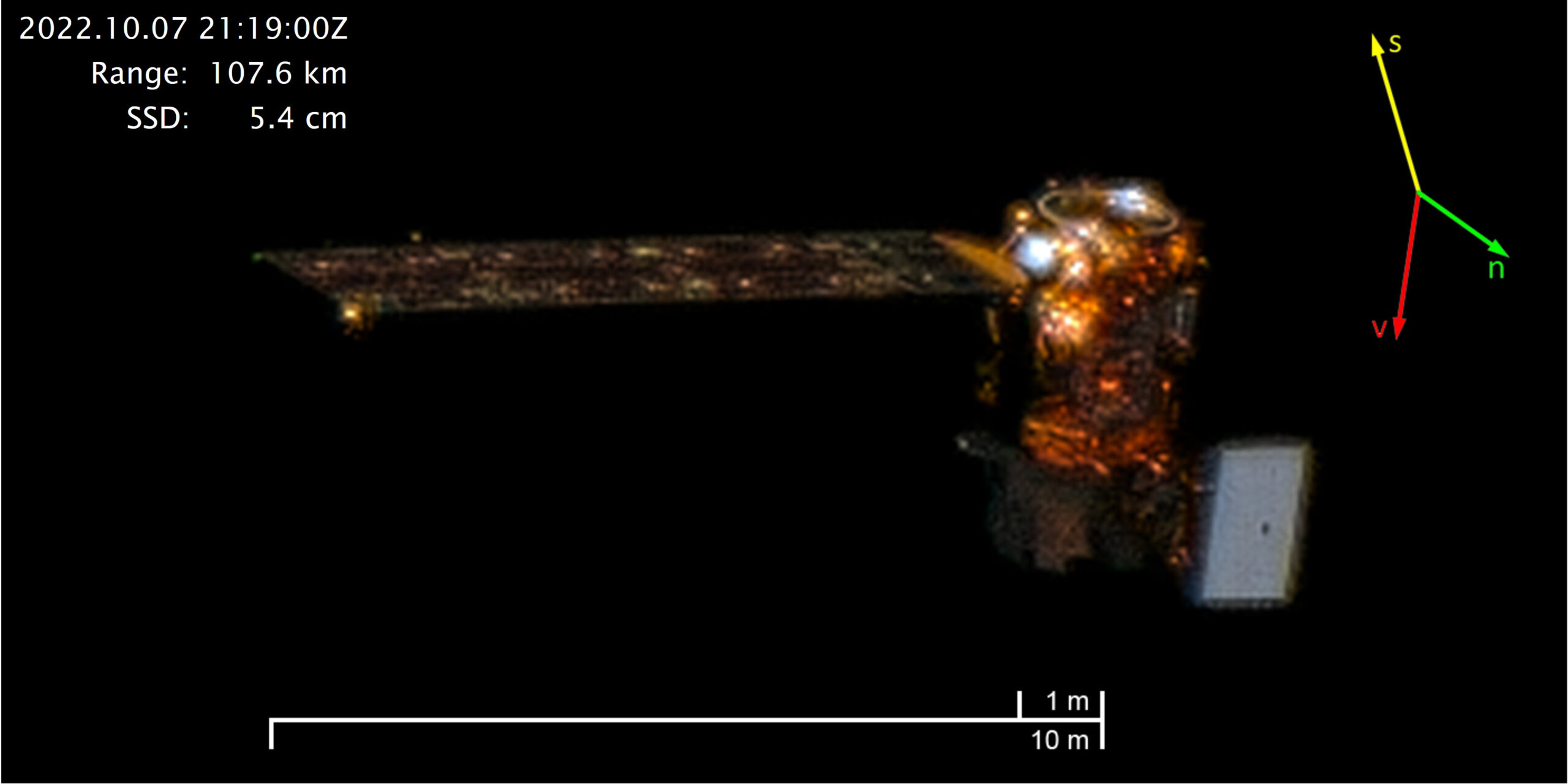
On October 7, 2022, Maxar’s WorldView-3 satellite snapped a sequence of images showing Landsat 8 in orbit.
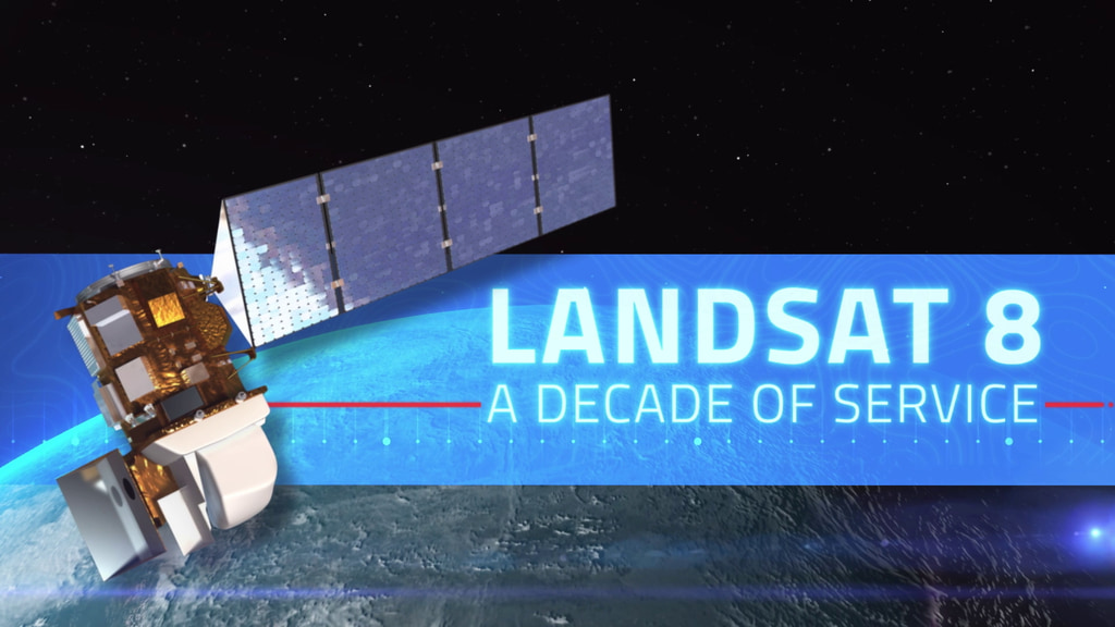
This February marks the 10th anniversary of the launch of Landsat 8, launched by NASA in 2013 and operated by the US Geological Survey.
In Beck’s “Hyperlife” video, the abstract beauty of our planet morphs from geographic location-to-location with the flow of the etherial track.

Aaron Gerace and Matthew Montanaro earned the 2019 USGIF Academic Achievement Award for their work on the Landsat 8 TIRS stray-light issue.
Landsat 8 continues a streak of engineering and science success unmatched in spaceflight.
An advanced photodetector camera that traces its heritage to one now flying on Landsat 8 is being studied as a potential payload on a conceptual satellite (CapSat) system purposely designed to take advantage of the expected boom in secondary-payload launch opportunities.
The band-average out-of-band spectral responses of the Operational Land Imager (OLI) are provided in this spreadsheet.
It’s hard to believe a year has passed since the launch of Landsat 8. This first anniversary is going to be an exciting, upbeat celebration because the new satellite is meeting, if not exceeding, all expectations. “Landsat 8 is nearly perfect,” said Jim Lacasse, Landsat Operations and Maintenance Project Manager. “We’re getting really high quality data.”
Within the next several weeks, all Landsat 8 data that have been acquired since achieving WRS-2 operational orbit will be reprocessed using updated calibration parameters for OLI and TIRS data. During this time, all online products will be purged and the online inventory will be re-populated.
The USGS is also developing the DPAS to manage the mission data transmitted from the LDCM observatory. The DPAS will be operated at EROS along with the rest of its Landsat data archive and it will consist of several subsystems: Storage and Archive (SA), Ingest System (IS), Subsetter System (SS), Image Assessment System (IAS), Level 1 Product Generation System (LPGS), and User Portal (UP). These subsystems will work together to ingest, store, and archive LDCM data and will also generate LDCM data products for distribution.
A flight operations team (FOT) will operate two computer systems within the MOC, the Collection Activity Planning Element (CAPE) and the Mission Operations Element (MOE). The CAPE will plan science data collection by building activity requests for the LDCM imaging sensors each day. The MOE will translate the activity requests into software command loads transmitted to the observatory.
The Landsat 8 Ground System includes all of the ground-based assets needed to operate the Landsat 8 observatory. The primary components of the Ground System are the Mission Operations Element, Collection Activity Planning Element, Ground Network Element, and the Data Processing and Archive System.
The band-average relative spectral radiance responses of the Operational Land Imager (OLI) are provided.
BATC has conducted robust testing of OLI performance in accordance with their proposal and contract. These prelaunch tests indicate that OLI performance meets specification with requirements exceeded in most cases.
< OLI Requirements Pre-launch OLI Performance > The OLI is a push broom sensor employing a focal plane with long arrays of photosensitive detectors
< Operational Land Imager (OLI) OLI Design > The OLI requirements specified a sensor that collects image data for nine spectral bands with a
< TIRS Design In-Band, Band-Average Relative Spectral Response The band-average relative spectral radiance responses of the Thermal Infrared Sensor (TIRS) are provided here. These
< TIRS Requirements TIRS Relative Spectral Response > Like OLI, TIRS is also a push broom sensor employing a focal plane with long arrays
< Thermal Infrared Sensor TIRS Design > TIRS requirements are specified in a manner similar to the OLI requirements. The specifications require TIRS to
The LDCM observatory will launch from Space Launch Complex-3E at Vandenberg Air Force Base aboard an Atlas V 401 launch vehicle built by the United
TIRS Requirements > The Thermal Infrared Sensor (TIRS) measures land surface temperature in two thermal bands with a new technology that applies quantum physics to
OLI Requirements > The Operational Land Imager (OLI), built by the Ball Aerospace & Technologies Corporation, measures in the visible, near infrared, and short wave
< Spacecraft The spacecraft will supplies power, orbit and attitude control, communications, and data storage for OLI and TIRS. The spacecraft consists of the
Spacecraft Design > Landsat 8 consist of two major segments: the observatory and the ground system. The observatory consists of the spacecraft bus and its
Have you ever wondered what it might be like to watch the world fly by beneath you from space? That dream is elusive for most of us, but the Landsat Data Continuity Mission offers a vicarious flight with a crisper view than our eyes alone would be capable of if we were in space. That view is now available in a new NASA animation.
Landsat 1 • Landsat 2 • Landsat 3 • Landsat 4 • Landsat 5 • Landsat 6 • Landsat 7 • Landsat 8 Landsat 8 launched on February 11, 2013, from Vandenberg Air Force Base, California, on an
