A mosaic of Landsat Thematic Mapper (TM) images with overlays of aerial photography flightlines (N-S lines) and boundaries of physiographic strata was created to help inventory the forests of Minnesota. The image data for the project consisted of portions of six Landsat TM scenes. Data were collected between 5/29/88 and 6/14/88, with scenes along the same path being collected on the same day. All images were virtually cloud free, with any clouds occurring outside of the study area; however, haze was observed over water bodies within the path 26, row 26 scene covering the northeast portion of the study area.
All scenes were rectified to the UTM (zone 15) projection and coordinate system using a nearest neighbor resampling scheme to preserve the original digital numbers. Rectification allowed for relatively easy overlay of reference data sets for training and accuracy assessment.
Because of the inherent problems of working across scenes of differing acquisition dates (changes in atmosphere, sun angle, and phenology), processing was limited to within scene (or path) processing. Consequently, three separate image data sets were processed; they were merged only as classified (GIS) files.

For further details, see: Bauer, M.E., T.E. Burk, A.R. Ek, P.R. Coppin, S.D. Lime, T.A. Walsh, D.K. Walters, W. Befort, and D.F. Heinzen: “Satellite Inventory of Minnesota Forest Resources”, Photogrammetric Engineering and Remote Sensing, 60(3):287-298, 1994.
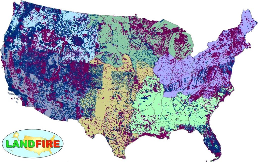
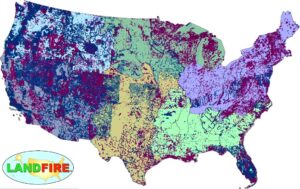
LANDFIRE Remap Is Here
LANDFIRE has released its Remap dataset; new techniques and new data provide significant improvement.