By Madeleine Gregory
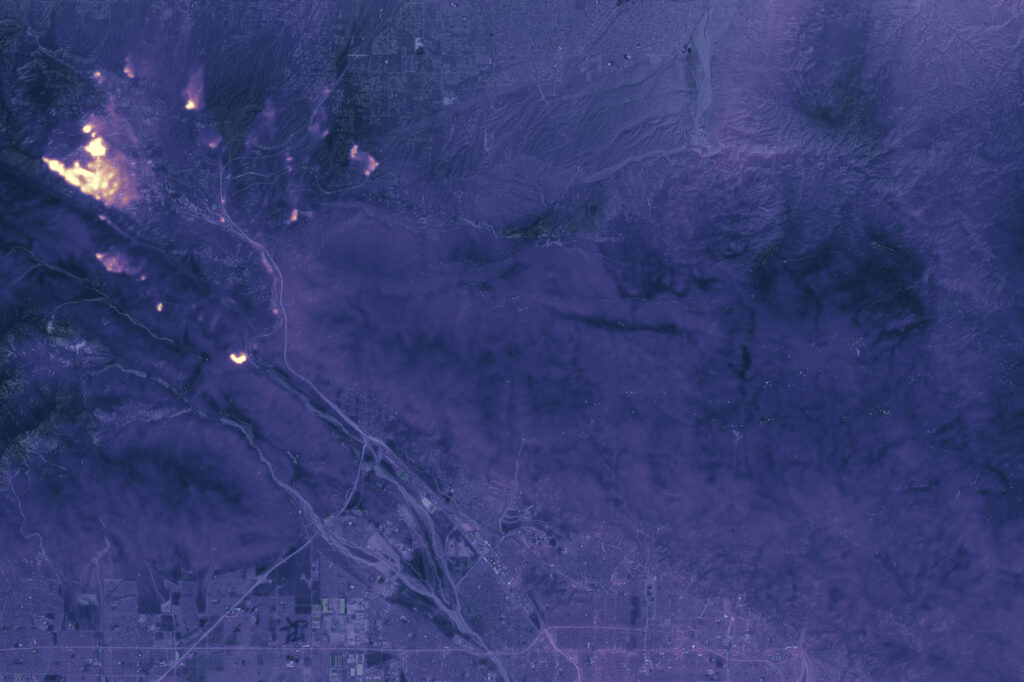
As wildfires have continued to burn larger and longer in western North America, scientists and firefighters often find themselves searching for a break in the heat. Historically, this has come at night: a cooler, wetter portion of the day when burning has slowed or stopped, allowing fires to shrink and firefighters to catch their breath. Now, researchers have found that more fires are burning through the night, which could lead to even bigger, longer-lasting fires.
In a study published in March in Nature, researchers in Canada combined geostationary satellite data with Landsat-based fire datasets to identify “overnight burning events” and assess contributing factors. With active fire information from geostationary satellites, hourly weather inputs, and wildfire perimeter and extent information from Landsat-informed databases, the researchers examined the hourly cycle of over 20,000 fires from 2017 to 2020 and found 1,095 overnight burns. Next, they used a random forest model to analyze key variables of fire weather to determine what fosters overnight burning. They found that two of the strongest predictors were how much fuel had built up and how dry it was, both of which are related to drought conditions. From this, they concluded that drought is a main driver of fires burning through the night.
Once they had identified the variables most correlated with overnight burning, the researchers created a model to test how well they could predict a nighttime fire. Feeding these models one or several variables, they were able to accurately predict when a fire would burn through the night. In the best model, 82.6% of overnight burning events were correctly predicted.
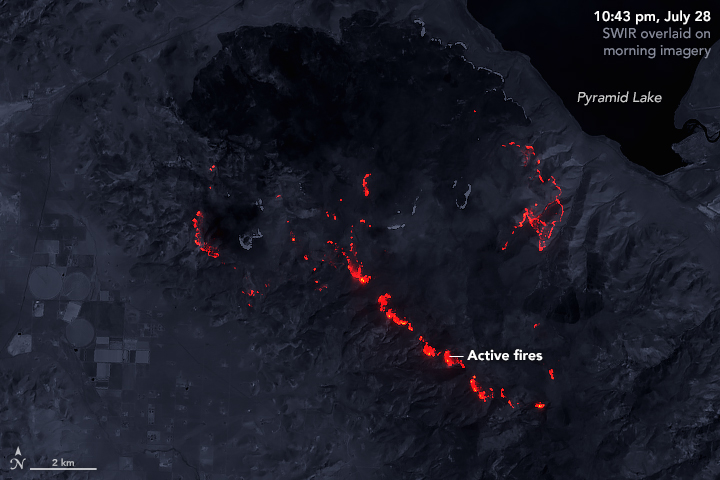
For their analysis, the team used the Canadian National Burned Area Composite (NBAC), the USA Monitoring Trends in Burn Severity (MTBS) and the Combined Wildland Fire Polygons (CWFP) datasets. NBAC is derived from Landsat imagery and MTBS uses images from Landsat and Sentinel-2, relying on their high spatial resolution to measure the size and intensity of wildfires. Researchers combined these datasets—which provide start and end dates for fires, burn severity, and burn extent—with active fire data from GOES-16 and GOES-17, geostationary satellites with high temporal resolution.
“Without a high-precision satellite like Landsat to map fire perimeters, large-scale, long-term, and fire event-based analyses across vast areas like North America would be quite challenging if not impossible,” co-authors Kaiwei Luo and Xianli Wang said in an email.
The team found that large fires were far more likely to burn overnight. Of the 1,095 overnight burning events they found, 99% of these occurred in fires over the size of 1,000 hectares. Importantly, these are the fires that tend to do the most damage. Though only 10% of fires that burned in North America from 2017 to 2020 were classified as “large” by this metric, these fires were responsible for 90% of the total burned area in that time. These fires tend to start burning overnight soon after ignition, and often burn for multiple consecutive nights.
The study authors warned that the changing state of nighttime flammability could lead to a “tipping point,” where the absence of a break in fire activity could allow fires to self-perpetuate, wriggling out of control of firefighters more often. They emphasize the importance of further research on nighttime fire activity, as most research on wildfires happens at the annual or seasonal scale. To that end, the improved spatial and temporal resolution of Landsat Next mission, set to launch in 2031, will enable more effective monitoring of wildfires—especially when, as in this study, it is used in combination with data from other satellite missions.
Reference
Luo, K.; Wang, X.; de Jong, M.; Flannigan, M. Drought Triggers and Sustains Overnight Fires in North America. Nature 2024, 627 (8003), 321–327. https://doi.org/10.1038/s41586-024-07028-5