
Tim Assal is a spatial ecologist at the USGS Fort Collins Science Center in Colorado. He combines his field work with satellite image processing and computer modeling to figure out the why, when, and where of land cover change happening around the world—all in an effort to put needed information into the hands of the resource managers and policy makers trying to keep this planet a healthy habitat for humans.
In late September, Dr. Assal wrote about his most recent journal paper on his blog. Here is what he shared:
Sept. 30, 2018
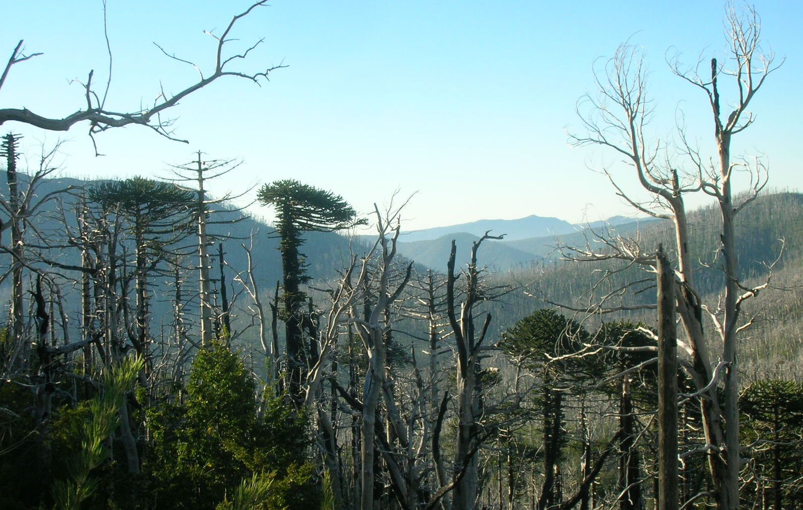
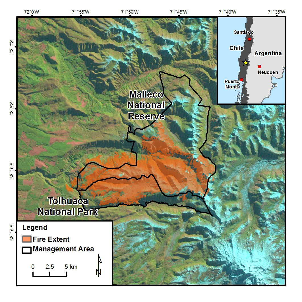
In our new paper, published in the Journal of Biogeography, we investigate postfire regeneration patterns of Araucaria-Nothofagus forests on the west slope of the Andes Mountains in the Araucanía region of Chile. Specifically, we:
(a) used satellite data and ground measurements to evaluate the relationship between remotely sensed burn severity and forest mortality; and
(b) assessed controls of burn severity on forest regeneration at local spatio‐temporal scales.
The paper is a product of a collaboration with Colorado State University (Jason Sibold) and the and Universidad Austral de Chile (Mauro González).
We think this work is noteworthy because:
(1) to our knowledge this is the first study that connects field-measured data with satellite-derived burn severity in this corner of the world;
(2) one of the primary species of study, Araucaria araucana (known commonly as monkey puzzle tree), is recognized as an endangered species on the International Union for Conservation of Nature Red List and faces a plethora of threats; and
(3) the framework relies on open data, namely Landsat satellite imagery, and could be applied to long-term monitoring or assessment of similar ecosystems.
I would go a step further and argue the availability of Landsat data was the primary reason we were able to get this project off the ground.
Reference:
Assal, T.J., González, M.E., and Sibold, J.S., 2018. Burn severity controls on post-fire Araucaria‐Nothofagus regeneration in the Andean Cordillera: Journal of Biogeography, DOI: https://doi.org/10.1111/jbi.13428.


