
By Laura E.P. Rocchio
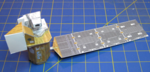
We recently spoke with Mike Mackowski, an engineer who worked on the Landsat 8 spacecraft. Mike was kind enough to create a 1/48 scale model of Landsat 8 for anyone to download and put together. We asked Mike what inspired him to create the miniature Landsat 8 and found out that making model spacecraft has been a lifetime hobby for him and he’s even written a book called Space in Minature.
Below, you can read the Q & A we conducted with Mike. Enjoy!

What was your role when Landsat 8 was being built?
I was the lead engineer for the electrical power subsystem on the spacecraft. That included the solar array, battery, battery charger electronics, and the power switching and distribution system.
What is your educational background? How did you decide to become an electrical engineer?
I grew up in the 1960s as a “child of Apollo”. When I watched the astronauts walk on the moon I told myself that I wanted to be involved in that. So I did well in high school, got an electrical engineering degree at the University of Arizona, and started work at McDonnell Douglas in St. Louis on their advanced space studies. After a few years there I got a Masters Degree in electrical engineering from Washington University in St. Louis.
Why did you decide to make a 1/48 scale model of Landsat 8?
I have been building models since I was a youngster, including space vehicles. I have built simple scale models for programs I work on professionally as engineering tools to demonstrate spacecraft attitude, pointing, and sun angle scenarios. Models are good visual tools, even for rocket scientists. And since I have also been involved in STEM outreach for many years, it seemed like a good idea to make a version for that purpose.
Have you made other satellite models before? If so, how many and what type satellites?
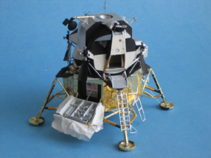
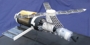
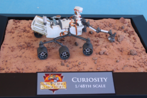
I have been building space models since grade school, and generally not paper models. My first model that was not a kit was a small model of the Surveyor lunar probe I build in 8th grade in 1967. I build a lot of kits of historical spacecraft and have scratchbuilt spacecraft that I find interesting, like the Curiosity Mars rover and the Skylab space station.
Further information:
+ Landsat 8 1/48 scale paper model
+ Assembly instructions
+ Mike Mackowski’s website Space City

