Contributor: Robert Bindschadler, NASA Goddard Space Flight Center

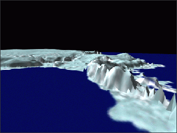
The stability of the West Antarctic Ice Sheet is an issue of active research and societal concern because of the potential economic impact resulting from an increase in global sea level. The West Antarctic Ice Sheet, riddled with deep crevasses and flowing ice streams, contains over 700,000 cubic miles (3 million cubic kilometers) of ice.
Researchers are studying how the ice moves and what forces cause the ice to flow. If the forces change, the ice sheets may flow much more quickly and slide off the continent into the sea. Monitoring these changes from the ground is difficult because treacherous conditions allow researchers to collect only a limited amount of measurements.
Robert Bindschadler, a glaciologist at NASA’s Goddard Space Flight Center, uses Landsat data in a variety of ways to make more information available for determining the ice sheet’s behavior. Landsat’s high spatial resolution allows individual crevasses to be tracked over time. Using these natural markers not only allows more velocity data to be collected, but also concentrates the measurements in the most rapidly moving and most dangerous areas.
Other surface features such as flowstripes formed by rapid ice flow are also being used to uncover the history of the ice sheet. Bindschadler and colleagues have analyzed surface features on the Ross Ice Shelf, a vast area of ice attached to the continent but floating on the ocean, to determine the past 1000 years of ice flow over much of West Antarctica.
Recently Landsat data have increasingly been used to create more useful maps for scientific research. Bindschadler is combining Landsat data with past surveys of the latitude, longitude, and elevation of known locations around the Antarctic continent to create a library of image control points. The library is available on the Internet for use by researchers.
Landsat 7 data enhance techniques developed at Goddard to study ice motion and flow history by providing finer spatial resolution, more continuous spatial coverage, and an updated view of the ever-changing Antarctic ice sheet.
West Antarctica is the most prominent remaining ice-filled marine basin on Earth. It is drained by fast-moving ice streams that extend far into the ice-sheet interior. Since the peak of the last ice age nearly 20,000 years ago, the West Antarctic ice sheet has lost nearly 2/3 of its mass – a volume sufficient to raise sea level 33 feet. There has been much debate over the potential effect of West Antarctic’s volume being released into the ocean. Scientists hope to better understand the history of Antarctic ice sheet so they might better predict how the ice sheet may respond to climate changes in the future.

Landsat Insights: Wetland History in Your Hand
Practitioners managing the wellbeing of wetlands have a new tool at their disposal. The Wetland Insight Tool, developed by Geoscience Australia, provides a visual summary of 35+ years of wetland dynamics.


