Q&A conducted by Michael Taylor, Sofie Bates, and Laura E.P. Rocchio
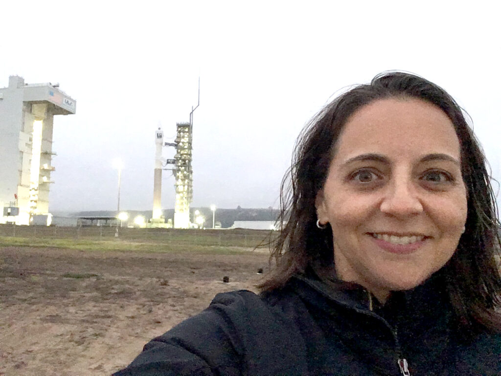
Julia Barsi
Landsat Calibration Scientist
How can Landsat satellites help us know if a forest is changing or a lake is blooming with algae? It starts with very precise sensors.
Julia Barsi has been helping keep Landsat sensors extremely precise for nearly a quarter-century.
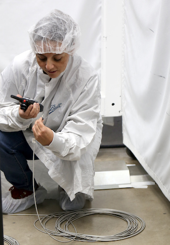
Barsi joined the Landsat calibration team in 2000. She’s helped with the pre-launch calibration of Landsat 8 and 9 and the on-orbit calibration of Landsats 4 through 9.
Barsi does pre-launch calibration work at the NASA Goddard GLAMR Lab where she tests satellite sensors before they head to space. The Goddard Laser for Absolute Measurement of Radiance (GLAMR) uses laser light to evaluate how sensors respond to different wavelengths of light.
Once satellites are in orbit, the sensor characterization that Barsi and her team performed pre-launch, helps scientists understand and interpret the satellite data.
What’s Barsi’s favorite Landsat image?
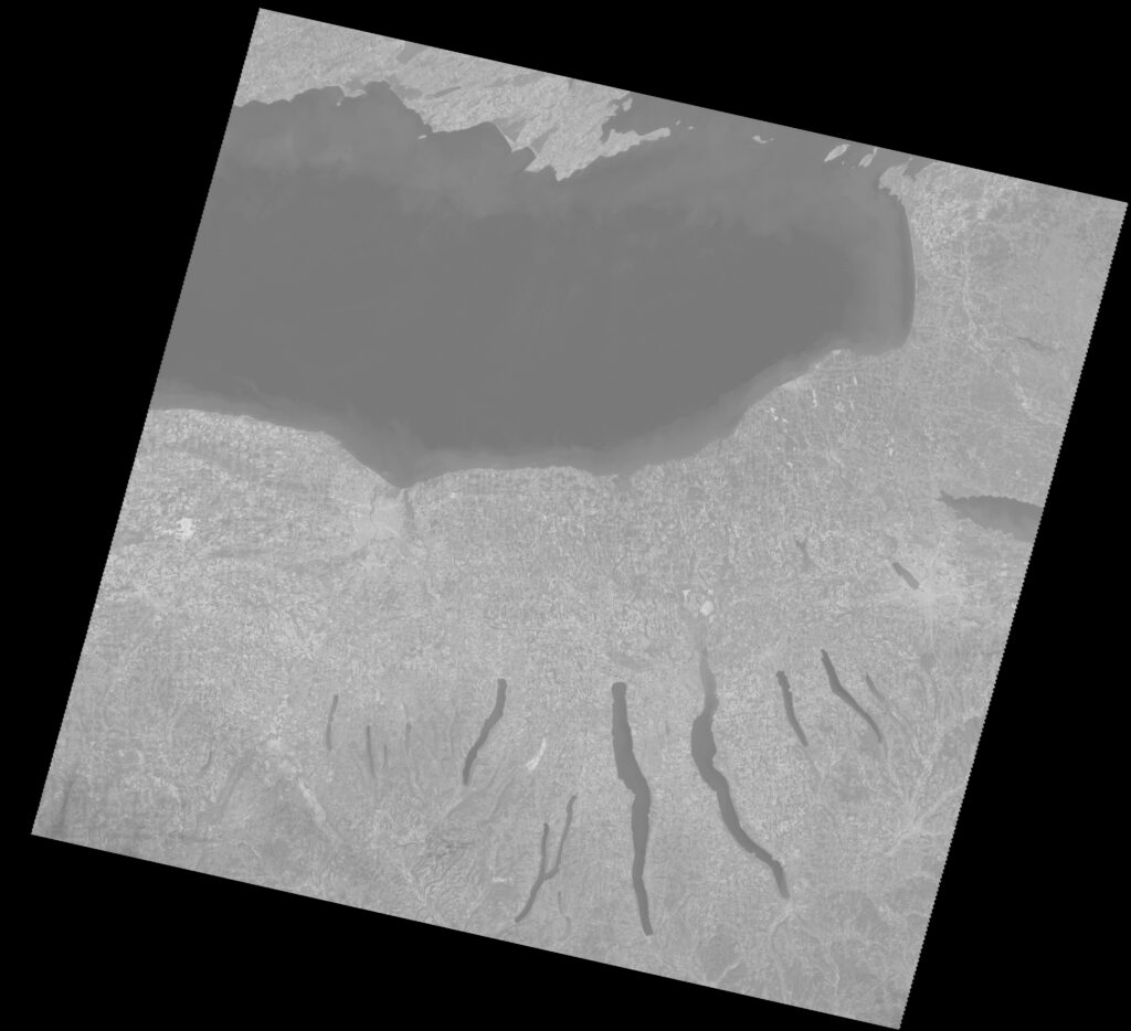
It’s this one of the Finger Lakes and Lake Ontario in New York, made with thermal data from Landsat 7.
Following Landsat 7’s 1999 launch, Barsi, then a recent Rochester Institute of Technology graduate, used this image to check whether the thermal channel of the instrument on Landsat 7—the Enhanced Thematic Mapper Plus (ETM+)—was calibrated properly.
We recently talked with Barsi about what calibration is all about. Here’s what she shared with us:
Why is Landsat considered the “gold standard” for satellite calibration?
Landsat is the gold standard calibration reference because the Landsat Program has committed to world-class radiometric and geometric calibration standards.
Obtaining world-class calibration standards starts with the instruments being built with the requirement to be highly calibratable. For radiometry, my specialty, this means including multiple types of radiometric calibration targets on the instrument. This means extensive testing before launch to transfer an international standard radiometric calibration to the instrument. This means monitoring the instrument and the on-board calibrators over time once on orbit to track and maintain high-precision knowledge of radiometric performance. And in the case of the Landsat program, it means developing techniques to calibrate back in time, to transfer the gold-standard radiometric scale from Landsat 7 to Landsat 5 and then to Landsats 4, 3, 2, and 1.
Why do we need calibration?
We need calibration to be able to make quantitative assessments of the physical properties being measured. Calibration allows us to convert an electronic signal (current or voltage) from an instrument/sensor like those aboard Landsat satellites into spectral radiance (W/cm² sr µm), reflectance or temperature (degrees Celsius).
The calibration puts an absolute scale on the measurement that then can be quantitatively compared to other measurements.
Without calibration, we might be able to say that one plant is greener than another plant, for instance. But with calibration, we can say exactly how much greener one plant is and perhaps build a model of how greenness indicates plant health.
How do we calibrate the sensors?
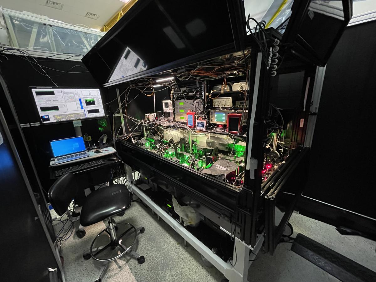
In the laboratory, calibration is usually performed in a controlled environment with a known reference target that is very well understood. Targets for the visible and near-infrared regions of the spectrum include diffuser panels and integrating spheres that have known reflectances which are illuminated with lamps or lasers that have known emitted radiances.
Targets for the thermal region of the spectrum are usually blackbodies which emit a very stable temperature. The reference targets are generally very flat, so the sensor sees nothing but a uniform field.
The sensor is looks at the target, which generates some electronic response. The response is recorded along with the property of the reference target. The ratio of the sensor response to the target property is the radiometric calibration of the sensor.
Calibration is usually performed in a controlled environment to ensure that the sensor is only responding the physical input under test and not outside influences. The internal temperature of the sensor may impact its responsiveness so it would be important to calibrate the sensor at the range of temperature conditions under which it would be used. The illumination conditions are generally controlled so that only light coming from the reference target is shining on the sensor.
Why is it important to continue to check our calibration?
Sensors can change over time. Sometimes a film builds up on mirrors or lenses making the optical path less transmissive. Sometimes the detector material degrades which causes loss of responsiveness. These changes can happen slowly or they can happen suddenly. And they will change the relationship between the sensor response and the physical parameter. If the calibration is not checked, the sensor response may have changed, but the result is that the physical property being measured appears to have changed.
For example, if the optical path has become 25% less transmissive, the sensor will be 25% less responsive. Let’s say you measured a target at the beginning of the month that has a light intensity of 4 µW/cm² and you repeat the measurement at the end of the month but now is it only 3 µW/cm². With calibration, you would have known that the target would look 25% darker, but without calibration, you think the plant is less healthy.
Looking back, is there a teacher that influenced your love of science and your career choice?
My most important year of school was 11th grade, when I was taking AP Chemistry with Mrs Roe, Physics with Dr. Roe and Photography with Mrs. Yuspa. The combination and overlap of the three subjects made a clear impression on me that science can be fun and beautiful as well as technical and challenging.
The three teachers allowed me to work across subjects to develop an entry to Odyssey of the Mind (the specific OM topic has been lost to history) and link the subjects. When I learned that all of these subjects could be combined in a field like Remote Sensing—specifically imaging from satellites—I signed up and never looked back.
You’re also a mom. Do you share the excitement of your job and STEM careers with your young daughter?
Clara is inspired by knowing how things work. So I try to make sure she sees all of the amazing behind-the-scenes science and engineering it takes to do all of the public facing work that NASA does. How do we keep our instruments clean? How do you find something in the vastness of space? How do we make sure that a satellite will survive launch? These keep her little engineering mind active and she often comes up with ways to apply them to her lego creations and art projects.Related Resources
+ Landsat Data: Community Standard for Satellite Calibration (Report; PDF)
+ NASA GLAMR website
+ Landsat Cal/Val at USGS EROS CalVal Center of Excellence (ECCOE)


