
Presentation Title
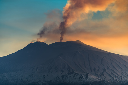
Multi Scale Multi Temporal Near Real Time Approach for Volcanic Eruptions Monitoring, Test Case: Mt Etna Eruption 2017
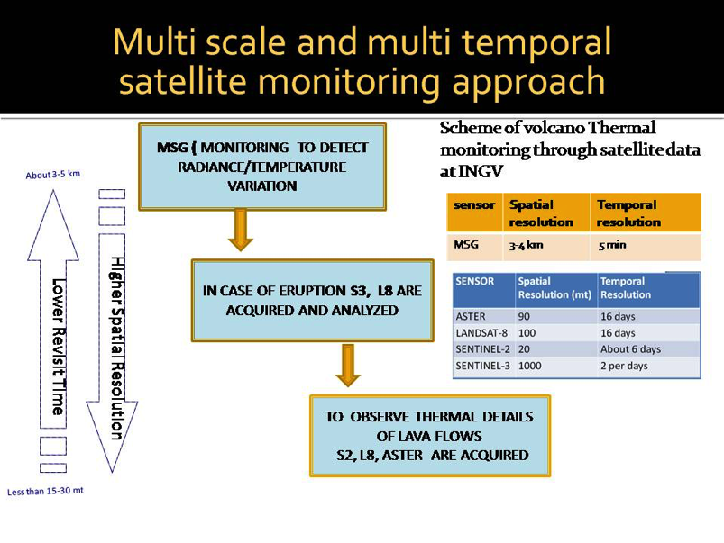
The main finding of this research is that it is possible to access high/mid-resolution optical data from different EO missions carrying shortwave infrared and thermal infrared (SWIR-TIR) channels and to use that data to develop robust processing procedures both for scientific exploitation of the EO data and for operational monitoring of active volcanoes.
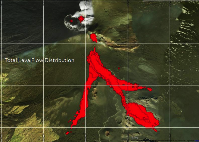
The study also demonstrated that TIR data acquired by different EO missions can be successfully integrated to obtain more homogeneous data sets, and to offset the impact of cloudy images. The study successfully tested the use of different optical satellite data during different volcanic phases. In particular, the combined use of Landsat and Sentinel-2 SWIR channels made mapping the evolution of lava flow emitted during the February-April Etna eruption possible.
What are the implications of your findings?
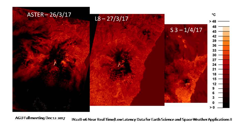
This research has enabled the comparison of retrieval algorithms to obtain ground temperature maps by using different satellite missions. The availability of high spatial resolution time series images of temperature is key to studying volcanic eruption precursors—and could also benefit other studies related to climate changes and human impact on the environment.
The ESA experiment with the GEP (Geohazards Exploitation Platform) has been very valuable since it permits the selection of EO data and processing chains to obtain products which can be used by researchers, students and end users.
Moreover, an international cooperation between Italy and the U.S. has been carried out for many in years to exchange data and increase understanding of the scientific requirements and end user needs for next generation multispectral/hyperspectral IR instruments for EO observations.
How does information from Landsat support this work?
The Landsat data represent the most continuous and available source of EO data with thermal infrared channels acquired at medium spatial resolution (100 m). As such, the data enabled us to study how medium spatial resolution time series data can be used to understand volcanic precursors and lava flow evolution.
Co-authors:
Maria Fabrizia Buongiorno
National Institute of Geophysics and Volcanology
Malvina Silvestri
National Institute of Geophysics and Volcanology
Massimo Musacchio
National Institute of Geophysics and Volcanology
Acknowledgments:
➢ ESA for the opportunity to contribute to the GEP project
➢ NASA-JPL for the very fruitful and long collaboration and for having continuously supported INGV by providing ASTER data to study and monitor Italian active volcanoes
➢ USGS for the active collaboration on Landsat 8 data, providing nighttime data, and for the participation in the calibration activities on Italian Volcanoes.
Anyone can freely download Landsat data from the USGS EarthExplorer or LandsatLook.
Further Reading:
+ CEOS / GEO Geohazards Exploitation Platform website
+ Landsat at #AGU17

Landsat at AGU24
The NASA Landsat Science and Outreach teams attended the American Geophysical Union’s annual meeting in DC in December. At AGU24, they shared research and educated the public about Landsat.


