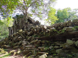
The data identify new hotspots emerging in the Mekong River Basin, West Africa, South America’s Gran Chaco region and Madagascar. The 2014 data confirm that countries with the fastest acceleration of tree cover loss are (starting with the highest): Cambodia, Sierra Leone, Madagascar, Uruguay, Paraguay, Liberia, Guinea, Guinea-Bissau, Vietnam and Malaysia. Globally, increasing demand for rubber and palm oil, expansion of soy farming and cattle ranching, and expansion of other agricultural commodities are driving deforestation in unexpected places.
“This analysis identifies a truly alarming surge in forest loss in previously overlooked hotspots,” said Dr. Nigel Sizer, global director, Forests Program, World Resources Institute (WRI). “In many of these countries, we’re seeing accelerating clearing associated with commodities such as rubber, beef, and soy, along with palm oil. To slow this forest loss, we need improved forest governance to prevent illegal clearing, more balanced land use planning, and greater demand from major importers and trading countries for sustainable commodity production.”
The new data show that tree cover loss is rapidly accelerating in the tropics, home to some of the world’s most biodiverse and carbon-rich forests. And, much of the clearing is taking place outside typical hotspots Brazil and Indonesia. More than 62 percent of forest loss occurred in countries outside of Brazil and Indonesia in 2014, compared to 47 percent in 2001.
“The dry forests of the Gran Chaco region do not usually get as much attention as the jungles of the Amazon,” said Alberto Yanosky, executive director, Guyra Paraguay, a non-profit organization. “But they are home to thousands of indigenous peoples and are extremely biodiverse. This analysis shows again that we need more international engagement on how to ensure cattle ranching and soy production don’t result in the destruction of our unique home.”
Global Forest Watch is a dynamic online platform, with more than 70 partners and convened by World Resources Institute.
UMD and Google’s new data measures tree cover loss, using satellites to see all types of clearing and death of trees for all types of tree cover, from tropical rainforests to boreal forests and plantations at high resolution. These data do not account for tree cover gain, which is another important dynamic affecting forest landscapes worldwide. The new data was made possible through free public access to satellite imagery provided by the U.S. Geological Survey Landsat program, in partnership with NASA.
“With the Landsat satellite system capable of delivering global coverage every 8 days, we have an unprecedented ability to monitor global forest change,” said Dr. Matt Hansen, Professor of Geography, University of Maryland. “The 2014 tree cover loss data, incorporating hundreds of thousands of Landsat images, confirms that deforestation is not just high in certain countries, it’s speeding up. The next step is to use this information to improve forest protection and more equitably balance economic development with the invaluable ecosystem services forests provide.”
The new tree cover data is one way of using technology to gain transparency into the world’s environment and development challenges. The new data represent the largest and most up-to- date global data set for tree cover loss. Global Forest Watch now features annual tree cover loss data spanning 2000-2014 at 30-meter resolution.
“Just a few years ago, this sort of detailed global data on forests would have been unthinkable,” said Rebecca Moore, engineering manager, Google Earth Outreach and Google Earth Engine. “Now, we are leveraging the power of cloud computing to produce it faster than ever before.”
The new 2014 forest data is publicly available through maps, data visualizations, and downloads at www.globalforestwatch.org.
Further Reading:
+ Cambodia Sees World’s Fastest Acceleration of Forest Loss
About World Resources Institute
The World Resources Institute is a global research organization that turns big ideas into action at the nexus of environment, economic opportunity and human well-being. Our 450 experts and staff work with partners in more than 50 countries; we have offices in Brazil, China, Europe, India, Indonesia and the United States. www.wri.org
About Global Forest Watch
Global Forest Watch (GFW) is a dynamic online forest monitoring and alert system empowering people everywhere to better manage forests. For the first time, GFW unites satellite technology, open data, and crowdsourcing to guarantee access to timely and reliable information about forests. Armed with the latest information from GFW, governments, businesses, and communities can halt forest loss. http://www.globalforestwatch.org/

Be Part of What’s Next: Emerging Applications of Landsat at AGU24
Anyone making innovative use of Landsat data to meet societal needs today and during coming decades is encouraged to submit and abstract for the upcoming “Emerging Science Applications of Landsat” session at AGU24.


