Search
Close this search box.

Poster Featuring Landsat-based Research Wins 2018 NRCan Map Contest

Poster Featuring Landsat-based Research Wins 2018 NRCan Map Contest

The Canadian Forest Service writes: “Access to image data collected by the Landsat series of satellites has improved Canada’s ability to observe, track and study forest disturbances such as wildfires and insect infestations, and how quickly forests grow back after these disturbances. This poster shows how forest recovery is a continuous process that ultimately returns most disturbed lands to forest over time.”
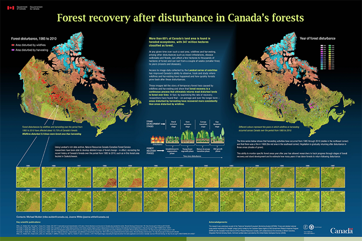
That poster recently won the 2018 Natural Resources Cananda (NRCan) Map Contest:


winning poster
+ Poster PDF

On Key

Recent Posts

Earthrise

Remembering Bill Anders

Anders, 90, the astronaut who captured the iconic Earthrise photograph, died on June 7, 2024, when the plane he was piloting crashed into the San Juan Channel.

Read More »
On Key

Related Posts