
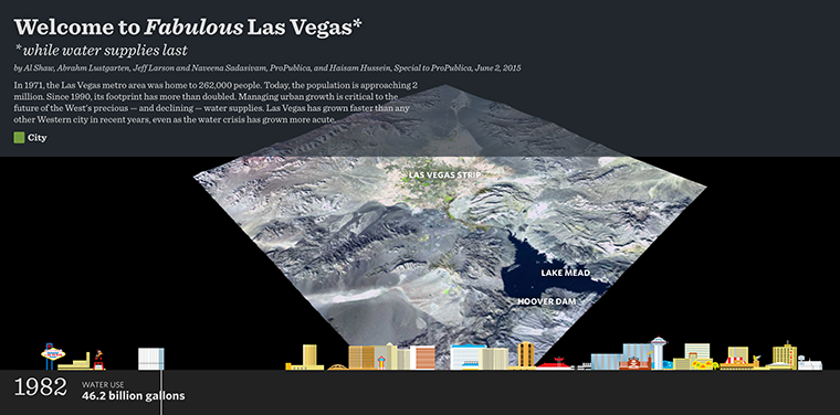
As part of ProPublia’s “Killing the Colorado” investigation, viewers can watch the footprint of the city grow on the Landsat images, while its skyline swells and its water consumption rises and then plateaus.

Be Part of What’s Next: Emerging Applications of Landsat at AGU24
Anyone making innovative use of Landsat data to meet societal needs today and during coming decades is encouraged to submit and abstract for the upcoming “Emerging Science Applications of Landsat” session at AGU24.


