Meat of the Matter: Colorado River Over-Consumed
More water is taken from the Colorado River than it has to give. Better water use accounting made possible by Landsat provides needed guidance for difficult water use decisions.

More water is taken from the Colorado River than it has to give. Better water use accounting made possible by Landsat provides needed guidance for difficult water use decisions.

Over the past few years, machine learning techniques have been increasingly used to analyze the vast amount of data collected by the Landsat mission, which has been circling the globe for over 50 years.
A new analysis found that between 34,000-38,000 could have been reduced with local increases in green vegetation in US metropolitan areas from 2000-2019.
Rooftop gardens and greenery can help ease some of the severe heat in cities, according to research from climate scientists at NASA’s Goddard Institute for Space Studies (GISS) in New York.
The World Settlement Footprint is the world’s most comprehensive dataset on human settlement.

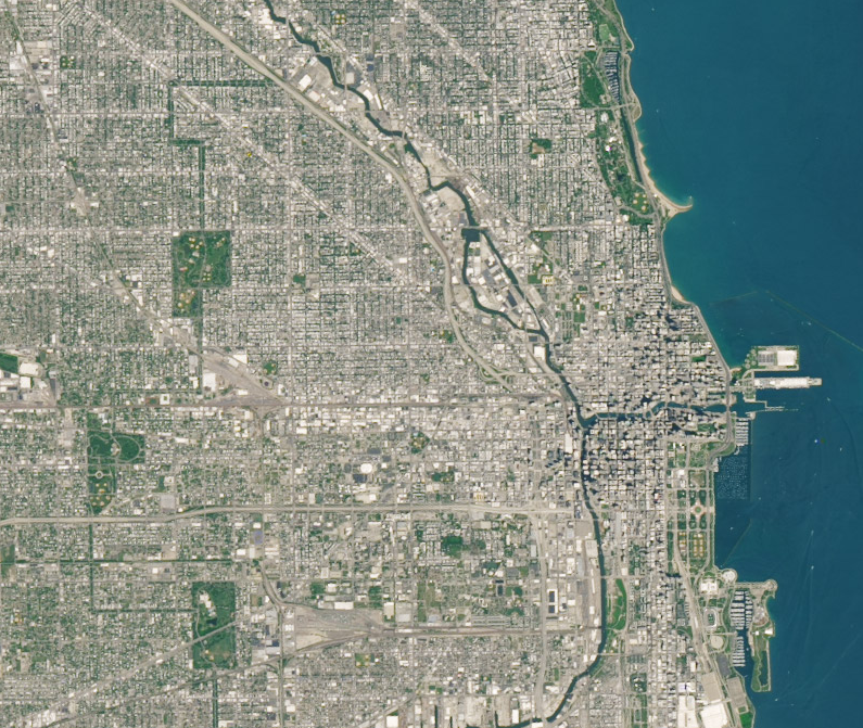
Study of two metro areas finds where parks, trees and other green spaces are located.
Landsat-based urban extent and phenology indicators provide new information about urban environments.
Socio-economically vulnerable populations are at a higher risk of experiencing urban heat effects.
A new investigative report published by NPR has found that it’s hotter in cities’ low income areas.
Two new Landsat-based data products and a mapping tool provide data on man-made impervious surfaces and urban extents throughout the world.
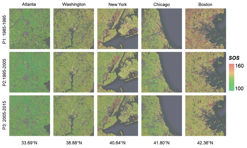
New insights on how vegetation phenology in urban and surrounding areas respond to urbanization.
On creating a high-quality map of urban areas in India.
How the urban heat island of Boston affects the growing season of vegetation in and around the city.
We know very little about cities worldwide. In many instances we have little idea about the use and morphology of cities.
In a recent Eos Project Update, a group of researchers from Italy and NASA’s Jet Propulsion Lab shared the results of their large Po Plain Experiment (POPLEX).
More and more we hear the term “anthropocene” used to describe the current epoch of our planet when humankind has had a profound impact on Earth. This month, the U.S. Geological Survey has released a Landsat-based report and dataset on anthropogenic land use trends in the U.S. between 1974 and 2012.
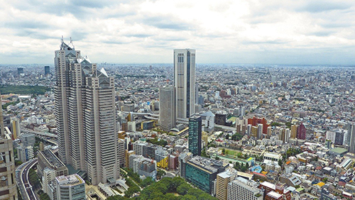
Cities are well known hot spots – literally. The urban heat island effect has long been observed to raise the temperature of big cities by 1 to 3°C (1.8 to 5.4°F), a rise that is due to the presence of asphalt, concrete, buildings, and other so-called impervious surfaces disrupting the natural cooling effect provided by vegetation. According to a new NASA study that makes the first assessment of urbanization impacts for the entire continental United States, the presence of vegetation is an essential factor in limiting urban heating.
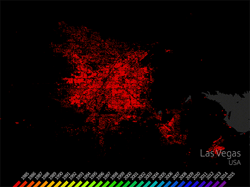
ProPublica has put together an interactive graphic called Welcome to Las Vegas*” that uses 40 years worth of Landsat data, together with a graphic representation of the city’s changing skyline and its water use statistics.
Land change is a signature activity of human civilization. Since the dawn of history, people have purposefully converted natural landscapes to human-dominated areas. Typical motivations for land change are cultivation (e.g. slash-and-burn fields, rice paddies, modern farms); occupation (villages, cities, housing developments); and other cultural and economic pursuits (roads, schools, airports).
Satellite images since 1987 show substantial environmental change on the island nation of Bahrain, including shifting vegetation patterns and more than a doubling in the extent of urbanization, according to a new analysis by the Geospatial Technologies and Human Rights Project of the American Association for the Advancement of Science (AAAS).
Images from Landsat satellites provided free to the public by the Department of the Interior’s U.S. Geological Survey were the starting points for “a new
• The city of Las Vegas, Nevada has undergone a massive growth spurt. An image series, created in honor of Landsat 5’s twenty-eighth birthday, shows
• While urban expansion in Europe and America has been stymied by the recent economic slowdown, the developing world’s cities have been gobbling up land.
• In an article titled “Modeling the human invader in the United States,” USGS scientists Thomas Stohlgren, Catherine Jarnevich, and Chandra Giri modeled humans as
• A recently published Nature Geoscience article by Ruth DeFries et al. reveals that urban pressures (for food and resources) have replaced subsistence farmers as the leading
• Images taken from satellites more than 400 miles above the Earth’s surface are bringing land-cover changes throughout the Chesapeake Bay watershed into tighter focus.
• A recent NASA Technical Report from Stennis Space Center has used Landsat data to document land use changes in Alabama’s Mobile Bay watershed between
• To learn more about the tropical forests that are cleared when urban and residential development spreads, scientists assembled the most comprehensive time series of
• John Smith’s Bay Then & Now – When Captain John Smith first explored the Chesapeake Bay in 1607, the “Great Shellfish Bay,” as it
For the first time, scientists have used satellite images to demonstrate a link between rapid city growth and rainfall patterns, as well as to assess
A new website featuring Landsat images of 77 international cities has been published by the Socioeconomic Data and Applications Center (SEDAC). By analyzing urban reflectance
