
Presentation Title
The WUDAPT Project: Engaging a global community to map and characterize cities worldwide
What are the World Urban Database and Access Portal Tools (WUDAPT)?
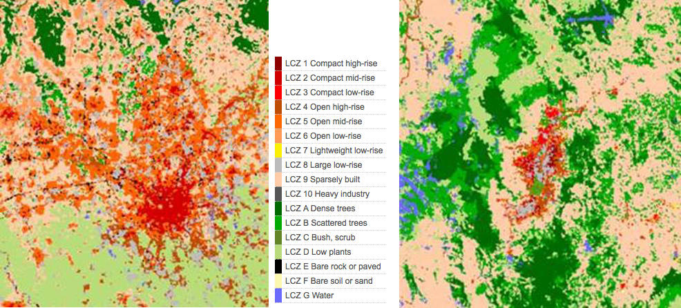
WUDAPT is a project that acquires, stores and disseminates spatial information on cities worldwide that is useful for climate research. It is distinguished by its use of consistent land cover classes called Local Climate Zones (LCZ), which are neighborhood scale areas derived from Landsat data. LCZ areas have similar urban morphology (building heights, building densities etc.). There are 10 urban categories of LCZ and each one can be linked to the degree that the urban area alters its climate (e.g. urban heat island intensity). The WUDAPT project has developed a simple procedure to link neighborhood scale areas to specific LCZ classes using a set of open source software tools and data (Google Earth, SAGA GIS, Geopedia and Landsat data). Local experts with knowledge of their city identify training areas, which are then used to classify Landsat images of the city into a LCZ map of the city. Each LCZ map is also a table of urban parameter values that can be used in urban climate models. The portal tools being developed allow these data to be extracted in a format suited to different modelling schemes.
Why is there a need for WUDAPT?
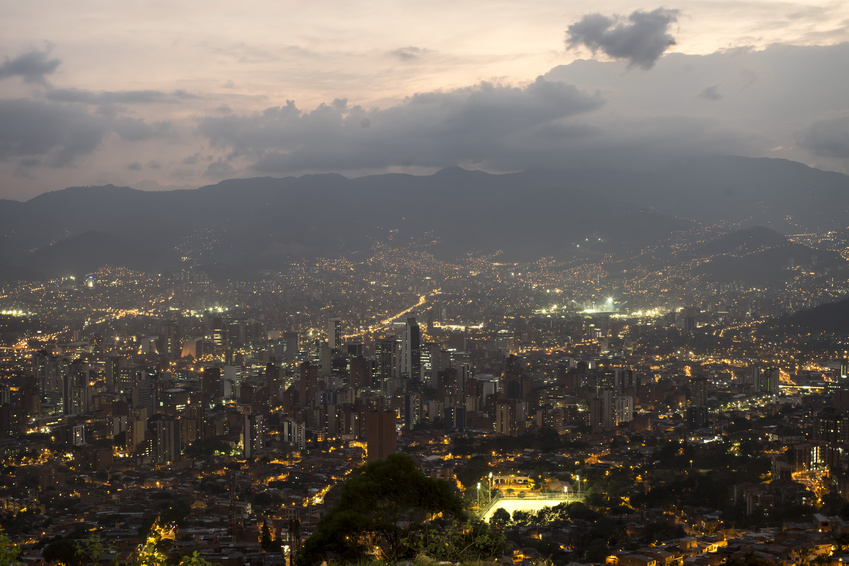
We know very little about cities worldwide. In many instances we have little idea about the use and morphology of cities. WUDAPT is an attempt to map cities across the world into similar land cover classes. There already have been a number of potential uses of the dataset. First and foremost is that LCZs are linked to specific urban morphology characteristics that can be used for simulating urban climates in models for assessing urban climate impacts, energy consumption and air quality modeling. WUDAPT has already developed an automated way to incorporate LCZ maps into the NCAR WRF regional climate model and we are exploring their use for estimating city scale carbon emissions (in coordination with the Global Carbon Project, part of the Future Earth research initiative). In addition it has been linked to a number of other water and energy balance models for urban areas. Other work includes using the dataset to understand how cities develop in different parts of the world, development patterns of cities by evaluating different time periods, and linking LCZs to health outcomes.
What insight did you gain from Landsat that would have been impossible to glean otherwise?
Landsat is an invaluable resource for developing these high resolution maps. Without the Landsat imagery we would not have the spectral information needed to decompose urban landscapes into LCZ types. Hence the data is at the heart of the project and it is the most critical piece—without Landsat there is no project. As is true for so many projects, the information that feeds into the project is crucial, and continued observations on similar platforms will allow us to observe change in cities through time. Hence we believe it is critical that NASA continue these types of data gathering missions.
Co-authors:
Gerald Mills
University College Dublin
Linda M See
IIASA
Benjamin Bechtel
University of Hamburg
Jason Ching
University of North Carolina at Chapel Hill
Freely available Landsat data and open source software tools such as SAGA GIS make it possible to do this project and to provide valuable scientific resources to researchers in countries that lack the technology, funding, and resources to do this type of research. In addition, this technology also allows for citizen science through internet access.
The following individuals initiated the WADAPT project:
Dr. Gerald Mills, University College Dublin, Ireland (Geographer, Urban Climatologist)
Dr. Benjamin Bechtel, University of Hamburg, Germany (Geographer, Remote Sensor)
Dr. Jason Ching, Retired EPA, University of North Carolina, USA (meteorologist)
Dr. Linda See, IIASA, Austria (Geographer, GIS/crowd sourcing specialist)
The project now involves well over 100 scientists from around the world and many have contributed time and effort to provide materials for the project. Funding and support partially comes from the scientists’ home institutions and the International Association for Urban Climate (IAUC). The project also has support from scientists at the WMO, Météo France, NCAR, and a number of other institutions.
Anyone can freely download Landsat data from the USGS EarthExplorer or LandsatLook.
Further Reading:
+ WUDAPT website
+ Landsat Abounds at #AGU16

Be Part of What’s Next: Emerging Applications of Landsat at AGU24
Anyone making innovative use of Landsat data to meet societal needs today and during coming decades is encouraged to submit and abstract for the upcoming “Emerging Science Applications of Landsat” session at AGU24.


