
Source: Australia’s NSW Government media release
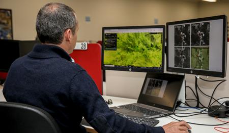
The largest, most systematic water use monitoring effort in Australia’s history has recently been conducted in an effort by Geoscience Australia (GA), the New South Wales Natural Resources Access Regulator (NRAR), and the Murray–Darling Basin Authority (MDBA).
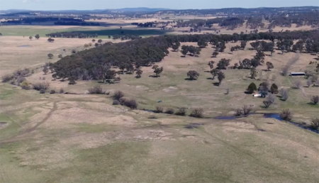
Using satellite data from the European Space Agency (Sentinel), the United States Geological Survey [USGS/NASA] (Landsat) and commercial service provider Planet, NRAR monitored an environmental flow as it travelled across 306,400 square kilometres and past more than 3,500 on-farm storages.
NRAR’s Chief Regulatory Officer, Grant Barnes, said as a result of our partnerships with the MDBA and GA, NRAR now has eyes in the sky.
“We’ve worked with these agencies to access satellite data from world-leading technology providers to monitor an environmental flow as it travelled throughout the state. This was the biggest monitoring effort in our history,” Mr Barnes said. “We increased our capacity to monitor on-farm storage units by almost 500 percent, from 600 to 3,500 storage units.”
The MDBA’s head of Basin Strategy and Knowledge, Vicki Woodburn, said the MDBA had built its independent science capability, including the MDBSat platform to monitor and evaluate the benefits of water reform across the Basin at a landscape scale.
“We use the MDBSat platform to track how floodplain vegetation responds to environmental water, as well as to monitor the speed, flow and spread of water through the landscape,” Ms Woodburn said. “Having this type of technology available ensures the Basin’s water resources are protected and monitored for the benefit of all.”
Geoscience Australia’s Branch Head of National Earth and Marine Observations, Maree Wilson, said the organisation is excited to see its digital infrastructure and satellite data being used in real-world scenarios to enable better management of Australia’s water resources.
“Through our Digital Earth Australia applications, we’re facilitating fast, large-scale assessments of surface water across the Murray–Darling Basin in unprecedented detail and look forward to seeing it used by regulators and water users into the future,” Ms Wilson said.
In its almost three years of operations, NRAR has sought to diversify its investigative and monitoring tools, by investing in national collaborations and new technology.
This technology also allowed the regulator to respond to 748 suspicious activity reports and take 943 enforcement actions in 2020. The regulator finalised a total of 1,536 investigations of alleged breaches of NSW water laws and commenced eight prosecutions last year.
A video explaining how technology is being used to monitor water use compliance in Australia. Source: NSW Government/Department of Planning, Industry and Environment
Related Reading:
+ Watchdog looking for illegal water take can now use satellite imagery from European Space Agency, NSW Country Hour
+ Rain Showers, Flowers, and Floods—Understanding How Vegetation Responds to Flooding and Drought in Australia’s Breadbasket
+ Thirsting for Equitable Water Distribution, Australia Turns to Landsat


