The Earth Observer Shares Landsat Happenings

The Earth Observer Shares Landsat Happenings

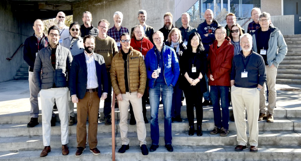
The 2018-2023 Landsat Science Team stands on the stairs of the Desert Research Institute in Reno.
The Landsat Science Team at the 2023 Landsat Science Team Meeting held at the Desert Research Institute (DRI) in Reno, NV.

The recently published Sept.–Oct. issue of NASA’s The Earth Observer  includes a summary of the final activities of the 2018–2023 Landsat Science Team. + Read it here (PDF)

The issue also includes a detailed account of the Sept. 2022 History of NASA and the Environment Symposium. The Landsat 8 and 9 Project Scientist, Christopher Neigh, presented on Landsat’s fifty-year history during the event. +  PDF

Another interesting story shared at the History Symposium was the origin story of NASA’s SERVIR program:

“As frequently happens, a chance meeting led to the development of a new NASA applications program. In the late 1990s Dan Irwin had a chance meeting with Tom Seaver—a NASA space archaeologist. Irwin’s first view of a giant Landsat map made him realize that he’d spent years in the field trying to map out what this single satellite image was showing him. The idea emerged that remote sensing could be used not only for learning about the past but also learning about present. Thus developed SERVIR, originally conceived as “one-stop-shop” for data. A NASA Research, Education and Applications Solution Network (REASON) proposal in 2003 bought in USAID as a partner.

Banner Image Caption: A rare cloud-free image of Tutuila, the largest island in the American Samoan chain, was acquired by Landsat 8 on July 22, 2022. This NASA/USGS Landsat image was featured in the Sept.–Oct. 2023 issue of The Earth Observer in an article about NASA researchers measuring sinking land in American Samoa.

Get the latest from Landsat in your inbox.


By submitting this form, you are consenting to receive marketing emails from: Landsat Science. You can revoke your consent to receive emails at any time by using the SafeUnsubscribe® link, found at the bottom of every email. Emails are serviced by Constant Contact
On Key

Recent Posts

Map shows South Korea with waterways highlighted. In the top right corner is a north arrow and in the bottom left corner is a legend of different rivers in South Korea.

Monitoring Water Quality in South Korea

South Korea is facing a water quality problem. Researchers Hyunglok Kim and Seongjun Lee from the Gwangju Institute of Science and Technology (GIST) embarked on developing a model to predict water quality indicators in near real-time.

Read More »
Landsat outreach specialist Allison Nussbaum and GEDI/UMD Faculty Specialist Talia Schwelling hold Landsat/GEDI postcards at the NASA exhibit booth at AGU24.

Landsat at AGU24

The NASA Landsat Science and Outreach teams attended the American Geophysical Union’s annual meeting in DC in December. At AGU24, they shared research and educated the public about Landsat.

Read More »
On Key

Related Posts

Map shows South Korea with waterways highlighted. In the top right corner is a north arrow and in the bottom left corner is a legend of different rivers in South Korea.

Monitoring Water Quality in South Korea

South Korea is facing a water quality problem. Researchers Hyunglok Kim and Seongjun Lee from the Gwangju Institute of Science and Technology (GIST) embarked on developing a model to predict water quality indicators in near real-time.

Read More »
Landsat outreach specialist Allison Nussbaum and GEDI/UMD Faculty Specialist Talia Schwelling hold Landsat/GEDI postcards at the NASA exhibit booth at AGU24.

Landsat at AGU24

The NASA Landsat Science and Outreach teams attended the American Geophysical Union’s annual meeting in DC in December. At AGU24, they shared research and educated the public about Landsat.

Read More »