
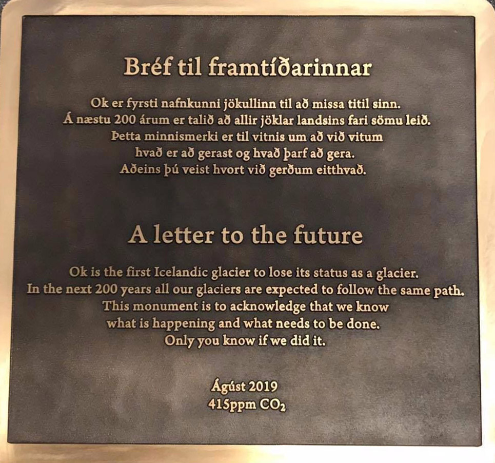
On 18 August 2019, a memorial was placed on top of the volcano where Okjökull Glacier’s ice once flowed.
The loss of Okjökull (Ok Glacier) was announced by Oddur Sigurðsson in 2014 based on his many years observing the island’s glaciers and ice caps for the Icelandic Meteorological Office.
That 2014 total loss of the small glacier atop a volcanic peak in west-central Iceland led to the creation of this NASA/USGS Landsat imagery series showing ice area changes during the past ~46 years (1973-2019).
In the Landsat images here, you can see not only the disappearance of Okjökull but ice area losses to the other small ice caps nearby and also the retreat of larger glaciers flowing from the main ice cap in the area, Langjökull. The impact of ash deposition from eruptions two of Iceland’s many volcanoes is also evident (Hekla, February 2000 and Eyjafjallajökull, in April 2010). The highest point in the area is on the north side of Langjökull and is about 1,450 m (4,760 ft) above sea level.
Video credits: Christopher Shuman (UMBC JCET), Lead Scientist & Amy Moran (GST), Lead Animator
Further reading & video viewing options:
+ Landsat View of a Disappearing Glacier in Iceland, NASA Goddard Science Visualization Studio
+ Lost glacier to be honored with memorial monument, Rice University
+ Glacier Loss in Iceland, USGS
+ Okjökull Remembered, Earth Observatory
+ Geographic Names of Iceland’s Glaciers: Historic and Modern , Oddur Sigurðsson and Richard S. Williams, Jr. / USGS


