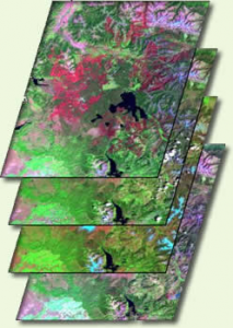
Ecosystems provide vast services and benefits to humankind: food and water that is needed for survival; nutrients and other natural products that fuel farms and industries; natural controls on many pests and pathogens; storage of carbon safely out of the atmosphere; shared spaces for tourism and recreation; and sanctuaries that preserve biodiversity, natural beauty, and cultural history.
The Third National Climate Assessment confirms that ecosystems and the benefits they provide to society are being affected by climate change. These changes are having impacts on biodiversity and limiting the capacity of ecosystems—including forests, barrier beaches, and wetlands— to continue to play their roles in reducing the impacts of extreme events on infrastructure, human communities, and other valued resources.
Land and water managers, environmental planners, and those who rely on ecosystems to support and run businesses need easy, intuitive access to the most accurate and relevant available information about climate change in order to make informed decisions on the ground.
Today, in an important milestone to help achieve this goal, the Department of Interior and other Executive Branch agencies and offices are releasing, on climate.data.gov, new troves of government data on water and ecosystems, as well as new geospatial tools, as part of the President’s Climate Data Initiative. Earlier installments of that initiative focused on data relating to sea-level rise, flood risk, and agriculture.
The newly released datasets—which include critical information about streamflow, soil, landcover, and biodiversity and are complemented by tools to overlay and visualize them—will be extremely valuable to natural-resource managers faced with day-to-day and long-term strategic decisions about how to operate in the context of climate change.
In a further step to make these data as useful as possible, today a host of public, nonprofit, and private-sector organizations made commitments to devote resources, expertise, and technological capabilities to leverage climate data in ways that make the Nation’s ecosystems and water resources more resilient to the impacts of climate change.
For example, Amazon Web Services (AWS) has committed to make a petabyte of [Landsat] Earth-imagery data from the U.S. Geological Survey widely available as an AWS public dataset; the University of Maryland’s Socio-Environmental Synthesis Center has committed to fund 25 early-career scholars as they conduct research at the nexus of water systems, food systems, and climate change; Esri will stand up a Water Open Data portal to extend accessibility of key water data through interactive services and tools by which selected data can be downloaded in various formats through an intuitive user interface; and HP has announced a partnership with the Camera Trap Data Network to create new data-sharing and analytic tools that allow users to access and analyze millions of camera-trap images and related data about threatened species and biodiversity.
From the Harnessing Climate Data to Boost Ecosystem & Water Resilience Fact Sheet released today:
Amazon Web Services (AWS) is today committing to make up to a petabyte of Landsat earth-imagery data from the USGS widely available as an AWS Public Data Set. AWS and its collaborators will also contribute expertise, open source tools, and educational materials to accelerate climate research by making Landsat data easier to access and analyze.
“By unleashing the power of our vast and open data resources, the Climate Data Initiative helps spark private sector innovation and will leverage resources for those on the front lines who are dealing with climate change. We are pooling into one place data from across the federal government to make it more accessible to the public and we hope our efforts will inspire other countries to follow suit.” –Secretary of the Interior Sally Jewell


