Visualizing Data—Landsat at the World Economic Forum

Visualizing Data—Landsat at the World Economic Forum


Matt Hansen
Matt Hansen talking at the World Economic Forum.
The World Economic Forum has published a talk given by Illah Nourbakhsh, professor of robotics from Carnegie Mellon and Matthew Hansen, a remote sensing specialist at the University of Maryland, that demonstrates how visualizing big data can revolutionize the way we understand and imagine the world.
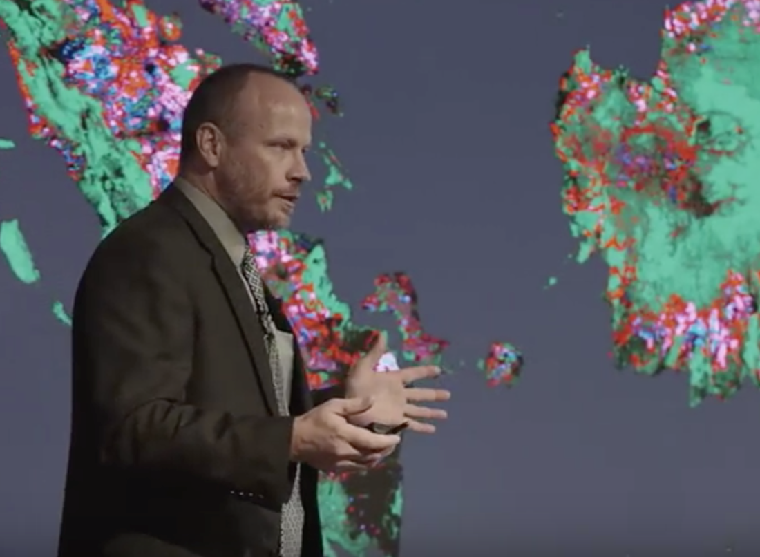
Landsat data features prominently into this talk (see timestamps 06:10 and 07:00–16:02). In this presentation, Matt Hansen commented:

“Very importantlty, big data and its use for societal good is based on really progressive data policies. The Landsat sensor has 40 years of data in the archive and it is available to anyone on the planet.”

“One of the things we like about the [Landsat] satellite is that as it orbits the Earth it is calibrated consistently so we have a globally constant picture that we can make comparisons—apples to apples—of what’s happening. We can drill down to countries, even parks, and say this is what is happening at a local scale. That is another really powerful part of this big data story.”

Further Information:
+ Watch the video on YouTube
+ New Global Data Finds Tropical Forests Declining in Overlooked Hotspots
+ Big Data Helps Scientists Dig Deeper
+ Mapping Global Forest Change with Landsat: Discussion, Demonstration, Q&A

Get the latest from Landsat in your inbox.


By submitting this form, you are consenting to receive marketing emails from: Landsat Science. You can revoke your consent to receive emails at any time by using the SafeUnsubscribe® link, found at the bottom of every email. Emails are serviced by Constant Contact
On Key

Recent Posts

Map shows South Korea with waterways highlighted. In the top right corner is a north arrow and in the bottom left corner is a legend of different rivers in South Korea.

Monitoring Water Quality in South Korea

South Korea is facing a water quality problem. Researchers Hyunglok Kim and Seongjun Lee from the Gwangju Institute of Science and Technology (GIST) embarked on developing a model to predict water quality indicators in near real-time.

Read More »
Landsat outreach specialist Allison Nussbaum and GEDI/UMD Faculty Specialist Talia Schwelling hold Landsat/GEDI postcards at the NASA exhibit booth at AGU24.

Landsat at AGU24

The NASA Landsat Science and Outreach teams attended the American Geophysical Union’s annual meeting in DC in December. At AGU24, they shared research and educated the public about Landsat.

Read More »
On Key

Related Posts

Map shows South Korea with waterways highlighted. In the top right corner is a north arrow and in the bottom left corner is a legend of different rivers in South Korea.

Monitoring Water Quality in South Korea

South Korea is facing a water quality problem. Researchers Hyunglok Kim and Seongjun Lee from the Gwangju Institute of Science and Technology (GIST) embarked on developing a model to predict water quality indicators in near real-time.

Read More »