Scientists like myself create maps of land cover from Landsat but we are also interested in the proportions of various cover types within the Landsat pixels. Colleagues of mine are working on determining the percent of tree cover in Landsat pixels, while I have been determining the percent of man-made, impervious surfaces in a pixel. (These are built-up areas like roads, parking lots and buildings.)
Other scientists focus on the percent of bare ground, and the percent of water, wetlands, grass, etc. It turns out that with the GLOBE Observer (GO) app and a few simple steps you can provide valuable data for our research!
After all, it’s only through connecting the space and the ground views that we can verify the areas where we are correct, and pick up on missed areas we map incorrectly.

I also want to take a moment to thank all the citizens around the world who are participating in the current NASA GLOBE Land Cover Challenge 2022 (Land Cover in a Changing Climate), and to thank you for your many contributions!
The data you have been acquiring helps land cover scientists, like myself, evaluate the quality of the maps we produce from satellites like Landsat.
If you have recently made a GO observation or measurement for the current challenge, you may not have realized you were actually standing inside a Landsat pixel!
Take a moment to think about what the tree or ground cover looked like, what did you observe? Landsat measures square chunks of land that are 30 meters on each side (about 90 feet) and we call these “pixels.” If you can visualize an invisible grid of 30 meter (m) squares on the landscape, that is essentially what a Landsat image might look like.
As a geographer, it fascinates me that the center of each pixel is tied to a latitude/longitude coordinate on the Earth. In fact, if you paced 30 m in all directions, (North, South, East, West) you would find the next Landsat pixel on that grid.
Before you try this, please make sure it is SAFE for you to do so! So the next time you make an observation, remember that each observation you make is tied to a Landsat pixel and that is how we can compare your observation to our satellite maps.
Urban Fabric Pilot Project
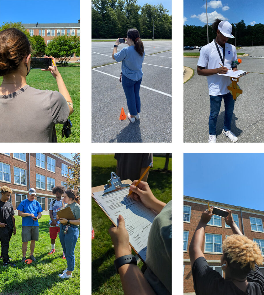
Here are pictures of our summer interns testing out a pilot project doing the same measurements you have been making to participate in the 2022 Land Cover Challenge. These measurements also improve our insight on land cover!
The following steps can also help you grasp a better idea of how to make the final land cover classification in GLOBE Observer. Please also consider joining our Urban Fabric Pilot Project (described further in the below).

Urban Fabric Pilot Project Instructions
- Download the GLOBE Observer app and complete the tutorial.
- Download the GO “Pace-a-Pixel” activity from the Observer website and print the data sheets found on pages 7-8. (If you want to measure tree cover, please read that section and print the data sheets on pages 5-6.)
- Get outside and make a GO Land Cover observation! ***PLEASE STAY SAFE!!!!*** Do not go into areas with dangerous terrain or active traffic, or try to access private or restricted property. Consider having someone with you to look out for safety issues. And always follow local mandates as well.
- The GO Land Cover app will guide you to take pictures in the up and down directions, and then the North, South, East and West directions. Save the pictures to your phone.
- Pace (a pace = two steps ) in the directions of the pictures and record the groundcover you’re stepping on on your data sheet or your phone notes. Take 5-10 paces taking a new observation at each pace.
- If you have tree cover, look up at each pace and estimate the tree cover as well.
- Use the final data sheet on page 8 (page 6 if tree cover) to calculate the percent ground cover you just measured. This is the number of tallies for any category divided by the total for all four cardinal directions.
- The last step is to complete the land cover classification part of the GO Land Cover app using these numbers and submit them to GLOBE! You can also scan or take a picture of your data sheet and send it to the contact email below.
- Please contact me if you have questions or issues: eric.c.browndecolsto@nasa.gov – remember that your data is valuable to scientists like me!
If you choose to do this ‘extra credit’ activity with our team you contribute, not only, to the science we are doing but you are also helping us better understand how our cities are growing and the impacts that this growth has on both the environment and the people that live there. If you find yourself in a spot that you know has changed, please document this as it is very important for this research.
I recently visited Denver, CO and found myself in a large parking lot making a GLOBE Observer Land cover observation, however that same spot I was on was shown as a big baseball field in another mobile phone app map. Was this evidence of recent change? I asked a bus driver and sure enough he told me that this area had changed less than two years ago. Our home planet is ever changing and documenting this change is exceedingly important!
So as you become an “Urban Fabric” detective with us please remember that the data you collect helps us do better science. And as you do science with us please, please, please, remember… HAVE SOME FUN! 🙂 Thank you so much for your contributions – now get out there and do some science!
About the Author
Dr. Eric Brown de Colstoun is a Research Physical Scientist in the Biospheric Sciences Laboratory at NASA’s Goddard Space Flight Center in Greenbelt MD, USA, where he has been working for over 20 years. Currently, his research interests include the study of various aspects of land cover, land use, and land cover/use change from the Landsat satellite, particularly global urbanization. His other passion is to engage with students, educators, and the public to actively participate in the NASA Earth Science experience.


