Landsat's Role in Understanding Climate Change
Long-term weather patterns averaged over 30 years or more make up our climate. Human well-being—our infrastructure and agriculture—depend on a reliable climate. This reliability allows farmers to plant seeds in the spring with confidence that temperatures and rainfall will sustain crops in the coming months. It allows communities to build and maintain roads, buildings, and drainage systems best suited to local conditions. Earth’s climate is controlled by the amount of energy that flows through the atmosphere, oceans, and land. By adding heat-trapping gases to the atmosphere—primarily carbon dioxide—people are increasing the amount of energy in the Earth system that would otherwise escape to space. This increase in energy is changing Earth’s climate, and consequently, the weather patterns that people rely on are shifting. Changes in long-term weather patterns have wide-ranging impacts on ecosystems and peoples’ lives. Designed to observe land and coastal ecosystems, Landsat instruments provide an unparalleled space-based record of the impact of climate change on Earth’s landscapes, the growth and loss of carbon- storing.
![Nereocystis luetkeana](https://landsat.gsfc.nasa.gov/wp-content/uploads/2020/03/20200305_nu1-1024x481-1.jpg)
Landsat Boosts Understanding of Climate Change’s Impact on Kelp
Landsat imagery shows that bull kelp canopy area can vary dramatically from year to year, and that long-term population trends vary from reef to reef.
![forest image](https://landsat.gsfc.nasa.gov/wp-content/uploads/2020/02/20200226_nu1.png)
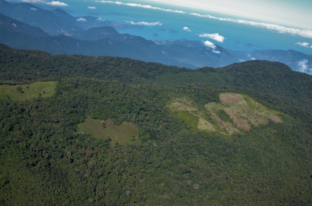
Destruction of Atlantic Rainforest Tied to Local Temperature Increases
Considered one of the world’s richest and most endangered forests, the Atlantic rainforest occupies 15% of Brazil’s landmass in an area that is home to 72% of the population.
![A natural-color NASA/USGS Landsat 8 image showing ice breaking up in the Lena River Delta](https://landsat.gsfc.nasa.gov/wp-content/uploads/2020/02/lena_oli_2015162-1.jpg)
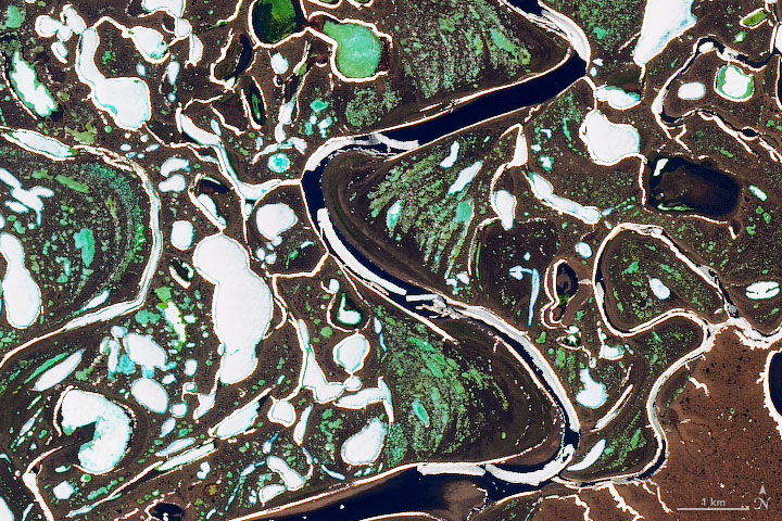
Landsat Reveals Vanishing River Ice
The extent of wintertime river ice has declined by 2.5 percentage points globally over the past three decades.
![The photos here show what subnival ecosystems in Nepal’s Sagarmatha National Park](https://landsat.gsfc.nasa.gov/wp-content/uploads/2020/01/Anderson_etal2020-768x417-1.png)
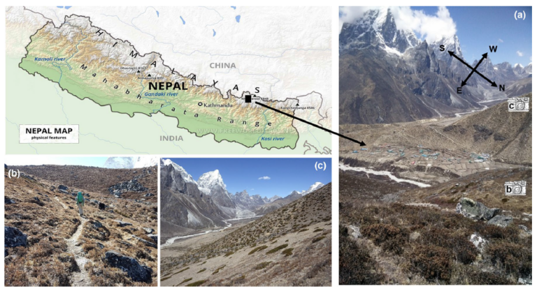
Landsat Reveals Expanding Plant Life in the Everest Region
Plant life is expanding in the area around Mount Everest, and across the Himalayan region, new research shows.
![multitemporal Enhanced Vegetation Index-2 information from HLS for an area of irrigated cropland of Central California](https://landsat.gsfc.nasa.gov/wp-content/uploads/2019/12/AGU19-Sulla-Menashe2-768x392-1.png)
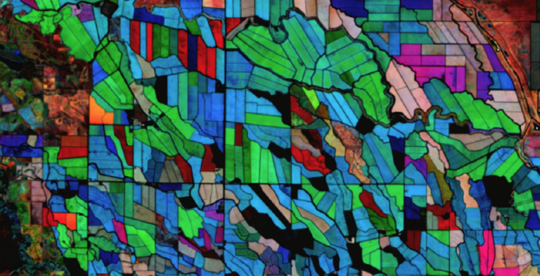
Using NASA’s Harmonized Landsat Sentinel-2 Product to Give Farmers Real-Time Crop Health Information
IndigoAg is using HLS data to help fulfill its mission of making farms more profitable and sustainable.
![Sachs Harbour community](https://landsat.gsfc.nasa.gov/wp-content/uploads/2019/12/AGu19-RS-2-768x354-1.png)
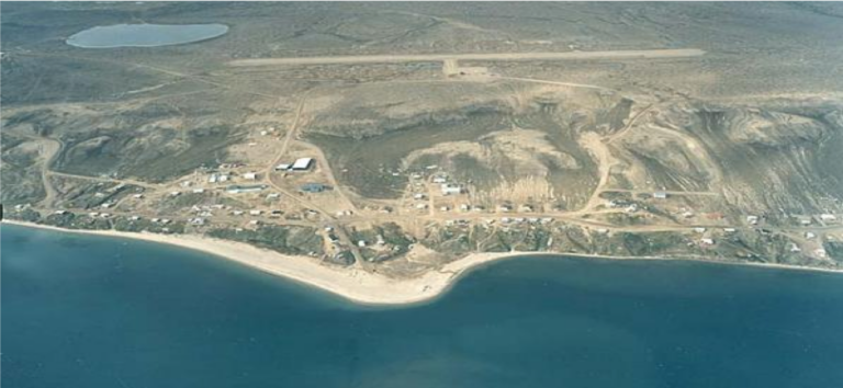
Coastal Change in the Northwest Territories
Southwest Banks Island has experienced the deleterious effects of climate change.