Landsat’s Role in Managing Ecosystems and Biodiversity
Our world is made of complex networks of living things and physical elements that constantly interact and affect each other. Such networks are known as “ecosystems.” Healthy and economically important ecosystems such as temperate forests, wetlands, grasslands, coastal zones, coral reefs, and rainforests all play roles in human life. For example, farm and rangeland ecosystems must be healthy to produce the grains and livestock on which we depend as a nation. Marine ecosystems depend on the health of land ecosystems, because coastal areas provide habitat needed to support the productivity and diversity of aquatic organisms. Landsat has brought valuable capabilities to ecosystem studies. Landsat instruments measure reflected light in visible and infrared wavelengths. Because plants reflect little visible light and a lot of infrared light when they are healthy, the measurement of both types of light simultaneously gives scientists a way to assess plant health and density over a landscape. Measurements are detailed enough while still covering a wide area that ecologists can expand their interpretations of local events and processes, such as an insect infestation in a specific forest, to a regional scale. This helps them to gauge the health of larger ecosystems. Because Landsat data are accurately mapped to reference points on the ground and adjusted for topographic relief, they can be integrated with other geographic data sets and models to explore more complex studies of ecosystems and biodiversity across space and time.
Global Mangrove Mapping with Landsat
The area of mangrove wetlands around the world has been declining over recent decades.
Floating Forests: Citizen Scientists are Mapping Giant Kelp with Landsat
Learn more about the huge citizen science kelp mapping endeavor called Floating Forests.
What Lies Beneath: Mapping Benthic Habitats with Landsat
A method for mapping coral reefs or other benthic habitats over time.
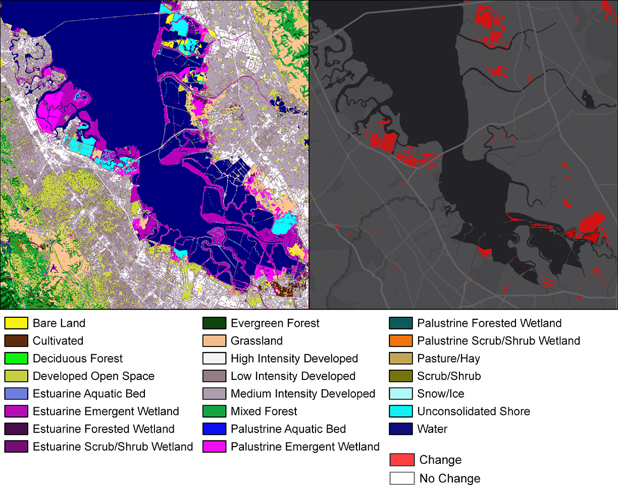
How Much Swamp Are We Talking Here? Towards Better Mapping of Coastal Wetlands
Ways to better estimate the greenhouse gas contributions of wetlands.
Graphing a Path to Survival: Habitat Connectivity in Australia's Murray-Darling Basin
Quantifying the impact of historic land-use and hydroclimatic variability on landscape connectivity dynamics across Australia’s breadbasket.
Researchers Explore Causes of Land Cover Change in African Savannas
This study examined Landsat satellite data from the past 30 years to track broad land cover change in the Chobe district of Northern Botswana.