

Ten Years of TIRS: Data for a Thirsty World
Landsat 8 very nearly flew without a thermal infrared sensor. This is the backstory of how TIRS made it onto Landsat 8.
NASA-Led Project Tracking Changes to Water, Ecosystems, Land Surface
Merging data from multiple satellites, OPERA can help government agencies, disaster responders, and the public access data about natural and human impacts to the land.
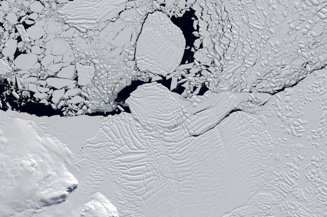
Influencing Factors: Satellites Help Decipher the Fate of West Antartica
An international team of researchers has combined satellite imagery and climate and ocean records to obtain the most detailed understanding yet of how the West Antarctic Ice Sheet – which contains enough ice to raise global sea level by 3.3 metres – is responding to climate change.
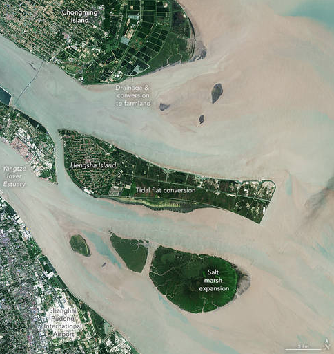
NASA Scientists Map Global Salt Marsh Losses and Their Carbon Impact
The world has lost 561 square miles (1,453 square kilometers) of salt marshes over the past 20 years.
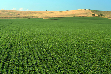
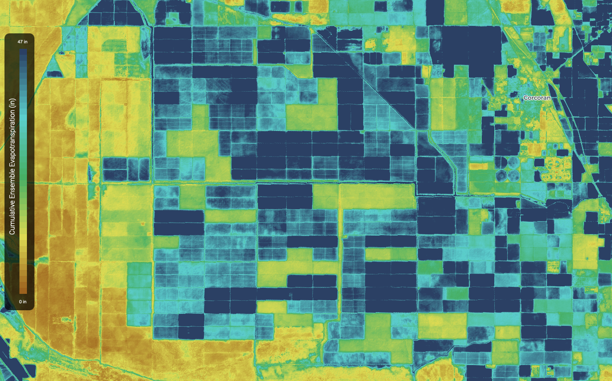
Space for Ag: How Satellites Aid Water and Food Security
Satellites offer a wealth of information pertinent for water and food security. Landsat has long been a foundational piece of the “Space for Ag” initiative.
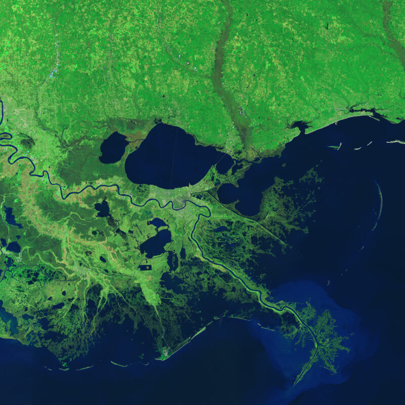
Landsat Helps Scientists Track Dramatic Wetlands Loss in Louisiana
New research uses Landsat observations and advanced computing to chronicle wetlands lost (and found) around the globe.