
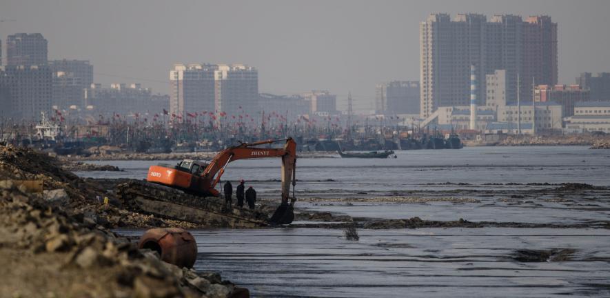
Landsat Reveals Dramatic Loss of Global Wetlands Over Past Two Decades
An analysis of over a million Landsat images has revealed that 4,000 square kilometres of tidal wetlands have been lost globally over twenty years.

Landsat Interns Observing Earth in Innovative and Creative Ways
In recognition of Earth Day, NASA is highlighting two interns advancing the well-being of our planet through their work with the Landsat team.
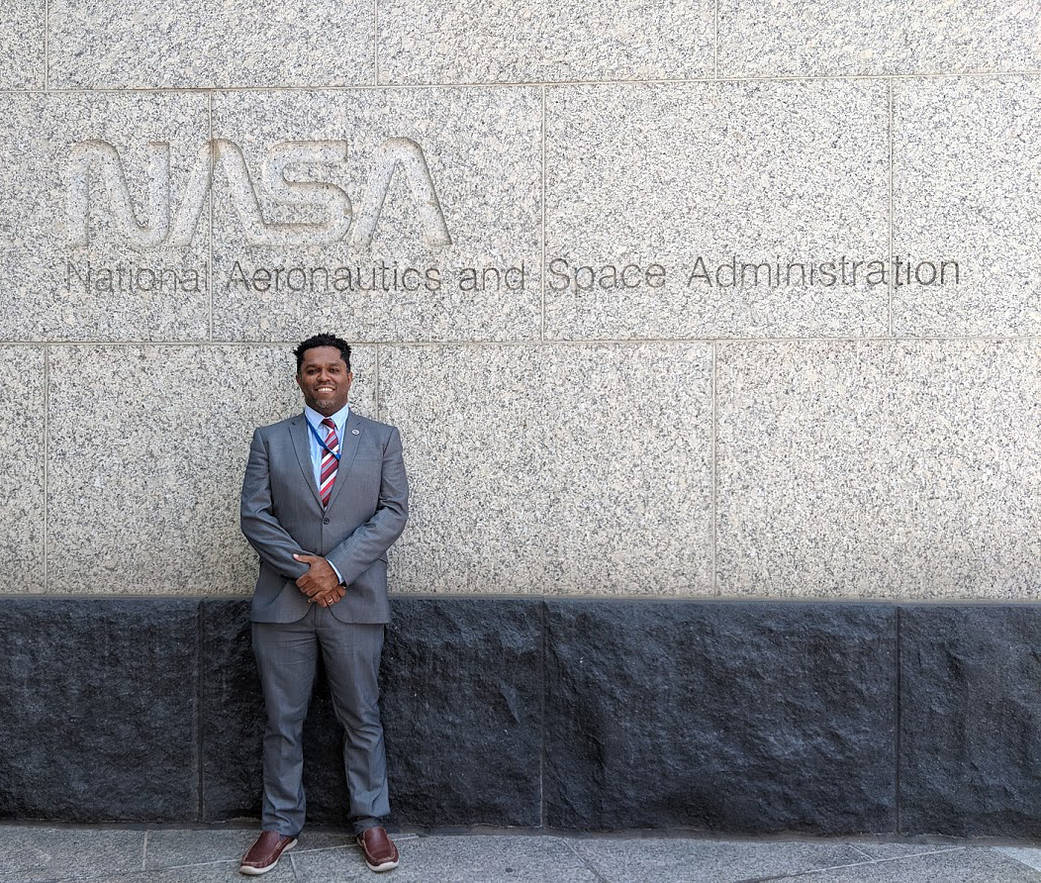
Faces of NASA: Emil Cherrington
Get to know Emil Cherrington, a scientist and Landsat data user.
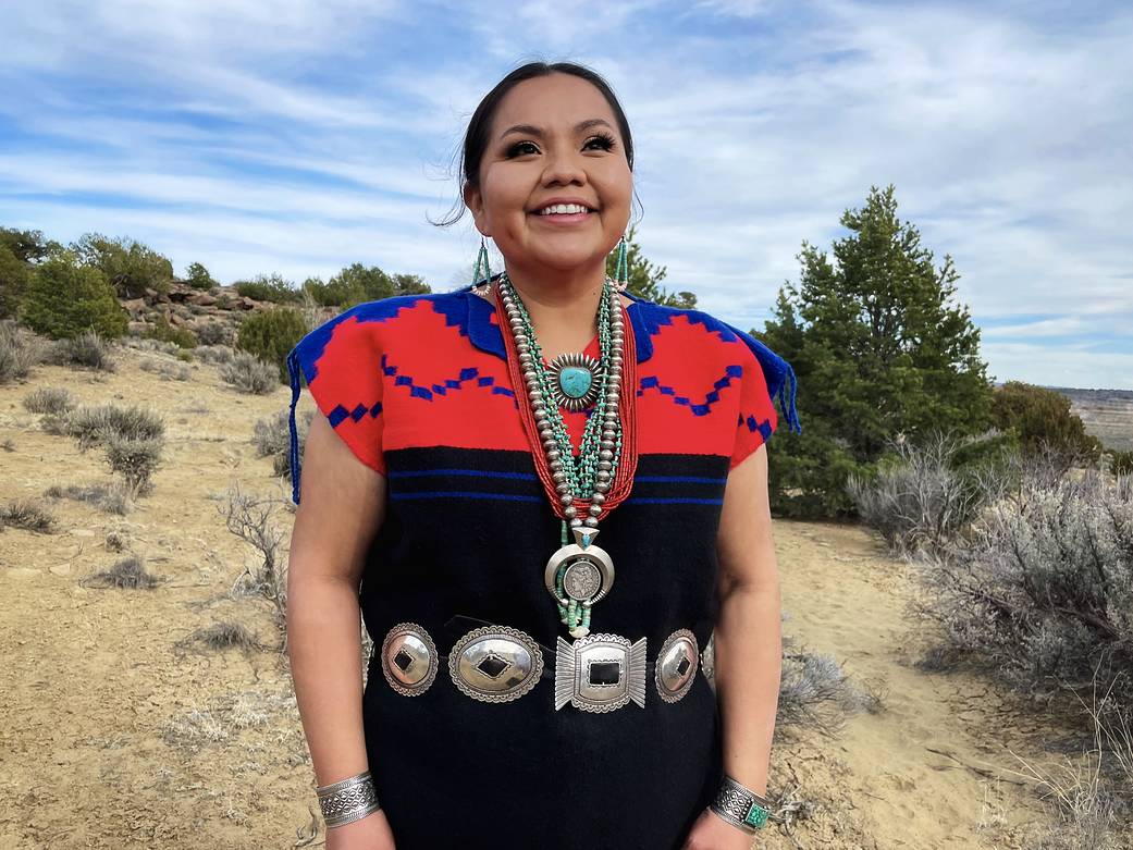
Faces of NASA: Nikki Tulley
Get to know Nikki Tulley, an Assistant Research Scientist at NASA’s Ames Research Center and Landsat data user.
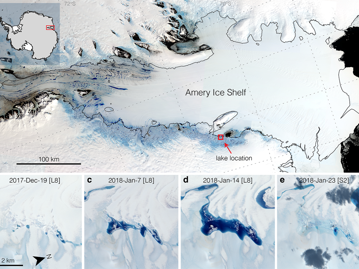
Strong Tides, Vanishing Lakes May Prove Beneficial to Antarctic Ice Shelf
Satellites have helped show that strong tidal activity may facilitate water-induced fracturing, or hydrofracturing, where land ice transitions to floating ice shelf and cause the meltwater lake to drain quickly, often in as little as several days.
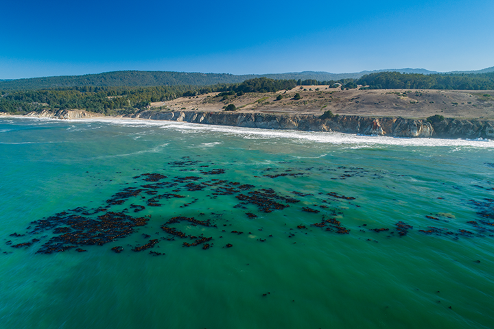
World’s Largest Dynamic Kelp Map Launched
The Landsat-informed kelpwatch.org hosts the world’s largest open-source dynamic map of kelp forest canopy.
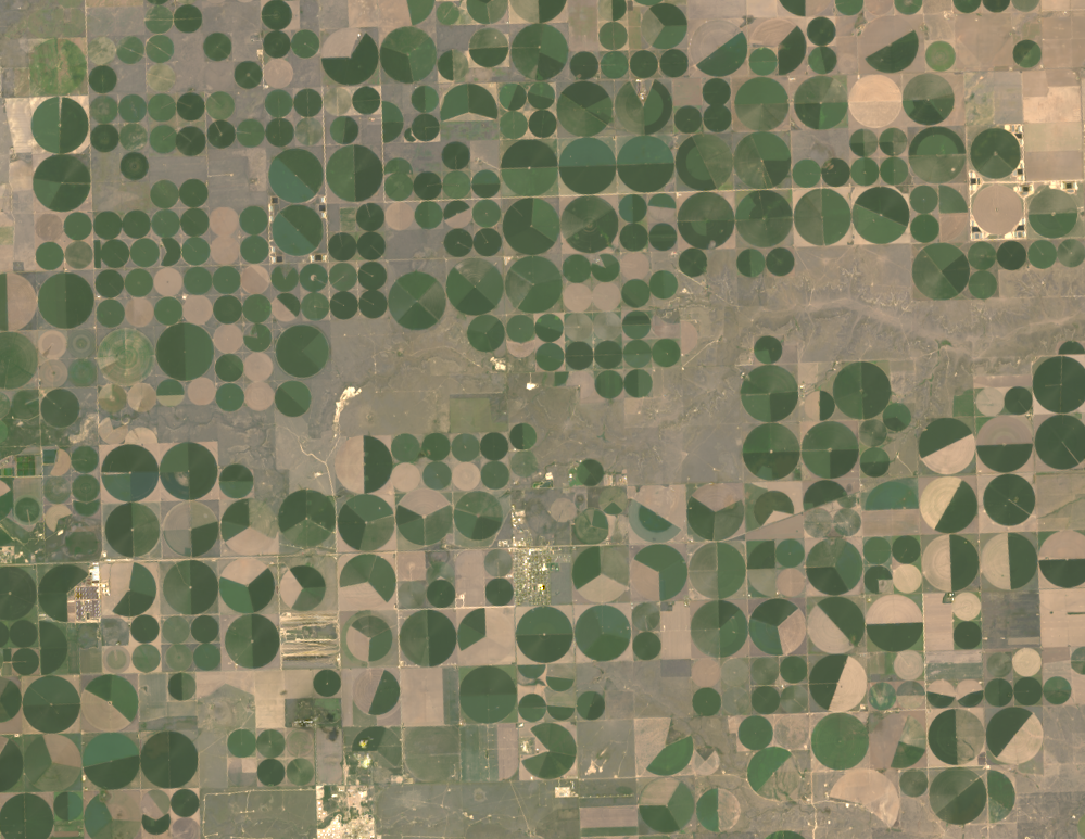
Food Documentary Explores Satellites and the Future of Farming
BBC’s Follow the Food documentary series has reported on Earth observations supporting food production, market stability and on-farm decisions.

From Seeds to Satellites
NASA is partnering with farmers to deliver new technology, new tools and new data to help producers make decisions at every level, from the farm field to the state to the nation to the world.
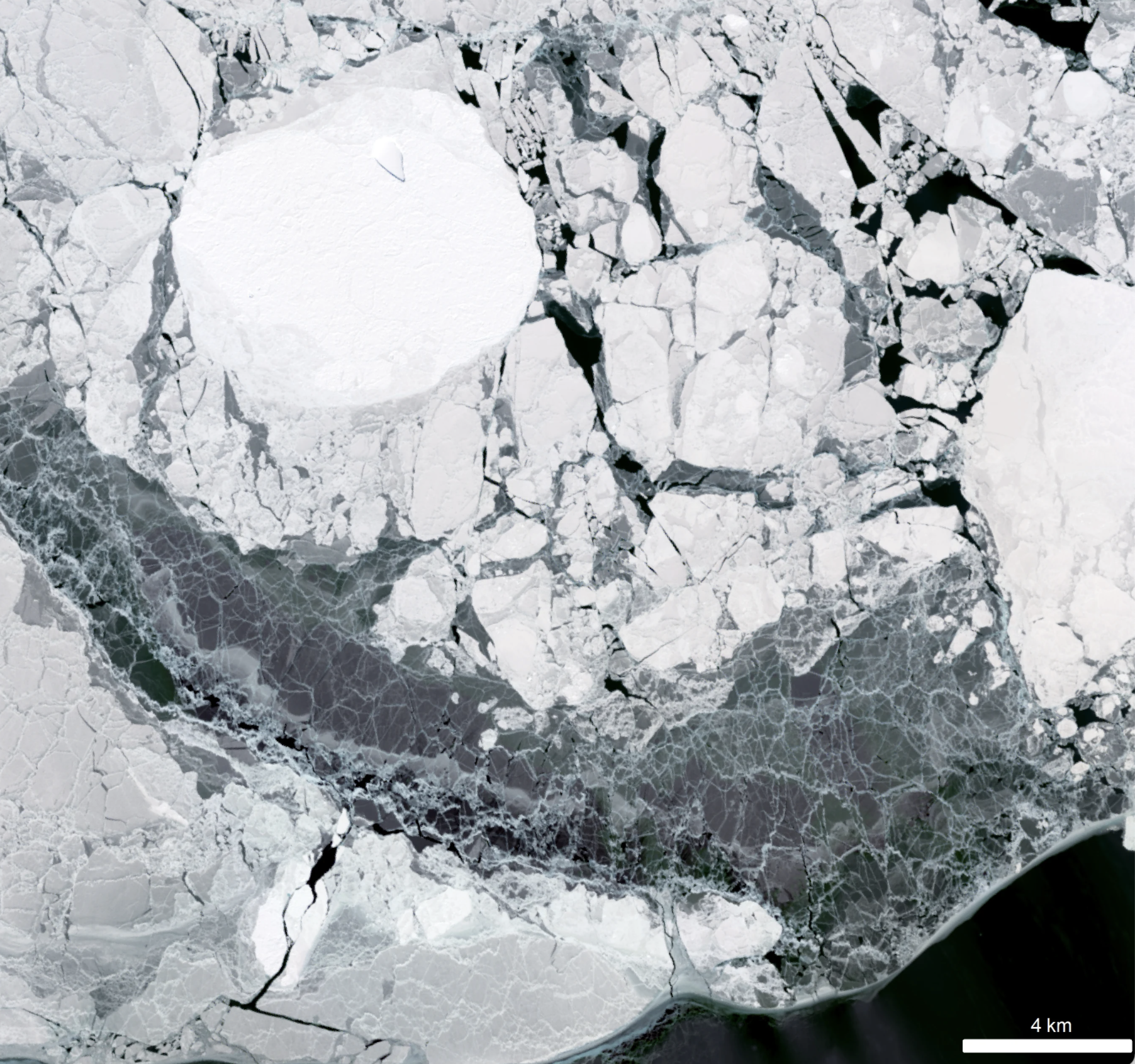
New Research Finds Sea Ice Can Control Antarctic Ice Sheet Stability
Despite the rapid melting of ice in many parts of Antarctica during the second half of the 20th century, researchers have found that the floating ice shelves which skirt the eastern Antarctic Peninsula have undergone sustained advance over the past 20 years.
Landsat Reveals Dramatic Loss of Global Wetlands Over Past Two Decades
An analysis of over a million Landsat images has revealed that 4,000 square kilometres of tidal wetlands have been lost globally over twenty years.
Landsat Interns Observing Earth in Innovative and Creative Ways
In recognition of Earth Day, NASA is highlighting two interns advancing the well-being of our planet through their work with the Landsat team.
Faces of NASA: Emil Cherrington
Get to know Emil Cherrington, a scientist and Landsat data user.
Faces of NASA: Nikki Tulley
Get to know Nikki Tulley, an Assistant Research Scientist at NASA’s Ames Research Center and Landsat data user.
Strong Tides, Vanishing Lakes May Prove Beneficial to Antarctic Ice Shelf
Satellites have helped show that strong tidal activity may facilitate water-induced fracturing, or hydrofracturing, where land ice transitions to floating ice shelf and cause the meltwater lake to drain quickly, often in as little as several days.
World’s Largest Dynamic Kelp Map Launched
The Landsat-informed kelpwatch.org hosts the world’s largest open-source dynamic map of kelp forest canopy.
Food Documentary Explores Satellites and the Future of Farming
BBC’s Follow the Food documentary series has reported on Earth observations supporting food production, market stability and on-farm decisions.
From Seeds to Satellites
NASA is partnering with farmers to deliver new technology, new tools and new data to help producers make decisions at every level, from the farm field to the state to the nation to the world.
