
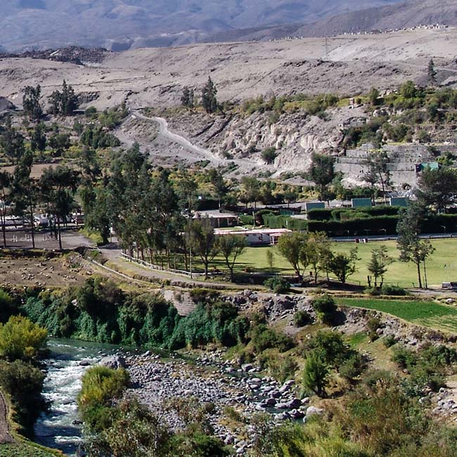
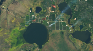
Arid-Region Agriculture in Arequipa, Peru
Landsat has helped map the expansion of intensive agriculture in arid Arequipa, Peru.
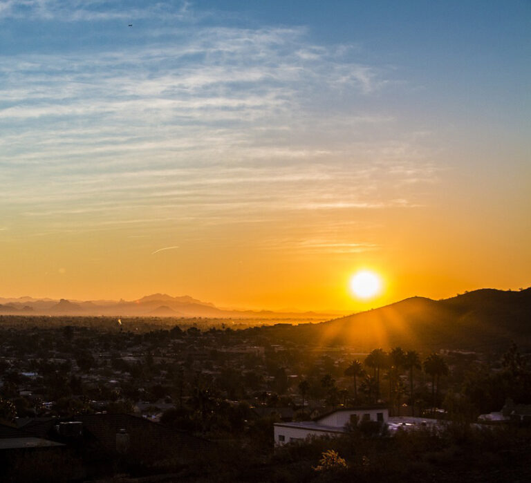
How Urban Heat Affects the Socially Vulnerable in Sun Belt Cities
Socio-economically vulnerable populations are at a higher risk of experiencing urban heat effects.

Landsat at the 2019 AGU Fall Meeting
At the 2019 AGU Fall Meeting, over 500 presentations feature research conducted with the aid of Landsat data.
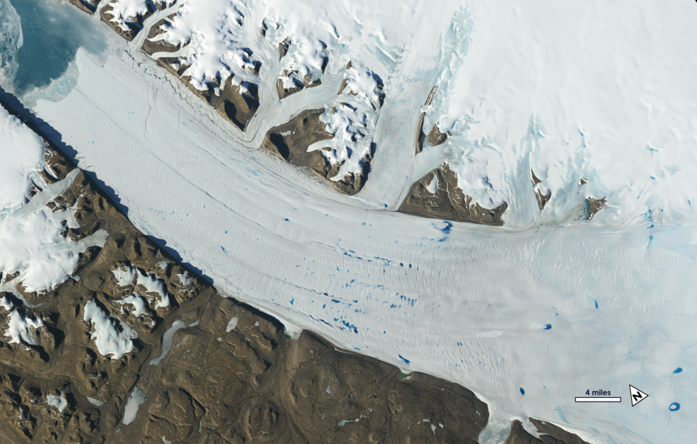
Ice in Motion: Satellites Capture Decades of Change
New time-lapse videos of Earth’s glaciers and ice sheets as seen from space are providing scientists with new insights into how the planet’s frozen regions are changing.
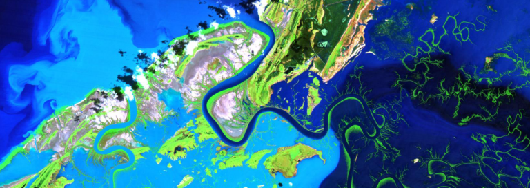
Mapping the Mighty Mangrove
A new longitudinal study from Australia has harnessed thirty years of NASA/USGS Landsat data to map the nationwide movement and migration of mangrove forests.
Satellites Track Status of Nation’s Food Supply
Farmers across the Midwest are in a race to finish harvesting their corn, soybean, and other staples of the Thanksgiving dinner table before the first crop killing freeze sets in.
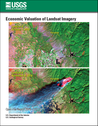
USGS Report Updates Economic Value of Landsat Archive
A new USGS report estimates an increase in the domestic and international economic benefits to society provided by the Landsat archive to about $3.45 billion in 2017, compared to $2.19 billion in 2011.
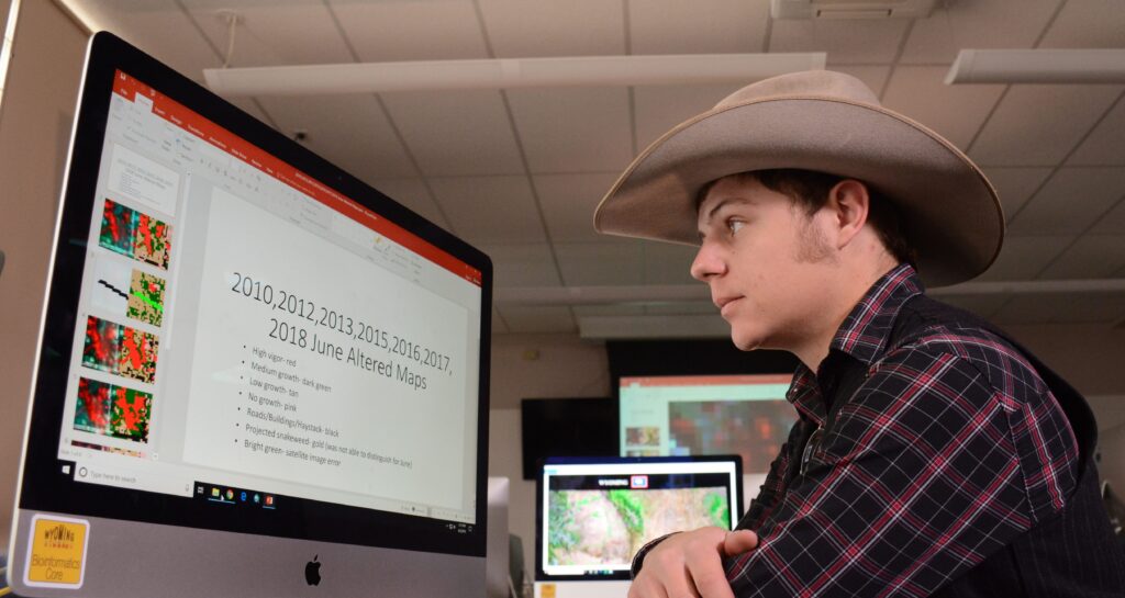
Landsat Images Help Wyoming Students Discern Problems on Family Lands
Wyoming students in the College of Agriculture and Natural Resources are using Landsat images to gauge and improve lands owned by their families.
How Urban Heat Affects the Socially Vulnerable in Sun Belt Cities
Socio-economically vulnerable populations are at a higher risk of experiencing urban heat effects.
Landsat at the 2019 AGU Fall Meeting
At the 2019 AGU Fall Meeting, over 500 presentations feature research conducted with the aid of Landsat data.
Ice in Motion: Satellites Capture Decades of Change
New time-lapse videos of Earth’s glaciers and ice sheets as seen from space are providing scientists with new insights into how the planet’s frozen regions are changing.
Mapping the Mighty Mangrove
A new longitudinal study from Australia has harnessed thirty years of NASA/USGS Landsat data to map the nationwide movement and migration of mangrove forests.
Satellites Track Status of Nation’s Food Supply
Farmers across the Midwest are in a race to finish harvesting their corn, soybean, and other staples of the Thanksgiving dinner table before the first crop killing freeze sets in.
USGS Report Updates Economic Value of Landsat Archive
A new USGS report estimates an increase in the domestic and international economic benefits to society provided by the Landsat archive to about $3.45 billion in 2017, compared to $2.19 billion in 2011.
Landsat Images Help Wyoming Students Discern Problems on Family Lands
Wyoming students in the College of Agriculture and Natural Resources are using Landsat images to gauge and improve lands owned by their families.
Lakes Worldwide Are Experiencing More-Severe Algal Blooms, 30-years of Landsat Data Shows
The intensity of summer algal blooms has increased over the past three decades, according to a first-ever global survey of dozens of large, freshwater lakes.

Pecora Award Honors Excellence in Earth Observation, Including Former Landsat Science Team Leader
The 2019 Pecora Award recipients include former Landsat Science Team leader Thomas R. Loveland and the Terra Science and Flight Operations Team.
How Urban Heat Affects the Socially Vulnerable in Sun Belt Cities
Socio-economically vulnerable populations are at a higher risk of experiencing urban heat effects.
Landsat at the 2019 AGU Fall Meeting
At the 2019 AGU Fall Meeting, over 500 presentations feature research conducted with the aid of Landsat data.
Ice in Motion: Satellites Capture Decades of Change
New time-lapse videos of Earth’s glaciers and ice sheets as seen from space are providing scientists with new insights into how the planet’s frozen regions are changing.
Mapping the Mighty Mangrove
A new longitudinal study from Australia has harnessed thirty years of NASA/USGS Landsat data to map the nationwide movement and migration of mangrove forests.
Satellites Track Status of Nation’s Food Supply
Farmers across the Midwest are in a race to finish harvesting their corn, soybean, and other staples of the Thanksgiving dinner table before the first crop killing freeze sets in.
USGS Report Updates Economic Value of Landsat Archive
A new USGS report estimates an increase in the domestic and international economic benefits to society provided by the Landsat archive to about $3.45 billion in 2017, compared to $2.19 billion in 2011.
Landsat Images Help Wyoming Students Discern Problems on Family Lands
Wyoming students in the College of Agriculture and Natural Resources are using Landsat images to gauge and improve lands owned by their families.
Lakes Worldwide Are Experiencing More-Severe Algal Blooms, 30-years of Landsat Data Shows
The intensity of summer algal blooms has increased over the past three decades, according to a first-ever global survey of dozens of large, freshwater lakes.
Pecora Award Honors Excellence in Earth Observation, Including Former Landsat Science Team Leader
The 2019 Pecora Award recipients include former Landsat Science Team leader Thomas R. Loveland and the Terra Science and Flight Operations Team.
