
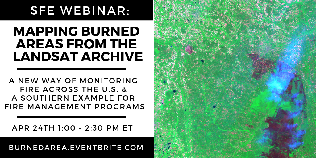
Upcoming Southern Fire Exchange Webinar: "Mapping Burned Areas from the Landsat Archive"
Learn about the Landsat Burned Area algorithm that identifies burned areas in dense time-series of Landsat data.
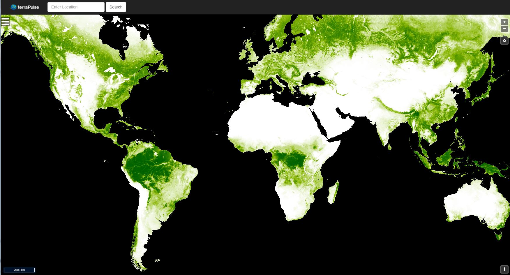
Global 30m Landsat Tree Canopy Version 4 Released
This latest version was created by mining and processing the entire Landsat archive.

Landsat Highlights from 2019 LCLUC Program Manager Message
Some Landsat-focused excerpts from Garik Gutman’s March 2019 message to the LCLUC team.

A Face Behind Landsat Images: Meet Dr. Valerie L. Thomas
Thomas managed the development of early Landsat image processing software systems and became the resident expert on the Computer Compatible Tapes that were used to store early Landsat imagery.
High-Resolution Data Products Help Illuminate Urbanization’s Reach
Two new Landsat-based data products and a mapping tool provide data on man-made impervious surfaces and urban extents throughout the world.
Landsat: the Cornerstone of Global Land Imaging
Evolving technology, free data and robust calibration have helped make Landsat the cornerstone of global land imaging.
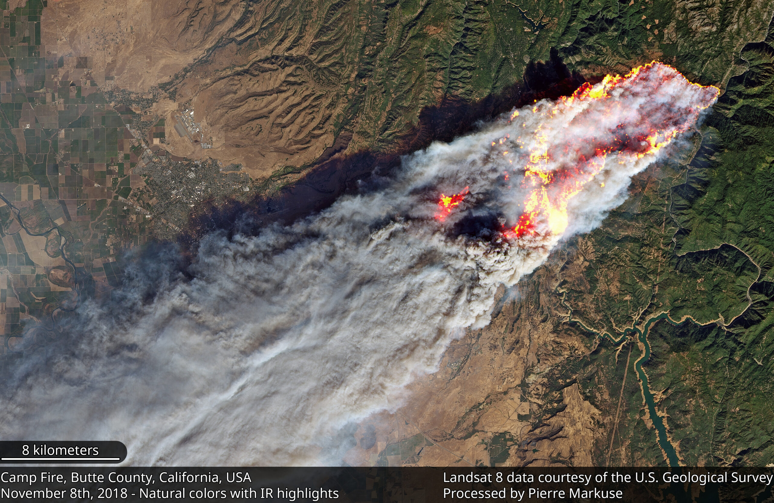
The Synoptic View of California’s Camp Fire: A Scorching Reality of Today’s Fires
Sprawling urban fires that once plagued civilization were thought to be a thing the past—the Camp Fire let us know they are back.

Loria Named New EROS Center Director
C.J. Loria will oversee Landsat satellite and Earth imaging operations.
Loria Named New EROS Center Director
C.J. Loria will oversee Landsat satellite and Earth imaging operations.
First in a Series of Landsat 9 Ground Readiness Tests is Successful
Landsat 9 Ground System development team members executed the first of a series of Ground Readiness Tests this week.
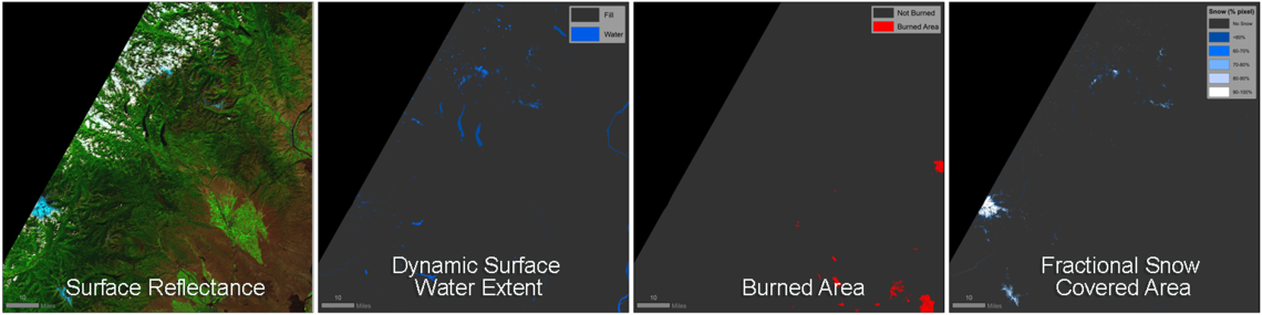
New Landsat Level-3 Products Released
The USGS has developed research-quality, applications-ready, Landsat Level-3 Science Products that are now available for download from EarthExplorer.

How You Can Help Make a Better World Land Map
Using the technology inside your phone, you can help scientists classify land cover and track changes.
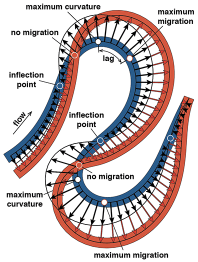
Sharp Bends Make Rivers Meander, As Landsat Attests
Turns out, the rate of river migration is directly linked to how sharp its bends are.
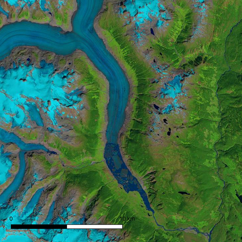
New Research Shows Significant Decline of Glaciers in Western North America
The first comprehensive assessment of glacier mass loss for all regions in western North America (excluding Alaskan glaciers) suggests that ice masses throughout western North America are in significant decline.
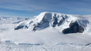
Antarctica Losing Six Times More Ice Mass Annually Now Than 40 Years Ago
Antarctica experienced a sixfold increase in yearly ice mass loss between 1979 and 2017.
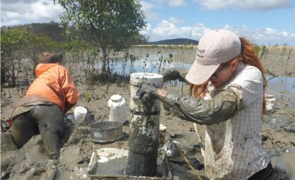
Loss of Intertidal Ecosystem Exposes Coastal Communities
The study used machine-learning to analyze more than 700,000 Landsat images to map changing global distribution of intertidal areas over a 30-year period.
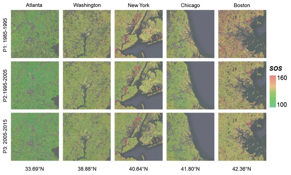
As Cities Grow, So Does the Urban Growing Season
New insights on how vegetation phenology in urban and surrounding areas respond to urbanization.
Loria Named New EROS Center Director
C.J. Loria will oversee Landsat satellite and Earth imaging operations.
First in a Series of Landsat 9 Ground Readiness Tests is Successful
Landsat 9 Ground System development team members executed the first of a series of Ground Readiness Tests this week.
New Landsat Level-3 Products Released
The USGS has developed research-quality, applications-ready, Landsat Level-3 Science Products that are now available for download from EarthExplorer.
How You Can Help Make a Better World Land Map
Using the technology inside your phone, you can help scientists classify land cover and track changes.
Sharp Bends Make Rivers Meander, As Landsat Attests
Turns out, the rate of river migration is directly linked to how sharp its bends are.
New Research Shows Significant Decline of Glaciers in Western North America
The first comprehensive assessment of glacier mass loss for all regions in western North America (excluding Alaskan glaciers) suggests that ice masses throughout western North America are in significant decline.
Antarctica Losing Six Times More Ice Mass Annually Now Than 40 Years Ago
Antarctica experienced a sixfold increase in yearly ice mass loss between 1979 and 2017.
Loss of Intertidal Ecosystem Exposes Coastal Communities
The study used machine-learning to analyze more than 700,000 Landsat images to map changing global distribution of intertidal areas over a 30-year period.
As Cities Grow, So Does the Urban Growing Season
New insights on how vegetation phenology in urban and surrounding areas respond to urbanization.
