
Landsat Images Provided to the Disaster Charter, May 2017
This month, 34 Landsat scenes were ingested by the USGS Hazard Data Distribution System to provide data for Charter activations.
Landsat 8 Scenes Top 1 Million
As of today, there are now over 1 million Landsat 8 scenes available to download from the Landsat archive.

Welcome to the Intertidal Zone: Mapping Australia’s Coast with Landsat
Using 28 years of Landsat data, an Australian research team has created a continent-wide intertidal zone extent map for the whole of the Australian coast.
Be Part of the Next Landsat Science Team
The USGS, in cooperation with NASA, is requesting proposals for membership on the 2018-2023 Landsat Science Team.
People & Projects Shaping the Future of Land Imaging: Introducing S.J. Ben Yoo
To learn how current investments could impact the future of Landsat we are conducting a series of interviews with ESTO-funded researchers working on technology for the Landsat 10 era and beyond.
Mt. St. Helens, 37 Years of Recovery
In the decades since the Mount St. Helens eruption, scientists have studied the recovery of the ecosystem around the mountain using the Landsat series of satellites.
Myanmar’s Extensive Forests Are Declining Rapidly
The loss of intact forest cover in Myanmar has accelerated in the past decade, according to a study by Smithsonian Conservation Biology Institute scientists and partners.
"Listening to Landscapes" Wins Science's People Choice Award for 2017 Data Stories Contest
The data animation based on LandTrendr-derived land cover change illustrates the effects of political boundaries on forest cover as well as the relationship between insect infestations and forest fire behavior.
Landsat Images Provided to the Disaster Charter, Jan. 2017
The International Charter is a system that supplies free satellite imagery to emergency responders anywhere in the world. The Charter concept is this: a single phone number is made available to authorized
Landsat Science Team Happenings
The winter Landsat Science Team meeting was held earlier this month at Boston University from Jan. 10–12, 2017.
How Satellite Data Changed Chimpanzee Conservation Efforts
Approximately 345,000 or fewer chimpanzees remain in the wild, according to the International Union for the Conservation of Nature, a substantial decline from the more than two million that existed a hundred years ago.
Landsat-Related Webinar Offered by NASA ARSET
NASA ARSET is offering an advanced webinar that teaches you how to perform land cover classifications with Landsat data.
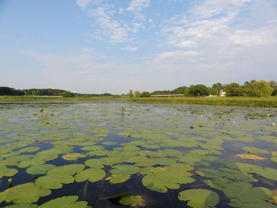
Where the Wetlands Are
Documenting and protecting wetlands has become crucial to the eight states and two Canadian provinces thronging the Great Lakes.
LANDFIRE 2014 Update Completed for CONUS
The LANDFIRE 2014 Update for the conterminous United States has been completed, with Alaska and Hawaii soon to follow.
Using Landsat to Take the Long View on Greenland's Glaciers
A new Landsat-based data portal enables scientists to study in unprecedented detail how fast outlet glaciers such as this one move and change over space and time.
Landsat Images Provided to the Disaster Charter, Dec. 2016
You can think of the Charter as a one-stop-shop for impact maps—an essential resource, since in many cases satellite data are the only practical method to assess current ground conditions after a disaster.
Google Earth Has Updated Its Landsat-based Timelapse
Google Earth’s Timelapse gets an update.
Landsat Images Provided to the Disaster Charter, Jan. 2017
The International Charter is a system that supplies free satellite imagery to emergency responders anywhere in the world. The Charter concept is this: a single phone number is made available to authorized
Landsat Science Team Happenings
The winter Landsat Science Team meeting was held earlier this month at Boston University from Jan. 10–12, 2017.
How Satellite Data Changed Chimpanzee Conservation Efforts
Approximately 345,000 or fewer chimpanzees remain in the wild, according to the International Union for the Conservation of Nature, a substantial decline from the more than two million that existed a hundred years ago.
Landsat-Related Webinar Offered by NASA ARSET
NASA ARSET is offering an advanced webinar that teaches you how to perform land cover classifications with Landsat data.
Where the Wetlands Are
Documenting and protecting wetlands has become crucial to the eight states and two Canadian provinces thronging the Great Lakes.
LANDFIRE 2014 Update Completed for CONUS
The LANDFIRE 2014 Update for the conterminous United States has been completed, with Alaska and Hawaii soon to follow.
Using Landsat to Take the Long View on Greenland's Glaciers
A new Landsat-based data portal enables scientists to study in unprecedented detail how fast outlet glaciers such as this one move and change over space and time.
Landsat Images Provided to the Disaster Charter, Dec. 2016
You can think of the Charter as a one-stop-shop for impact maps—an essential resource, since in many cases satellite data are the only practical method to assess current ground conditions after a disaster.
Google Earth Has Updated Its Landsat-based Timelapse
Google Earth’s Timelapse gets an update.
