
Monitoring Coastline Change with Landsat
Q & A with John Trinder, a Professor Emeritus from the University of New South Wales, about using Landsat data to monitor coastal change.
A Cloud-Free Makeover of Google Maps Courtesy of Landsat 8
Google Maps Blog announced on June 26, 2016 that Google Maps and Google Earth have a new cloud-free mosaic based on Landsat 8 data.
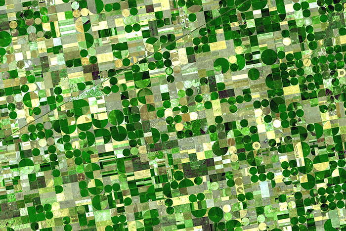
Agriculture: The View From Space
The Food and Agricultural Organization of the United Nations published an audio article about using geospatial data, including Landsat, to monitor would agriculture on soundcloud.
Restore-L Mission to Demonstrate Technology by Refueling Landsat 7
NASA moved forward with plans to execute the ambitious Restore-L mission, an endeavor to launch a robotic spacecraft in 2020 to refuel a live satellite. The current candidate client for this venture is USGS-operated Landsat 7.
Maker of a Miniature Landsat 8
We asked Mike what inspired him to create the miniature Landsat 8 and found out that making model spacecraft has been a lifetime hobby for him.
Flying High: Landsat 8 Sees the International Space Station
We are used to seeing photographs captured by the International Space Station, but on June 19, 2016 Landsat 8 caught a glimpse of the station itself.
Sierra Nevada Snowpack Not Likely To Recover from Drought Until 2019
Even with this winter’s strong El Niño, the Sierra Nevada snowpack will likely take until 2019 to return to pre-drought levels, according to new research.
Details of a Greening Arctic
The northern reaches of North America are getting greener, according to a NASA study that provides the most detailed look yet at plant life across Alaska and Canada. In a changing climate, almost a third of the land cover – much of it Arctic tundra – is looking more like landscapes found in warmer ecosystems.
A New Observation Method That Sees the Forest for the Trees
A marriage in the remote forests of China promises to unite two important forces to better inform the health and future of biodiversity. The union is reported in this week’s journal Ecological Indicators by Michigan State University researchers.
56 Landsat Images Provided to International Charter, Jan. 2016
The Charter as a one-stop-shop for impact maps—an essential resource, since in many cases satellite data are the only practical method to assess current ground conditions after a disaster.
Science, Nature, and Landsat in 2015
Last year, Landsat data were used in some aspect to inform more than a dozen research papers published in Science, Nature and Nature’s discipline-specific journals. The paper topics included animal migration patterns, glacier trends, post-earthquake landslide inventories, inland water studies, agriculture policy decisions and forest cover estimates.
Landsat Sees a Blizzard, January 24, 2016
On January 24, 2016 Landsat 8 acquired a clear view—from South Carolina to Pennsylvania—the day after a blizzard covered much of the eastern United States in snow. Watch as more than 620 miles (1,000 km) of landscape are shown in detail.
Landsat Science Team Meeting – Jan. 2016
The USGS Landsat website has made all presentations given at the January 2016 Landsat Science Meeting available online.
Satellite Images are Source for First-of-its-Kind Charts of Alaska's Yukon River
NOAA’s Office of Coast Survey has issued provisional charts for barge operators and others traversing Alaska’s challenging Yukon River.
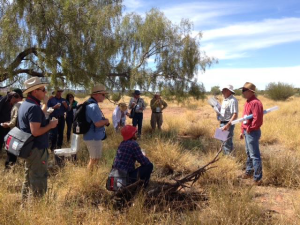
Satellite Data Help Australian Ranchers Meet the Rising Demand for Meat in a Changing World
When Russell Lethbridge walks his property in northern Australia — kicking-up clouds of dust that catch the sunlight as he assesses the grasses, shrubs and brush that fill the landscape with muted tones of green — he carries the legacy of five generations before him on his shoulders.
Landsat 8 Thermal Data Update
Landsat 8 Thermal Infrared Sensor (TIRS) data continue to be collected with the scene select mirror encoder electronics disabled (mode 0). While in this mode, the TIRS line of sight model (LOS) will be regularly updated and modifications are being made to automate revisions to the LOS in the Level-1 Product Generation System (LPGS).
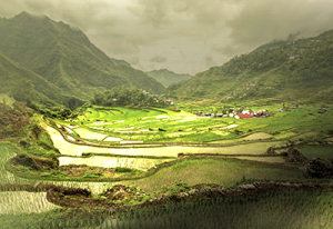
Future Grains
When global food prices spiked dramatically in late 2007 and into 2008, the costs of many basic dietary staples doubled or even tripled around the world, sparking protests and riots. Panicked governments stopped exporting food, aggravating the crisis.
A New Observation Method That Sees the Forest for the Trees
A marriage in the remote forests of China promises to unite two important forces to better inform the health and future of biodiversity. The union is reported in this week’s journal Ecological Indicators by Michigan State University researchers.
56 Landsat Images Provided to International Charter, Jan. 2016
The Charter as a one-stop-shop for impact maps—an essential resource, since in many cases satellite data are the only practical method to assess current ground conditions after a disaster.
Science, Nature, and Landsat in 2015
Last year, Landsat data were used in some aspect to inform more than a dozen research papers published in Science, Nature and Nature’s discipline-specific journals. The paper topics included animal migration patterns, glacier trends, post-earthquake landslide inventories, inland water studies, agriculture policy decisions and forest cover estimates.
Landsat Sees a Blizzard, January 24, 2016
On January 24, 2016 Landsat 8 acquired a clear view—from South Carolina to Pennsylvania—the day after a blizzard covered much of the eastern United States in snow. Watch as more than 620 miles (1,000 km) of landscape are shown in detail.
Landsat Science Team Meeting – Jan. 2016
The USGS Landsat website has made all presentations given at the January 2016 Landsat Science Meeting available online.
Satellite Images are Source for First-of-its-Kind Charts of Alaska's Yukon River
NOAA’s Office of Coast Survey has issued provisional charts for barge operators and others traversing Alaska’s challenging Yukon River.
Satellite Data Help Australian Ranchers Meet the Rising Demand for Meat in a Changing World
When Russell Lethbridge walks his property in northern Australia — kicking-up clouds of dust that catch the sunlight as he assesses the grasses, shrubs and brush that fill the landscape with muted tones of green — he carries the legacy of five generations before him on his shoulders.
Landsat 8 Thermal Data Update
Landsat 8 Thermal Infrared Sensor (TIRS) data continue to be collected with the scene select mirror encoder electronics disabled (mode 0). While in this mode, the TIRS line of sight model (LOS) will be regularly updated and modifications are being made to automate revisions to the LOS in the Level-1 Product Generation System (LPGS).
Future Grains
When global food prices spiked dramatically in late 2007 and into 2008, the costs of many basic dietary staples doubled or even tripled around the world, sparking protests and riots. Panicked governments stopped exporting food, aggravating the crisis.
