News Archives
Science, Nature, and Landsat in 2015
Last year, Landsat data were used in some aspect to inform more than a dozen research papers published in Science, Nature and Nature’s discipline-specific journals. The paper topics included animal migration patterns, glacier trends, post-earthquake landslide inventories, inland water studies, agriculture policy decisions and forest cover estimates.
Landsat Sees a Blizzard, January 24, 2016
On January 24, 2016 Landsat 8 acquired a clear view—from South Carolina to Pennsylvania—the day after a blizzard covered much of the eastern United States in snow. Watch as more than 620 miles (1,000 km) of landscape are shown in detail.
Landsat Science Team Meeting – Jan. 2016
The USGS Landsat website has made all presentations given at the January 2016 Landsat Science Meeting available online.
Satellite Images are Source for First-of-its-Kind Charts of Alaska's Yukon River
NOAA’s Office of Coast Survey has issued provisional charts for barge operators and others traversing Alaska’s challenging Yukon River.
![Specialists collaborating with the NRM Spatial Hub](https://landsat.gsfc.nasa.gov/wp-content/uploads/2022/02/20160113_nu3-300x225-1.png)
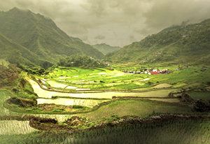
Satellite Data Help Australian Ranchers Meet the Rising Demand for Meat in a Changing World
When Russell Lethbridge walks his property in northern Australia — kicking-up clouds of dust that catch the sunlight as he assesses the grasses, shrubs and brush that fill the landscape with muted tones of green — he carries the legacy of five generations before him on his shoulders.
Landsat 8 Thermal Data Update
Landsat 8 Thermal Infrared Sensor (TIRS) data continue to be collected with the scene select mirror encoder electronics disabled (mode 0). While in this mode, the TIRS line of sight model (LOS) will be regularly updated and modifications are being made to automate revisions to the LOS in the Level-1 Product Generation System (LPGS).
![The Philippines’ famed Banaue Rice Terraces, pictured here](https://landsat.gsfc.nasa.gov/wp-content/uploads/2016/01/20160111_nu1-300x206-1.png)
Future Grains
When global food prices spiked dramatically in late 2007 and into 2008, the costs of many basic dietary staples doubled or even tripled around the world, sparking protests and riots. Panicked governments stopped exporting food, aggravating the crisis.
Future Science Products for Landsat Satellite to be Discussed at Landsat Science Team Meeting
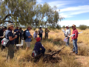
Virginia Tech faculty members and graduate students will get to present their remote sensing research to scientists from across the world when the Landsat Science Team meets on the Blacksburg campus Jan. 12-14.
News Archives
Landsat 9 Project Scientist Talks Carbon During Reddit AMA
On Nov. 12, Jeff Masek, the NASA Landsat 9 Project Scientist, participated in a Reddit Ask Me Anything (AMA) session, part of the AskScience AMA Series. Masek was one of three participating NASA scientists studying the role of carbon on Earth’s climate.
A Remote Sensing Tutorial from World Bank Group
In a effort to help sustainable development professionals learn more about Earth observation resources that can help with their work, the World Bank Group released an informational website focused on remote sensing.
Case Studies in Carbon and Climate
Every part of the mosaic of Earth’s surface — ocean and land, Arctic and tropics, forest and grassland — absorbs and releases carbon in a different way. Wild-card events such as massive wildfires and drought complicate the global picture even more. To better predict future climate, we need to understand how Earth’s ecosystems will change as the climate warms and how extreme events will shape and interact with the future environment.
DOI & Mexico Sign Agreement to Share Landsat Data
U.S. Secretary of the Interior Sally Jewell, leading the U.S. delegation to the 2015 Ministerial Summit of the Group on Earth Observations (GEO), today signed an agreement with Mexico serving as a regional milestone for international cooperation in using land-surface satellite images for the benefit of effective land use planning and sustainability.
Free Data Proves Its Worth for Observing Earth
Since late 2008, when Landsat earth observation images were made available to all users free of charge, nearly 30 million Landsat scenes have been downloaded through the U.S. Geological Survey portal – and the rate of downloads is still increasing.
Half a Year, Half a Billion Landsat Data Requests
On March 19, 2015 Amazon Web Services (AWS) announced that it was hosting Landsat 8 imagery. With the help of USGS and the White House Office of Science and Technology Policy, AWS started with a collection of over 85,000 Landsat 8 scenes.
New Landsat Data Set: Russian Boreal Forest Disturbance Maps
The Oak Ridge National Laboratory’s Distributed Active Archiving Center (DAAC) released a series of boreal forest disturbance maps derived from Landsat for the 1984–2000 time period.
A String of Pearls Viewed From Space
A Landsat mosaic of the Chesapeake Bay Watershed was unveiled at a Nov. 12 String of Pearls ceremony in Easton, Maryland.
Picture This: Newly Released Photo Catalog Puts U.S. Landscapes On Exhibit
The U.S. Geological Survey announced today that it has made part of a huge national repository of geographically referenced USGS field photographs publicly available. USGS geographers developed a simple, easy-to-use mapping portal called the Land Cover Trends Field Photo Map.