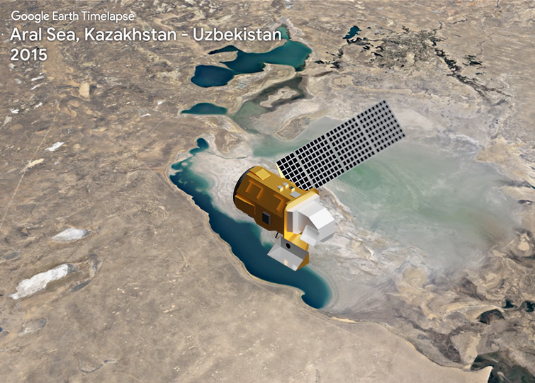
TIME-lapse Travel
Since 1984, Landsat has observed changes in Earth’s water resources like the Aral Sea on the border of Kazakhstan and Uzbekistan. Freshwater is used to irrigate crops, generate power, and support life.
Watching the Waters
What better way to spend a hot summer day than by the water! Landsat helps managers monitor water quality—from the cold water you sip to stay cool to the lakes and coastal waters where you swim.
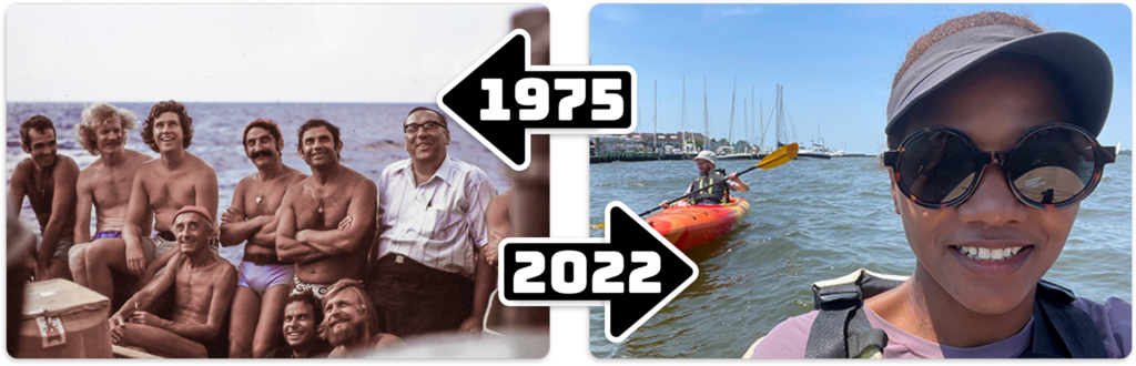
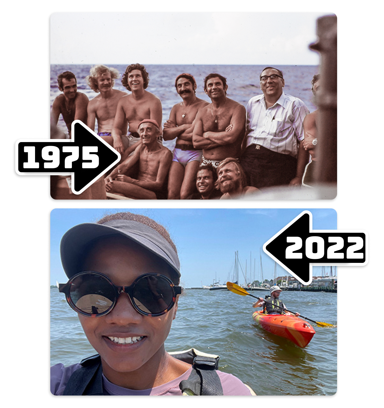
Then & Now
Knowing near-shore ocean depth is important for marine navigation and coastal management. Scientists have used Landsat data to help make seafloor measurements in clear, shallow waters since the mid-1970s.
Landsat Collage Challenge
Explore these stunning patterns and colors from folded red mountain ridges, yellow dunes dotted with brilliant pools of blue water, and swirling clouds of blue-green phytoplankton.
Create your own Landsat collage and share with #CampLandsat
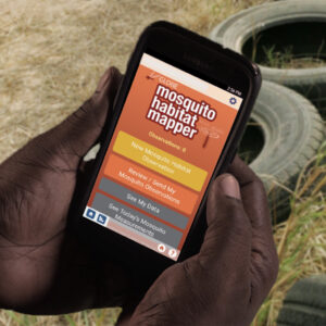
GLOBE Observer
Mosquitoes are a serious health risk: millions of people die each year from mosquito-borne disease. Water bodies make excellent breeding grounds as they provide mosquitos with hydration and safe spaces to lay their eggs. Scientists rely on ground measurements of mosquito habitats to enhance satellite-based research. Help collect data with the GLOBE Observer Mosquito Mapper.
Data Detective
Satellite images are used to monitor changes on Earth’s surface over time. In the case of the Karkheh Dam, scientists can calculate how much of the landscape is covered with water after a dam is built.

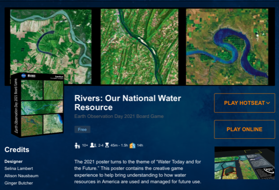
Rivers: Our National Water Resource
Play this online game and try your hand at cleaning our nation’s waterways! Win points for finding ways to use natural vegetation to keep water clean, learn how water is used in different places and industries, and try to avoid disaster.
Data Detective
Satellite images are used to monitor changes on Earth’s surface over time. In the case of the Karkheh Dam, scientists can calculate how much of the landscape is covered with water after a dam is built.
Rivers: Our National Water Resource
Play this online game and try your hand at cleaning our nation’s waterways! Win points for finding ways to use natural vegetation to keep water clean, learn how water is used in different places and industries, and try to avoid disaster.
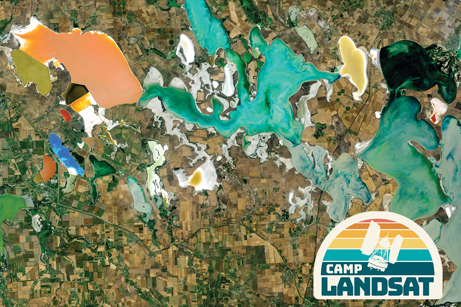
Postcard from Camp
This week we travel to the Crimean Peninsula. Here, various microalgae flourish in the shallow, salty lagoons between the Black Sea and the Sea of Azov. This natural color image portrays the unnaturally strange colors of the area known as Sivash, which is nicknamed the “putrid sea” because the algae in some of the lagoons produce a rotten smell.
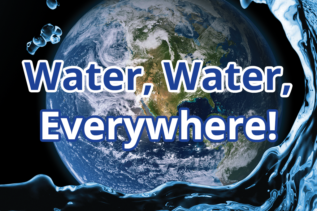
EO Kids
Where can you find freshwater on Earth and how do satellites see it? Explore water across the globe, from glaciers to groundwater in Water, Water, Everywhere!
Postcard from Camp
This week we travel to the Crimean Peninsula. Here, various microalgae flourish in the shallow, salty lagoons between the Black Sea and the Sea of Azov. This natural color image portrays the unnaturally strange colors of the area known as Sivash, which is nicknamed the “putrid sea” because the algae in some of the lagoons produce a rotten smell.
EO Kids
Where can you find freshwater on Earth and how do satellites see it? Explore water across the globe, from glaciers to groundwater in Water, Water, Everywhere!