Landsat Next Defined

Landsat Next Defined

Landsat Next is on the horizon—the new mission will not only ensure continuity of the longest space-based record of Earth’s land surface, it will fundamentally transform the breadth and depth of actionable information freely available to end users. Take a look at the new capabilities that will define the next Landsat mission.

Read More »

Expanding OpenET Across Amazon Basin

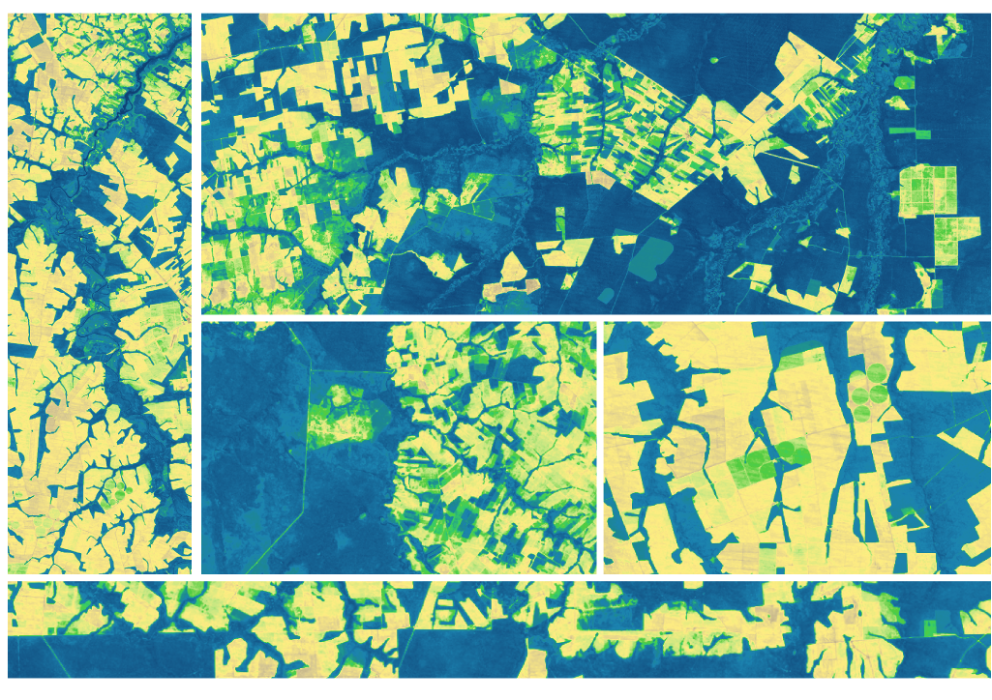
The research teams who help sustain the largest freshwater reserve in the world are developing a new tool to promote more resilient farming systems in Brazil. The goal is to help farmers better handle changes in the water cycle, deal with droughts, and adapt to a changing climate.

Read More »
Landsat Next Defined

Landsat Next Defined

Landsat Next is on the horizon—the new mission will not only ensure continuity of the longest space-based record of Earth’s land surface, it will fundamentally transform the breadth and depth of actionable information freely available to end users. Take a look at the new capabilities that will define the next Landsat mission.

Read More »

Expanding OpenET Across Amazon Basin

The research teams who help sustain the largest freshwater reserve in the world are developing a new tool to promote more resilient farming systems in Brazil. The goal is to help farmers better handle changes in the water cycle, deal with droughts, and adapt to a changing climate.

Read More »

“Landsat optically observes Earth’s surface through measurement of reflectivity and temperature in polar ice and oceans, as well as across the Earth, and these are two key geophysical parameters for measuring and modeling surface energy balance.”


“As the climate continues to warm and affect urban health, the Landsat satellites’ sensors are among our best tools for monitoring the thermal variations of the urban heat island.”


“Until recently the National Geospatial-Intelligence Agency has relied on very high spatial resolution imagery to assess environmental conditions that may pose threats to national security. This project has demonstrated the beneficial use of Landsat to assess water quality at a regional scale, which enables a broader understanding of changing environmental conditions.”


“A 35-year dataset in marine biology is really hard to find… But we need long-term data to understand climate change and how it impacts populations. This was an exponential increase in the amount of information available about kelp forests in Oregon.”


“Satellite imagery can be used retrospectively, meaning that the data collected by satellites today will probably help solve issues we are not currently even aware of—an advantage which is invaluable.”


“Measuring the past contributes to our understanding of the long-term consequences of our past economic and societal choices, and contributes to more informed management decisions in the future.”


“The power of Landsat is that you can travel through time and you can travel through space and tell these really rich stories to help the greater good.”


“Landsat satellite data are the most important source we have about how much deforestation happens each year across the Amazon.”


“It’s a treasure trove.”


“I have really appreciated being able to use Landsat data as a ‘time machine’ to understand our changing environment.”


“[T]he case for open data is more than proven by Landsat and Copernicus. Many innovative applications using these datasets are the dividends that benefit the taxpayer.”


“The Deltares Aqua Monitor is the first global-scale tool that shows at 30-m resolution where water is converted to land and vice versa. With assistance from Google Earth Engine, it analyzes satellite imagery from multiple Landsat missions, which observed Earth for more than three decades, on the fly.”


“Measuring the past contributes to our understanding of the long-term consequences of our past economic and societal choices, and contributes to more informed management decisions in the future.”


“The Landsat program relative to agriculture monitoring has been profound. The whole idea that Landsat could look at the condition of crops, the acreage of crops, seeing how they evolve, diseases… it just has been tremendously impactful for agriculture.”


“Landsat 8 imagery is an incredibly powerful resource. It is some of the most valuable open data produced by the US Government. Our partners rely on Landsat data for everything from evaluating droughts to tracking conflict.”


“Landsat has undoubtedly transformed our ability to understand urbanization processes and how cities expand and evolve… the multi-spectrality of Landsat, its relatively high spatial resolution, its revisit period, and especially the long observational record that made millions of scenes publicly available, make Landsat a key asset for the research community.”


“Without Landsat’s long record, studies like ours would be impossible to undertake, because we don’t have a time machine to go back to the 1970s and 1980s and see how Turkey’s glaciers were doing then. Using Landsat and commercial satellite data together, we can map glaciers with high accuracy. It’s a powerful combination for studying the Earth from space.”


“The rich history of Landsat (40+ years) enables not only change detection and trend analysis, but also provides a unique oppurtunity for hydrologic model calibration and validation as shown in this application.”


“The Landsat program doesn’t produce images like the ones of astronauts playing golf on the moon nor geologists scaling an erupting volcano, but it has created one of the most important scientific repositories of data ever made.”


“Landsat makes it possible to compare images over almost 5 decades and makes the role of climate change unmistakable in this incredibly beautiful mountainous part of Alaska.”


“With its superhuman sight, and decades of archived imagery, Landsat provides us with the ability to see through time, to track the vegetal movement which is beyond our normal sight and to see it for what it really is: a titanic unfolding of active and intentional life.”


“With 32 years’ worth of data — and ongoing data collection — the Landsat data record (satellites 5, 7 and 8) captures the decadal and interannual variability in forest losses and gains needed to drive global carbon cycle models.”


“The economic value of just one year of Landsat data far exceeds the multi-year total cost of building, launching, and managing Landsat satellites and sensors.”


Landsat 9 bw
Landsat 9 bw
Landsat 9 bw

The NASA/USGS Landsat Program provides the longest continuous space-based record of Earth’s land in existence. Landsat data give us information essential for making informed decisions about Earth’s resources and environment.