Landsat Next Defined

Landsat Next Defined

Landsat Next is on the horizon—the new mission will not only ensure continuity of the longest space-based record of Earth’s land surface, it will fundamentally transform the breadth and depth of actionable information freely available to end users. Take a look at the new capabilities that will define the next Landsat mission.

Read More »

Expanding OpenET Across Amazon Basin

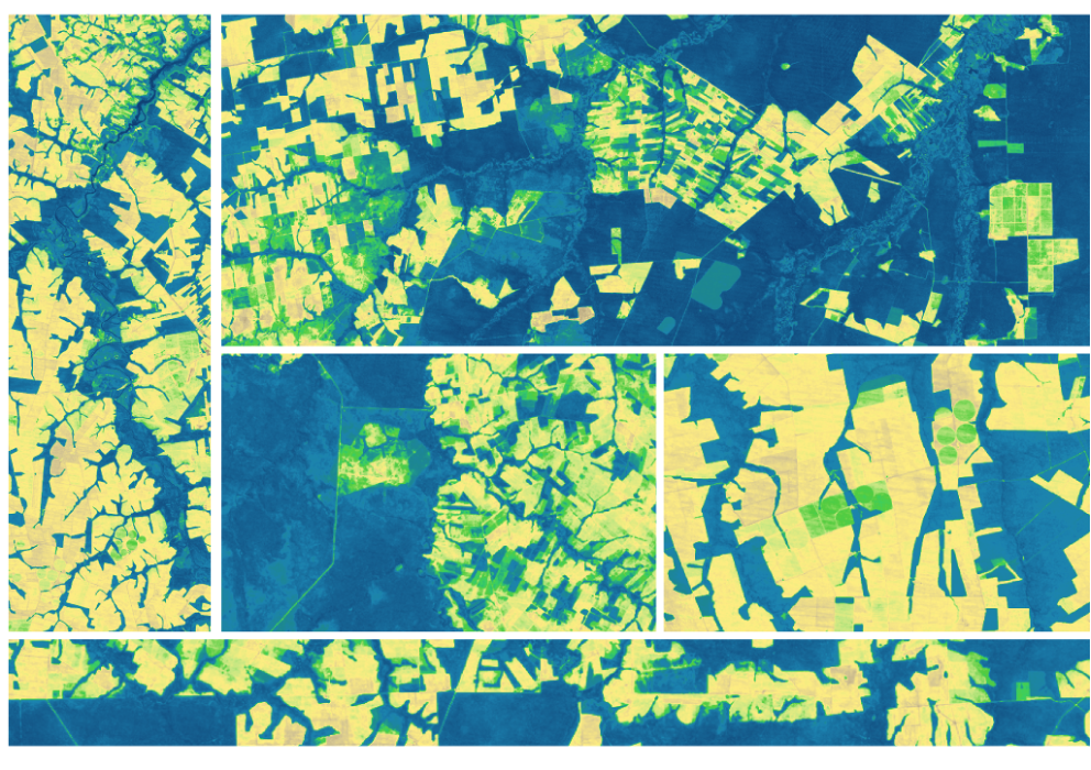
The research teams who help sustain the largest freshwater reserve in the world are developing a new tool to promote more resilient farming systems in Brazil. The goal is to help farmers better handle changes in the water cycle, deal with droughts, and adapt to a changing climate.

Read More »
Landsat Next Defined

Landsat Next Defined

Landsat Next is on the horizon—the new mission will not only ensure continuity of the longest space-based record of Earth’s land surface, it will fundamentally transform the breadth and depth of actionable information freely available to end users. Take a look at the new capabilities that will define the next Landsat mission.

Read More »

Expanding OpenET Across Amazon Basin

The research teams who help sustain the largest freshwater reserve in the world are developing a new tool to promote more resilient farming systems in Brazil. The goal is to help farmers better handle changes in the water cycle, deal with droughts, and adapt to a changing climate.

Read More »

“A new era of open-access satellite data has arrived. In 2008, The U.S. Geological Survey released for free to the public its Landsat archive, which dates back to the 1970s and is the world’s largest collection of Earth imagery.”


“The Landsat mission has been monitoring Earth from orbit for more than 40 years. It is by far the longest continuous record of the surface of the planet, and certainly one of the most valuable data sets in existence.”


“The Deltares Aqua Monitor is the first global-scale tool that shows at 30-m resolution where water is converted to land and vice versa. With assistance from Google Earth Engine, it analyzes satellite imagery from multiple Landsat missions, which observed Earth for more than three decades, on the fly.”


“It is one of the greatest wetlands management tools that has become available in many years. The wetlands mapping plus WIT outputs are used on a daily basis by a very broad range of stakeholders, from government officers to planners and to those involved in on-ground rehabilitation and management—frankly it’s hard to know how we managed without it.”


“It is a game changer for people who want to know the impact of a management action on particular piece of land, or how a dam affected the downstream area.”


“We live on this planet Earth. We all know that we want to leave this planet for our children. We know the importance of sustainability and I think that’s what Landsat’s all about. It’s about helping us manage the planet that we live on for the long-term. And that’s why it’s there and that’s why it continues to be here. And I expect it to be there for the next generation as well.”


“In order to produce a rock outcrop map for the entire Antarctic continent, we required a freely available georeferenced multispectral dataset. The dataset needed to cover the high latitudes; be recently acquired; be of a high enough resolution to identify individual outcrops and geomorphological features; and have suitable coverage of the continent. On this basis, the Landsat 8 multispectral satellite data was chosen for analysis as no other platform met these requirements. It would not ha…


“The tracking of over-irrigated areas for targeting irrigation advisory texts was completely dependent on Landsat TIR data.”


“If it weren’t for Landsat, we wouldn’t be where we are in terms of understanding our Earth.”


“The ability to see what was happening through time through Landsat imagery helped us tremendously… from sea-level, we hadn’t seen the signs of retreat that the Landsat imagery showed us—the diminishing of the glaciers, of the size and mass of the glaciers. It rocked our world. It truly changed the narrative of interpretation in Glacier Bay. The story that we shared with visitors about glaciers in Glacier Bay was transformed by that information.”


“With applied conservation programs, we’re using that [Landsat] imagery to say here are the areas that we can prioritize for conservation management, and here are areas that maybe we can let go. It’s a very powerful tool for getting conservation to happen.”


“Landsat provides a very good coverage of Amazonia both spatially and temporally. We have known for some time already that the Landsat images can be used to identify ecologically relevant environmental and biotic variation in Amazonian rainforests, but this is the first time we use satellite images to actually predict species distributions.”


“Without Landsat, ‘we would be flying blind. We need those eyes in the sky to complement our ground efforts.'”


“Global Forest Watch’s ability to take advantage of Landsat imagery to produce a global forest monitoring platform highlights why remote sensing has become such a revolutionary technology. The imagery has achieved a state-of-the-art quality—NASA’s Landsat data is delivered in 30x30meter squares and has been for the past 40 years. Beyond this, it has been made radically accessible. Since 2008, anyone has been able to view and download the data from the United States Geological Survey (USGS) websi…


“It is undeniable that having access to long-term satellite data has allowed ecologists and environmental managers to increase their understanding of the natural world, to make predictions about how this world might transform and to design efficient mitigation and adaptation strategies in the face of global environmental change.”


“If you don’t do the calibration right, you can’t do anything else.”


“Landsat is really important because it gives us that time component. We can go back in time and see what an area let’s say a coastal zone or a mangrove forest has been like over time.”


“Landsat’s work is epic in scale. In 43 years, it has amassed over a petabyte of data, with over 4 million scenes and counting.”


“[I]n 2008 USGS first instituted the policy of giving away Landsat data for free (first with Landsat 7, then the rest of the archive in 2009). It probably felt like a crazy choice at the time after billions of dollars of investment in the program… but the effect was immediate and extraordinary. Roughly a 100-fold increase in downloads in a decade.”


“Understanding how this planet works and helping people make better, informed decisions is really what we’re about in Earth Science.”


“The USGS’ incredible gift of open-source [Landsat] imagery and this kind of tool are truly advancing what non-scientists can expect when it comes to views of their planet. Never before have regular people had such ready access to geographic data at this depth and quality.”


“[Landsat] has transformed our understanding of Earth and allows us to better monitor and respond to changes on our planet.”


“As the global population surpasses eight billion people, it will be important to effectively manage land to sustain life on Earth. Landsat 9 will pair with Landsat 8 to greatly improve our understanding of what is driving changes to our lands, surface waters, and coasts, and how we can sustainably manage it.”


Landsat 9 bw
Landsat 9 bw
Landsat 9 bw

The NASA/USGS Landsat Program provides the longest continuous space-based record of Earth’s land in existence. Landsat data give us information essential for making informed decisions about Earth’s resources and environment.