
Source: South Dakota State University
“It depends on the height of the trees in the forest canopy,” according to Pedro Valle de Carvalho e Oliveira, a doctoral student at the Geospatial Sciences Center of Excellence at South Dakota State University.
The Brazil native has been awarded a NASA Earth and Space Science Fellowship to integrate remote sensing data from airborne light detection and ranging (LiDAR) and Landsat 8 and Sentinel-2 satellites to map the height of the Brazilian Amazon forest canopy. His research will make it possible to better calculate how much carbon is released through deforestation. His adviser is David Roy, a senior scientist at the Geospatial Sciences Center of Excellence and a professor in the SDSU geography department.
Oliveira is the 10th student in the SDSU geospatial sciences and engineering doctoral program to receive the NASA Earth Science Fellowship since 2006. The three-year fellowship provides a $35,000 doctoral student stipend and an allowance of $10,000 for student and university expenses. NASA received a total of 424 fellowship applications from which only 54 were selected.
“This means a lot—NASA is recognizing the importance of this research,” said Oliveira, who worked at the National Institute for Space Research in Brazil on a project to collect LiDAR data before coming to SDSU. “We are trying to reduce the uncertainties regarding the amount of carbon sequestered in the forest, so we can use these values for climate change mitigation,” he explained. This will help programs, such as United Nations REDD+, which reward countries for reducing carbon emissions.
Calculating biomass
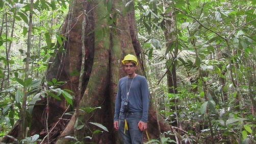
“The only way you can really measure a tree’s biomass is a destructive method—you go in the field, cut down the tree, remove the roots and weigh everything,” Oliveira explained.
Various allometric models use the trunk diameter at breast height, tree height and wood density recorded for all the trees that are at least 4 inches in diameter within an approximately 2.5-acre area. That information is then used to predict above-ground biomass.
Though the accuracy varies based on the method used, Oliveira pointed out, “the uncertainties of these models are very high—in the range of more than 50 percent. By taking advantage of remote sensing to look at a large area and combine all the information, we hope to come up with approaches that can more accurately estimate above-ground biomass.”
Combining satellite sensor, LiDAR data
Accessing data from Landsat 8 and the Sentinel-2A and 2B satellites makes it possible for Oliveira to retrieve images of the Brazilian Amazon every three days. “This increases the chance of acquiring cloud-free images, which is hard in the tropics,” he explained, particularly in the rainy season, November through May.
However, Oliveira pointed out, using the images from several satellite systems will be challenging because they have different spatial resolutions. The Sentinel-2A and 2B sensors have a 20-meter resolution, while the Landsat 8 sensor has a 30-meter resolution.
To assess vegetation in the Brazilian Amazon, Oliveira will use satellite sensor data from the red, near-infrared and shortwave infrared spectral bands during 2016 and 2017 and more than 1,000 airborne LiDAR point clouds acquired in this period through a $28 million project sponsored by the Amazon Fund.
“LiDAR height measurements collected from airplanes are now very accurate, with error margins in the 10- to 15-centimeter range,” he explained. Each airborne LiDAR transect is approximately 7-1/2 miles long and less than 1,000 feet wide.
“If we had airborne LiDAR data for the whole Amazon, it would be perfect, but that would be prohibitively expensive to collect,” said Oliveira. “Instead, we will use satellite data that is available for free to survey the entire area.” That will allow him to develop a cost-effective method to map above-ground biomass in tropical regions that will be more accurate than current ground-based sampling.
Furthermore, NASA plans to deploy LiDAR on the International Space Station through the Global Ecosystems Dynamics Investigation (GEDI) LiDAR mission, which launches in 2019. GEDI will take 25-meter radius LiDAR measurements of the world’s forests, according to the U.S. Forest Service website.
Once this data becomes available, it may become possible to map the above-ground biomass of forests on a global scale. “With this data, I can go further,” Oliveira added. “But for now, I’ll focus on the Brazilian Amazon.”


