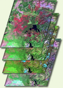
Category: Data

News Archive
Landsat 3 layers image

Unleashing Climate Data and Innovation for more Resilient Ecosystems

Ecosystems provide vast services and benefits to humankind: food and water that is needed for survival; nutrients and other natural products that fuel farms and industries; natural controls on many pests and pathogens; storage of carbon safely out of the atmosphere; shared spaces for tourism and recreation; and sanctuaries that preserve biodiversity, natural beauty, and cultural history.

Read More »

A Call for Open Access Earth Observations

This month in Nature, an emphatic plea to make more Earth satellite imagery free was made by Michael Wulder, a senior research scientist with the Canadian Forest Service and Landsat Science Team member; along with Nicholas Coops, a remote sensing professor at the University of British Columbia.

Read More »

Sun Seekers Unite in Ivanpah Playa

On public land in the Ivanpah Valley near the California/Nevada border, the world’s largest concentrated solar thermal plant sprawls across the desert landscape. Just on the other side of Interstate 15 (the long straight diagonal line) is the location of a Landsat calibration site.

Read More »

Unleashing the Power of Open Data Unanimously Endorsed for Another 10 Years

In Geneva on January 17, 2014, the Group on Earth Observations (GEO) received unanimous endorsement to unleash the power of open data for a second decade. There was agreement to continue building on the organization’s first 10 years of pioneering environmental advances, which are designed to improve the quality of life of people everywhere. Fueled by open data, GEO’s efforts are now evident in most regions of the world. GEO is comprised of 90 member nations, including the European Commission and 77 Participating Organizations.

Read More »

Unleashing the Power of Earth Observations

In December 2013, the Secretariat Director of the Group on Earth Observations gave a TEDx talk in Barcelona, Spain making the case that all Earth-oberservation data collected from governments and institutions should be open and available to everyone. She illustrates how this could reduce hunger and improve the quality of life of all Earth’s inhabitants. Ryan emphasizes that Earth observation data show Earth without political boundaries, as an entire system.

Read More »

Landsat Impedes Crop Insurance Fraud

With unbiased Landsat imagery as evidence, the U.S. Court of Appeals for the 9th Circuit affirmed an earlier jury-conviction of a northern California farmer found guilty on 16 counts of filing false federal crop insurance claims—scheming the government out of $410, 372.

Read More »

NRC Report "Landsat and Beyond" Available

In 1972 NASA launched the Earth Resources Technology Satellite (ETRS), now known as Landsat 1, and on February 11, 2013 launched Landsat 8. Currently the United States has collected 40 continuous years of satellite records of land remote sensing data from satellites similar to these. Even though this data is valuable to improving many different aspects of the country such as agriculture, homeland security, and disaster mitigation; the availability of this data for planning our nation’s future is at risk.

Read More »