Inside Dr. Anemone’s space, you spot books and binders on shelves all around. There’s a desk, a small conference table with chairs around it, and a couple of softer living room type chairs. It is all pretty standard college professor decor until you notice what is in the back corner.
“We apparently ran across the remains of a crocodile,” says Dr. Anemone, as he shows me about a half dozen fossils that are sitting atop a waist-high cabinet in the corner of his office. “Here’s the carapase of a turtle, so we know turtles were living around these swamps. Here’s the dermal bones, or skin bones, of an alligator, scutes, they’re called.”
The fossils in the cabinet are more than just proof of life at the start of the Eocene epoch in what is now the American west. It is a snapshot of time. Fifty million years ago, the Rocky Mountains were rising, the dinosaurs had disappeared, and in the Great Divide Basin of what is now southwest Wyoming, prehistoric mammals were adapting and spreading.
“There was a lake in this basin; the river drained into it and some of the animals we’re finding lived in the lake or the streams feeding into it,” adds Dr. Anemone, as he shows off other fossils that are stored in the dozens of drawers beneath the table top.
The collection is the result of 20 years of the professor’s work in the basin. The area covers about 10,000 square miles. It is in between chains of the Rocky Mountains, straddling the continental divide. It is an arid landscape now but at the start of the Eocene, the land was under water.
“The basin is beautiful, rugged and remote, so it is an amazing place to be in,” says Dr. Anemone. “But from an academic perspective, it is where so many of the ancestors of today’s mammals were getting started.”
The trouble is, finding the fossils that are needed to piece together the picture puzzle of early life in the basin is not only hard work. It also depends on a lot of luck.
“Paleontologists have been working in the field pretty much the same way for 100 or more years,” explains Dr. Anemone. “We go to places where the geologists tell us the rocks are of the right age and the fossils might be exposed because there is some erosion at the surface. And then were go out and start walking around and looking.”
The professor admits that the system has worked. He points to his fossil-filled cabinet as proof. But he also believes it is not very efficient. There has to be a better way.
And that’s where our fossil story changes. Because one night during a recent fossil-hunting trip, as Dr. Anemone was admiring the star-filled Wyoming sky after a long day of scouring the landscape, he had an idea.
Satellites.
“There is a sensor in the Landsat satellite which measures the intensity of the reflected radiation back into space,” he explained. “What if we could use satellite imagery from the Landsat program to find fossils?”
The Landsat program launched in 1972 as a joint project between NASA and the U.S. Geological Service. The eighth satellite in the program was launched in 2013. It is the world’s longest running earth imaging program, and the images are free to the public.
The satellites image the earth in various wavelengths of light bouncing off the surface; soil and earth features are in one wavelength, vegetation in another, water in still another, and the list goes on. All of those images are combined to form a complete picture.
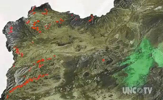
The program compares known fossil locations with prospective dig sites. If the spectral signatures of both sites match, which means soil types and other features are the same, the program predicts there’s a high probability fossils could be found there. In other words, if fossils are found in these conditions in one area, there’s a good chance fossils will be found in similar conditions in another area.
To test the program, Dr. Anemone and his team went to 31 locations where the program predicted fossils would be found. Twenty-five of those locations yielded fossils.
“Within an hour we found our first Eocene mammals following this predictive model,” Dr. Anemone says excitedly. “It was a eureka moment — the first time we thought this might really work.”
Senior biology student Ashley Bryant was a member of the fossil-hunting trip that tested the program. She remembers doubting the accuracy of the maps as she walked through areas of scrub brush and clay soil. It was not the type of location where the team had found fossils before.
But then as the scientists and students climbed a hill and approached the area where the program predicted fossils would be found, the landscape changed.
“And it opened up into an eroded sandstone valley, just like where we had found fossils in other areas,” says Bryant. “I remember when I found my first jaw, it was like the heavens opened up. It was just sitting there and I picked it up and it was a jaw with teeth!”
Bryant says jaws with intact teeth are the best fossil finds because you can learn so much about the animal, including age, diet and health, just by looking at the teeth.
“Working in the field was an amazing experience and I will never forget finding my first fossil,” adds Bryant. “But I also learned finding fossils is all about patience, because after a while it all starts to looks the same. You don’t know if this is a rock or a tooth, but once you find your first bone, it definitely pays off. It is so worth it.”
Dr. Anemone admits it will take time for paleontologists to accept his system. In a profession that studies the ancient past, the traditional ways of study are difficult to challenge. But he says even with the help of technology, paleontology still requires painstakingly difficult work in the field.
“What I can say to other paleontologists is that we still do the hard work in the field of walking long distances with our eyes on the ground and bent over at the waist,” says Dr. Anemone, as he traces his finger over the map showing one days work. “But the important thing is that we’re doing it more efficiently. It is not just about luck anymore.”
Further Information:
+ UNC-TV video “Dinosaur GPS”
+ Scientists Use NASA Landsat Data to Hunt for Dinosaur Fossils
+ Finding Fossils from Space
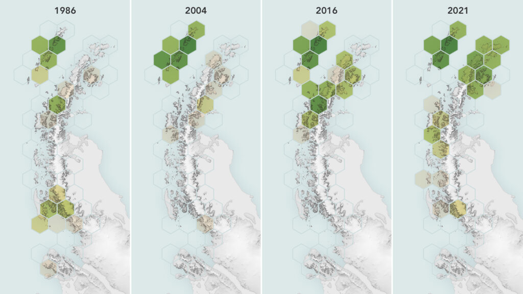
Mangroves Are Losing Their Resilience
Mangroves, the iconic trees and shrubs of the Florida Everglades, are under increased stress due to more frequent, intense hurricanes.