
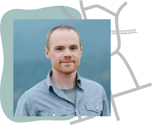
March 25, 2021 • Justin Braaten is an image processing code wizard, helping everyone from wildlife ecologists to machine learning experts more easily use Landsat. (Officially, he’s a technical writer for the Google Earth Engine Developer Relations team, working from Santa Cruz, California.)
He both educates and inspires the online community of Earth Engine developers. In the Twittersphere, Justin is regularly being thanked by Landsat cognoscenti and neophytes alike. We recently had a chance to talk with him. Here’s our Q&A:
How did your career path lead you to Landsat?
I studied biogeography in college and did field work on long-term forest monitoring projects during summer breaks. I was fascinated by local-scale patterns of vegetation in 1-hectare forest plots. I wondered about patterns at more regional scales and Landsat data seemed like a good fit. I was able to get four images from Olympic National Park GIS staff (before Landsat data were free) and was hooked.
Later I trained with Landsat Science Team members Robert Kennedy and Warren Cohen on remote sensing applications in ecology at Oregon State University. Much of the work was on developing systems for image processing, automated forest disturbance detection, and map/algorithm validation.
LandTrendr and TimeSync were foundational projects for me; they cemented my interest in Landsat image time series processing, analysis, and visualization. The combination of programming, ecology, landscapes, land use history, and data visualization really resonated with me.
How would you characterize the importance of the Landsat data archive?
I think its importance cannot be overstated. Landsat provides an unparalleled record of how terrestrial Earth has changed since the early 1970s, closely coinciding with the beginning of rapid environmental change. It provides important historical context for the current state of land cover and land use and provides a reference for identifying abnormal types and rates of change. I’m grateful that NASA, USGS, and scientists like William Pecora had the foresight to begin collecting Earth observations a half century ago.
Why did you start using Google Earth Engine?
My interest in Google Earth Engine stemmed from the difficulties with processing massive amounts of Landsat imagery with LandTrendr locally. The LandTrendr algorithm was ported to Earth Engine as an API component and I got really excited about how Earth Engine could be used to break down barriers to entry for large and complex Earth observation analyses.
With Earth Engine we didn’t need to manage downloading and storing imagery, we didn’t need to manage and maintain computers and servers for processing, and the system could be easily run by anyone—no IDL software license or detailed knowledge of a tedious workflow was required.
What drives your interest in helping others use geospatial satellite data?
I’m interested in enabling others to discover how Earth is changing through the charting and visualization of various Earth observation datasets which are now so freely available and accessible. I’m inspired by David Attenborough—his ability to connect people to nature through video and narration.
Earth observation (EO) data is not nearly as charismatic or engaging as wildlife, but I want to work toward eliciting a similar feeling of awe for Earth processes and empathy for creatures (including us!) experiencing effects of habitat and environmental degradation using EO data.
We often see ecologists thanking you on Twitter. Do you have any specific examples of people or projects you’ve assisted that you’re particularly proud of?
It’s always a joy to see people take a script or tutorial I’ve shared and modify it for their own use. It makes me happy to know that I can spark an idea, extend someone’s study, or enhance education. I’ve particularly enjoyed working with Clayton Lamb (@ClaytonTLamb), a wildlife scientist working on conservation issues. I’m most excited when my work can help those outside of the remote sensing community incorporate EO data in their studies and efforts to steer land management toward better stewardship and coexistence with nature.
You are the creator of a very popular tutorial on making Landsat change-over-time animated GIFs (that we share on this site). Which of your tutorials is most used?
The Landsat time series GIF creator is certainly up there. Another popular one is on how to make an annual MODIS NDVI time series animation—the example is Africa and the result is stunning—the tide-like latitudinal shift in vegetation productivity over the year resembles a beating heart.
What advice do you have for the ecologist or application scientist out there who wants to start using Landsat data to assist their understanding of Earth’s landscape?
Follow Mike Wulder (@mikewulder) and Ladies of Landsat (@LadiesOfLandsat) on Twitter and read the papers they post about Landsat applications. I think the greatest value of Landsat is its long time series. Getting familiar with time series algorithms like LandTrendr, CCDC, BFAST, and COLD is helpful. If image processing is too much, another good place to start is using Landsat-derived products such as NLCD, LCMAP, LANDFIRE, LCMS, MTBS (NLCD, LCMS, and LANDFIRE are available in the Earth Engine Data Catalog).
Do you have foundational steps to recommend for folks who are interested in doing their own coding for geospatial applications on Google Earth Engine but don’t have much coding background?
Luckily, Earth Engine requires very little knowledge of programming outside of the API. If you want to use Earth Engine, you essentially only need to learn the Earth Engine “language,” so don’t let
a lack of knowledge in JavaScript or Python scare you away.
Be intentional and commit to going through the Developer’s Guide. Don’t be tempted to Google “how do I _____ in Earth Engine” when you are first starting out—do this after you have a basic understanding of the Earth Engine architecture (object classes and methods, how GEE deals with projections and scaling, etc).
Here are some quick-start resources: Introduction to the Earth Engine JavaScript API series and a Beginners cookbook.
What do you envision for the future of remote sensing applications?
Here are four applications I hope to see in the next few years: (1) increased automation of change detection and classification; (2) increased near-real-time monitoring and forecasting of change for alerts e.g. illegal forest practices and unhealthy air quality; (3) increased value-added data products (e.g. land cover, land use change); (4) increased adoption by the non-remote sensing community, particularly of value-added products.
Any use of trade, firm, or product names is for descriptive purposes only and does not imply endorsement by the U.S. Government.
Q&A conducted by Laura E.P. Rocchio


