
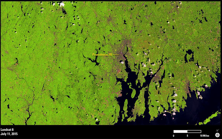
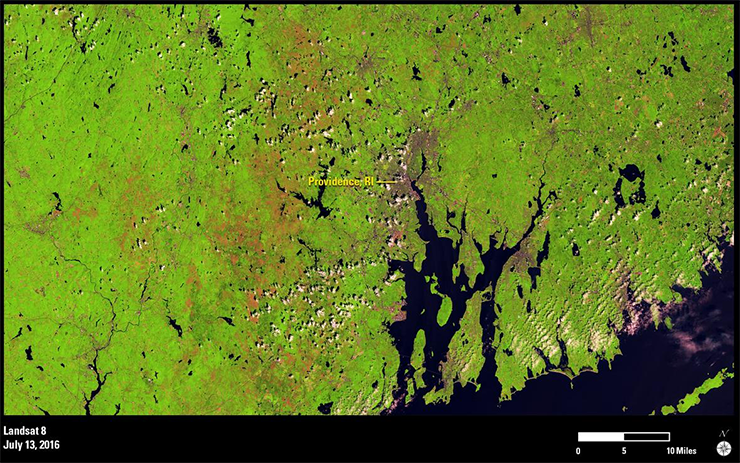
In these 2015 and 2016 Landsat images of the forested countryside surrounding Providence, RI, during July, defoliation is easily discernible. In the 2015 image, healthy forest appears light green. Almost exactly a year later, after the caterpillars have hatched and had an opportunity to feed, defoliation of the hardwood forests is captured by wide swaths of dull peach landscape through the middle of the image.
While gypsy moths are a constant presence in the northeastern United States, their populations swell certain years because of several environmental factors. In 2016, forest managers and biologists are blaming two successive dry springs and the accompanying drought on the outbreak. Drought in turn weakens a second factor that keeps the gypsy moth population in check—a fungus found on the ground that can infect and ultimately kill gypsy moth caterpillars.
Frequent monitoring to assess gypsy moth impacts is a valuable area of Landsat time-series research. In the past, traditional monitoring of gypsy moth damage to vegetation was done with aerial surveys that took hundreds of hours by pilots in planes crisscrossing the region once per season. Today, Landsat 8 imagery is acquired every 16 days, and automated algorithms are available for extracting change information. If used with Landsat 7 imagery, monitoring can take place every 8 days.


