Search
Close this search box.

MSS You! Photos from a 1972 Road Trip

MSS You! Photos from a 1972 Road Trip

In May 1972, with the launch of Landsat 1 just two months away, the instrument vendor of the satellite’s Multispectral Scanner System (MSS) decided to send its engineering model of the MSS on a California road trip to image some of the state’s iconic scenery.

These color photographs of the MSS engineering model shown above were taken during that road trip. To the best of our knowledge, this is the first time these color photos from the trip have been made available online. Two black and white versions of these photos appear in an August 1972 report.

Reason for a Road Trip

With the flight model of the Landsat 1 MSS already shipped to NASA and integrated onto the satellite bus, why did Hughes (the MSS fabricator) decide to hit the road with the engineering model?

According to Virginia T. Norwood, the “mother of Landsat” (and source of these photos), some managers at NASA were still unsure if the MSS would return usable images.

The MSS imaging technology was completely new. It used a banging mirror to scan back-and-forth more than 13 times a second and direct light from the ground onto the instrument’s detectors, and in that manner, “build up” an image as the satellite traveled overhead. Norwood had also made the decision to send the MSS data down to the ground digitally—a ubiquitous practice today, which was met with great resistance at the time.

To quell nervous doubts, Norwood and her colleagues at Hughes Santa Barbara Research Center decided to collect ground images with the MSS engineering model. 

Ralph Wengler, the lead MSS project engineer at Hughes Santa Barbara, gathered several technicians, mounted the MSS engineering model to a rotating table—to simulate the satellite’s orbital progression—and put everything on the back of truck.

An animation (right) of the MSS engineering model’s 1972 road trip to Yosemite National Park and its imaging of Yosemite’s iconic Half Dome. Animator: Ross Walter

On May 19, 1972, technicians in a four-door Ford Gran Torino and the MSS on a box truck set out on an eleven-day journey to image six test sites.

The test sites had been carefully selected. Requirements for a good site included a target more than five miles away with a large field of view and no foreground obstructions. There had to be a level parking area to image from, a haze-free day with visibility of greater than 30 miles, and a variety of subjects to image including vegetation, rocks, water, snow, or buildings.

The first stops were in eastern California and Nevada, including Lone Pine, Panamint Valley, and Lake Tahoe. By Wednesday, May 24, the team was in the San Francisco Bay area imaging the city’s skyline.

The most iconic images from the trip were taken over the next two days in Yosemite National Park. A panoramic image of Half Dome was among the Yosemite images captured by the MSS. A 40-inch print of that image hung on the wall of Norwood’s home for the rest of her life. Wengler, likewise, kept one at his home for decades.

A black and white image of the San Francisco skyline with the bay in the foreground.
A image of the San Francisco skyline imaged by the MSS engineering model on May 22, 1972, from the Golden Gate Bridge Vista Point (scanning from 70 to 210 degrees). Image credit: Hughes / NASA
MSS Half Dome image (black and white)
An MSS engineering model image of Yosemite's Half Dome taken from Glacier Point, using MSS band 2 (the red band). Image credit: Hughes / NASA
Another view of Yosemite National Park taken with the MSS engineering model.
Image of Yosemite National Park taken from Glacier Point on May 26, 1972, by the MSS engineering model. Image credit: Hughes / NASA
A black and white MSS engineering model image of Bridalveil Falls in Yosemite National Park.
An image of Yosemite Valley's Bridalveil Falls taken by the MSS engineering model on May 25, 1972. Image credit: Hughes / NASA
The MSS engineering model at the Smithsonian National Air and Space Museum
A photograph of the MSS engineering model at the National Air and Space Museum in 1993, taken by Ralph Wengler on a family visit to Washington, D.C. (more than two decades after the MSS California road trip).

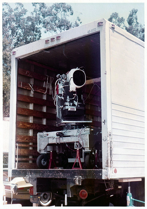
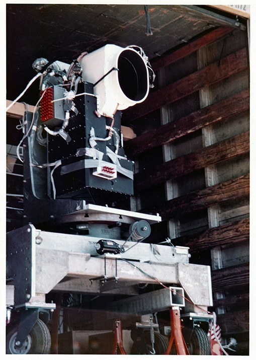
In a 2006 Landsat Legacy oral history conducted with Wengler, he stated that the Landsat 1 MSS engineering model was given to the Smithsonian National Air and Space Museum, in Washington, D.C.

Landsat engineer, Aram Mika, also documents the transfer of the model to the Smithsonian in a 1997 journal article.

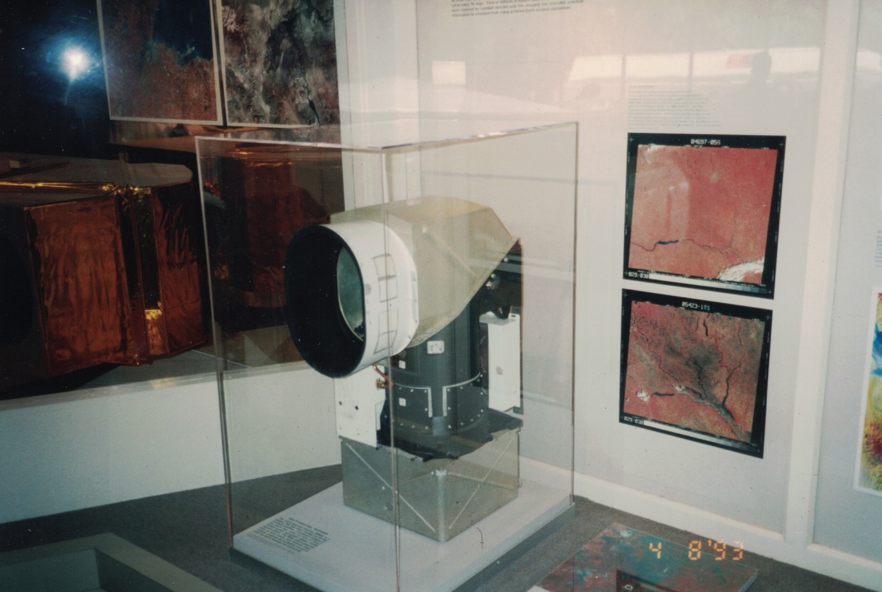
The National Air and Space Museum’s collection of historical Landsat artifacts also includes the Landsat 4 MSS engineering model and a model of the follow-on Thematic Mapper instrument.

If you are interested in more details about Landsat’s long history, the 2017 book Landsat’s Enduring Legacy: Pioneering Global Land Observations from Space, has been made freely available by NASA, and can be downloaded from the publisher, ASPRS.

Related Posts

History brief by Laura E.P. Rocchio

Acknowledgements: Thanks to Naomi Norwood for finding and sharing the photographs shown here from her mother’s Virginia document collection, and to Dave Doremus for identifying the make and model of the accompanying car.

Update: A 1993 photograph of the MSS engineering model at the Smithsonian National Air and Space Museum was added to this post on June 18, 2024.  The photograph was taken by Ralph Wengler on a family visit to the museum in 1993 and shared with our team by Jim and Earline Snell.

On Key

Recent Posts

Earthrise

Remembering Bill Anders

Anders, 90, the astronaut who captured the iconic Earthrise photograph, died on June 7, 2024, when the plane he was piloting crashed into the San Juan Channel.

Read More »
On Key

Related Posts

Earthrise

Remembering Bill Anders

Anders, 90, the astronaut who captured the iconic Earthrise photograph, died on June 7, 2024, when the plane he was piloting crashed into the San Juan Channel.

Read More »