
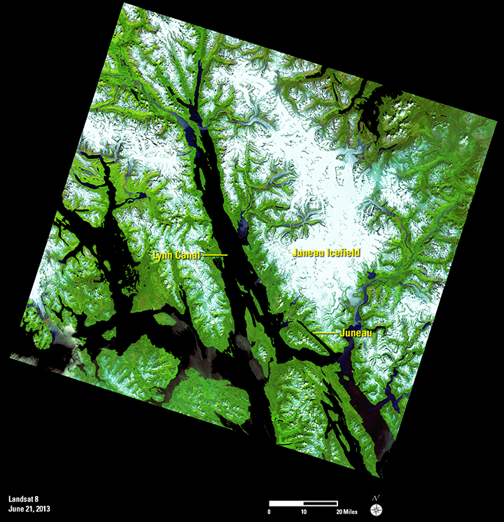
This Landsat 8 scene was one of the many downloaded on September 16. It shows the area around Juneau, Alaska. Water is dark and includes Lynn Canal, the long water body in the middle of the image. Green is vegetation and forested mountain areas.
This image also provides a clear view of the Juneau Icefield. Several glaciers flow from this icefield, and glaciologists are using the 42-year Landsat archive to monitor the advance and retreat of the glaciers over time. Since Landsat 7 and Landsat 8 together provide an 8-day repeat cycle, Landsat can be an important supplement to ground-based glacier monitoring.
Scientists, students, city planners, environmental engineers, and many others have been able to use the vast archive of Landsat data free of charge to support and enhance their research. The free availability of Landsat data enables scientists to conduct large-scale global studies that would otherwise be too costly.

Be Part of What’s Next: Emerging Applications of Landsat at AGU24
Anyone making innovative use of Landsat data to meet societal needs today and during coming decades is encouraged to submit and abstract for the upcoming “Emerging Science Applications of Landsat” session at AGU24.


