
By Laura E.P. Rocchio
Mingyang Lv is a geoscience Ph.D. candidate at Nanjing University and an intern at the Institute of Remote Sensing and Digital Earth of the Chinese Academy of Sciences. This morning at #AGU16, he shared his recent research on the 2015 Kelayayilake Glacier surge in Western China. Here is what he told us:
Presentation Title
Characteristics of a Glacier Surge Event Derived from Landsat Image Sequences and Its Response to Regional Climate Change: Kelayayilake Glacier, Western China, 2015
What are the major findings of this research?
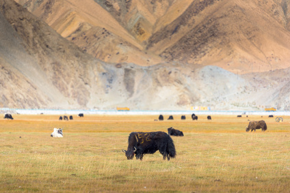
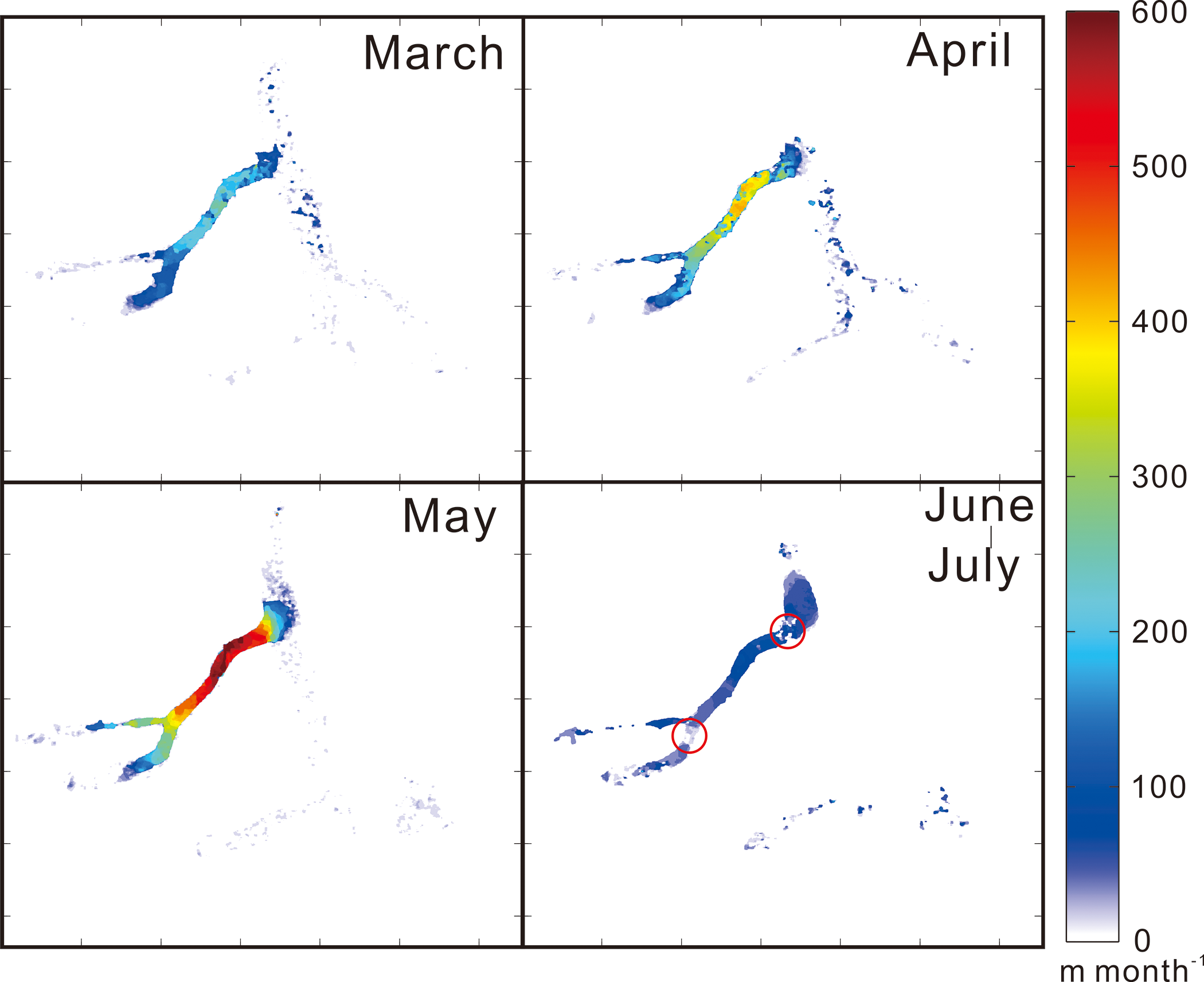
A severe glacier surge struck eastern Pamir, in western China, in May 2015. The surge was accompanied by an avalanche. The surging glacier is the west branch of Kelayayilake Glacier which is located in the north of Mt. Tobe Feng (38°37′N, 75°12′E). Fortunately, it caused no casualties. However, the glacier swallowed up hundreds of hectares of grazing meadow, damaged most herdsmens’ houses near the glacier, and left hundreds of livestock missing. The northern part of the glacier is completely blocked by the surging glacier. After the surge, parts of the glacier formed a dammed lake which is threat to downstream residents.
We used the Landsat 8 Operational Land Imager (OLI) images for several months during and before the west branch of Kelayayilake Glacier surge to detect the fluctuations both qualitatively and quantitatively. We found that the surge began in March, peaked in May, and terminated in July, which affected an 8.9 km2 area of the west branch. The west branch surged into the trunk glacier and then came to a sudden stop.
What are the implications of your findings?
The surge initiated in March, however, it did not negatively affect local residents until two months later. Knowing how the glacial motion changed in last few days or months can help forecast future forming surge events and thereby reduce local property loss. It also provides an opportunity for the detailed study of glacial dynamics in western China.
What insight did you gain from Landsat 8 that would have been impossible to glean otherwise?
In order to detect the displacement of glacial surface in a remote area like eastern Pamir, we need continuous optical satellite imagery with high temporal and high spatial resolution, and low cloud-cover conditions. The freely available Landsat 8 OLI data perfectly satisfied our needs of experimental data. The panchromatic band of Landsat 8 has the best spatial resolution (15 m) among the free datasets we can get. Temporal resolution of sixteen days is also perfect for detecting the displacement over each time interval. It would be impossible for us to reveal the evolution of this surge event utilizing other satellite imagery or by other research means.
Is the peak velocity of 605 m/month a typical speed for surging glaciers or is this particularly fast?
Most glaciers in this area and surrounding areas are extreme continental types and usually flow very slowly (30-100 m/year). According to other research, the peak velocities of glacier surges in western China are within the range of 100 m/month–200 m/month, with a few reaching ~450 m/month (Quincey, Glasser et al. 2015). So, the peak velocity (605 m/month) of this surge is particularly fast for a glacier surge in western China. Even though glacier surges are common in western China, such a large-scale surge is still rare.
Co-authors:
Huadong Guo
Nanjing University
RADI Institute of Remote Sensing and Digital Earth, Chinese Academy of Sciences
Guang Liu
RADI Institute of Remote Sensing and Digital Earth, Chinese Academy of Sciences
Zhixing Ruan
RADI Institute of Remote Sensing and Digital Earth, Chinese Academy of Sciences
Shiyong Yan
China University of Mining and Technology
Yixing Ding
RADI Institute of Remote Sensing and Digital Earth, Chinese Academy of Sciences
This research was supported by the International Cooperation and Exchange of the National Natural Science Foundation of China [No.41120114001].
Related reference:
Quincey, D. J., et al. (2015). “Heterogeneity in Karakoram glacier surges.” Journal of Geophysical Research-Earth Surface 120(7): 1288-1300.
Anyone can freely download Landsat data from the USGS EarthExplorer or LandsatLook.
Further Reading:
+ Landsat Abounds at #AGU16


