
Dr. Kyle Cavanaugh is an Assistant Professor in the Department of Geography at UCLA. His current research focuses on mangrove expansion poleward. Today at #AGU16, he presented a poster on this work. Here’s what Dr. Cavanaugh shared with us about his research:
Presentation Title
Global patterns in the poleward expansion of mangrove forests
What are the major findings of this research?
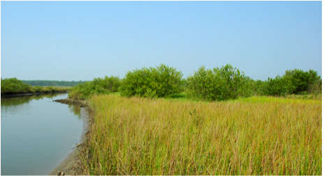
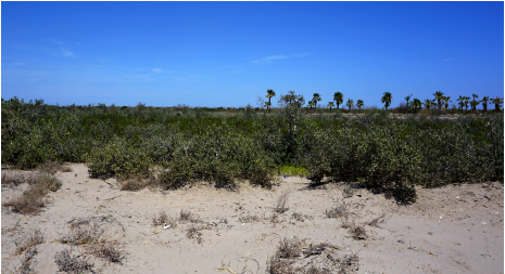
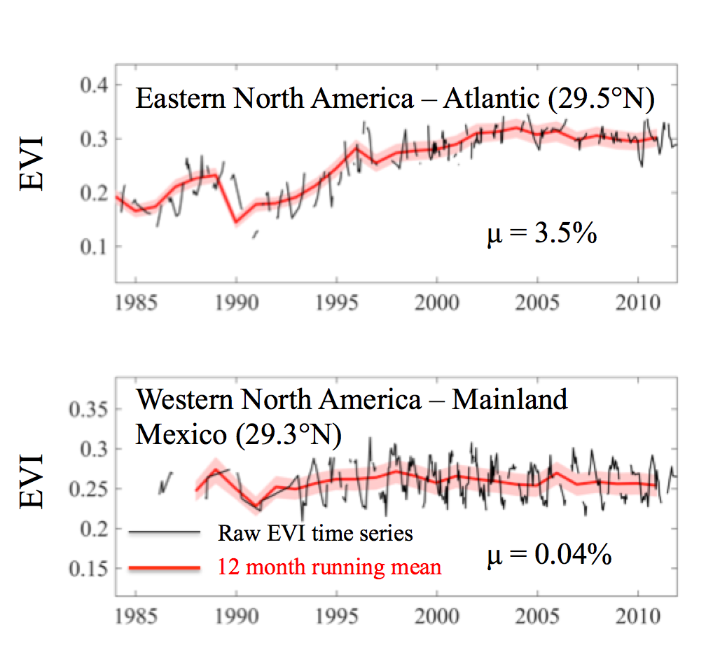
Mangrove expansion has been observed in some subtropical locations around the world. However, the scale and causes of this expansion remain unclear. In this project we examined long-term trends in a vegetation index that tracks the abundance of mangroves at six different poleward mangrove range limits: the east coast of Florida, the Gulf coast of Florida, Baja Mexico, mainland Mexico, Peru, and Brazil. We found a great deal of variability in the dynamics of different mangrove range limits. Some regions showed evidence of large-scale mangrove expansion (e.g. Florida) while others were highly stable over the past 30 years (Baja and mainland Mexico). We also found that mangroves at various range limits respond differently to changes in environmental conditions thought to control those range limits (e.g. temperature and precipitation).
What are the implications of your findings?
Improving our understanding of the processes that control the distribution of mangroves will help us better understand the causes of recent mangrove expansion and predict how future climate change will impact these ecosystems. Our results suggest that mangrove range limits on the east coast of North America are especially sensitive to changes in temperature. As a result, future warming is likely to lead to further expansion of mangroves in these areas.
What insight did you gain from Landsat that would have been impossible to glean otherwise?
This project would not have been possible without the consistent, long-term coverage provided by Landsat. The > 30-year archive of Landsat TM, ETM+, and OLI imagery enabled us to track changes in mangrove range limits on decadal scales. Furthermore, the resolution of Landsat imagery (30 m) is ideal for identifying mangrove forests, which often form relatively small and narrow patches and cannot be distinguished using imagery with coarser resolution.
Why are mangroves important/ what ecosystem services do they provide?
Mangroves provide habitat for a wide variety of fish, crab, shrimp, and other important species, sequester and store large amounts of carbon, trap sediments and prevent erosion, filter nutrients and other pollutants, and protect communities from storms and flooding. However, expansion of mangroves near their poleward range limits often comes at the expense of coastal salt marshes, which are important ecosystems themselves. More research is needed to fully understand the positive and negative effects of mangrove replacement of salt marsh.
Co-author:
Ilka C Feller
Smithsonian Environmental Research Center Edgewater
This research was made possible by the NASA New Investigator Program (#NNX16AN04G).
Anyone can freely download Landsat data from the USGS EarthExplorer or LandsatLook.
Further Reading:
+ Landsat Abounds at #AGU16


