
Presentation title:
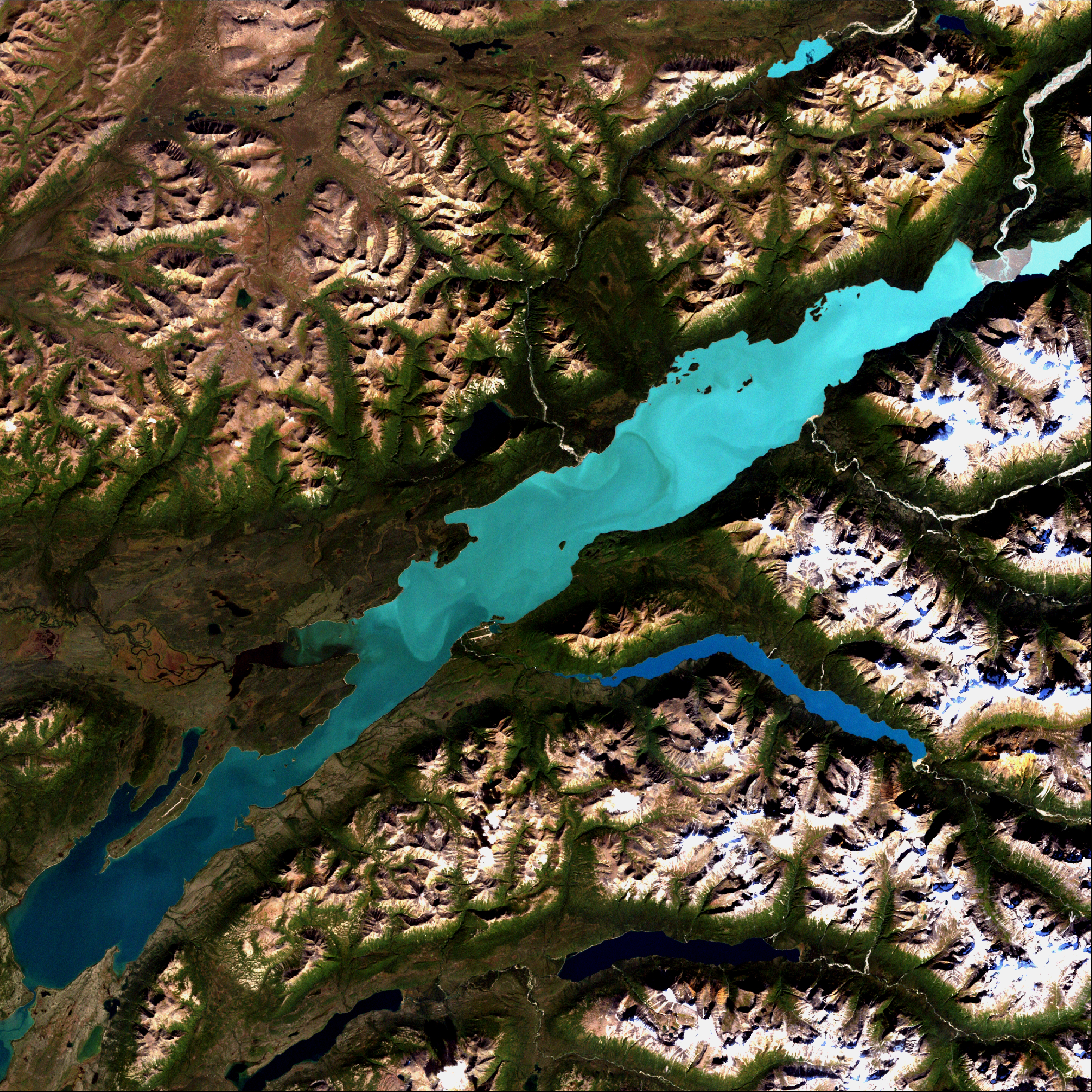
Patterns and Potential Drivers of a Seasonal Glacial Sediment Plume derived from Landsat CDR Data, Lake Clark, Alaska
What are the major findings of your research?
Our major finding was that there is no observable long term trend currently at play regarding Lake Clark water clarity during the growing season. We did find that, in recent years, water clarity is diminished earlier in the spring at the head of the lake but we did not see this trend in the middle or lower part of the lake or when we looked at the lake as a whole.
Additionally we found that water clarity can vary significantly from year to year. We found that water clarity was positively correlated with regional air temperature and negatively correlated with precipitation however the latter was non-significant. It’s likely that in addition to weather patterns, random events related to glacial processes and volcanic eruptions can also influence water clarity via sediment/ash contribution to rivers feeding Lake Clark.
Was the Landsat data archive essential to your research, and if so, why?
Yes. The Landsat archive offered us the longest record of imagery from a single remote sensing campaign. It was helpful to have data come from the same family of sensors (TM and ETM+) for the whole duration of the study.
What were the advantages of using the Landsat data from the Climate Data Record archive?
The main advantage was not having to process the Level-1 images regarding atmospheric corrections. This significantly shortened the amount of time needed to complete the analysis.
Do you think there will be long-term implications for salmon production in Lake Clark?
This study suggests that water clarity has been consistently variable over the last 30 years. This stability benefits aquatic organisms including salmon within Lake Clark.
With Landsat 8 data now part of the Climate Data Record, will you plan to use those data for future research?
It is very likely that Landsat 8 data will be utilized within our Office for additional projects in the near future. We do not have any set plans to continue processing surface reflectance data for Lake Clark but repeat studies utilizing our approach would be very informative.
Co-authors:
Benjamin Jones
Alaska Science Center, U.S. Geological Survey
Krista Bartz
National Park Service – Southwest Alaska Network
Daniel Young
National Park Service, Lake Clark National Park and Preserve
Christian Zimmerman
Alaska Science Center, U.S. Geological Survey
Anyone can freely download Landsat data from the USGS EarthExplorer or LandsatLook.
Further Reading:
+ Landsat at #AGU15


