Monitoring Small Surface Water Bodies in Africa

Monitoring Small Surface Water Bodies in Africa

installing water gages in Kenya
Installing FEWS NET water gages in Kenya. Photo credit: Velpuri et al.

surface water being monitored by FEW NET
The USGS Famine Early Warning Systems Network (FEWS NET), funded by the U.S. Agency for International Development (USAID), has initiated a large-scale project to monitor surface water bodies in the pastoral regions of Africa using multi-source satellite data and hydrologic modeling techniques. Currently, a total of 293 water points are being monitored in 10 countries. (Click image for a larger view.)

Naga Manohar Velpuri, works with the USGS Famine Early Warning Systems Network (FEWS NET). The project has recently initiated a large-scale project to monitor surface water bodies in the pastoral regions of Africa using multi-source satellite data and hydrologic modeling techniques. Currently, a total of 293 water points are being monitored in ten countries. Velpuri shared some of the projects findings he presented at #AGU15.
Presentation title:
Africa-Wide Monitoring of Small Surface Water Bodies Using Multisource Satellite Data: A Monitoring System for FEWS NET
What are the major findings of your research?
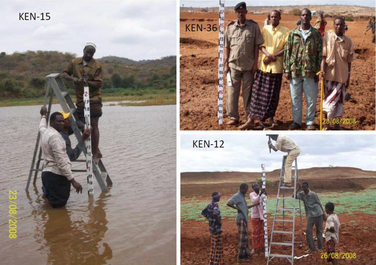
Landsat and ASTER imagery can be used to map small to medium surface water bodies in the remote pastoral regions of Africa.
Due to image complexity in water quality and geographic setting, there is no single index that can be used to delineate the surface area of a waterbody. Hence, a combination approach (that combines outputs from several indices) is used to delineate maximum surface area of the waterbody.
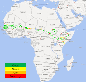
Daily water levels modeling using multi-source satellite data and hydrologic modeling approach adequately captures the seasonality and dryness trends.
What insight did you gain from Landsat that would have been impossible to glean otherwise?
The rich history of Landsat (40+ years) enables not only change detection and trend analysis, but also provides a unique oppurtunity for hydrologic model calibration and validation as shown in this application.
In what ways does this research benefit people?
Information on daily water levels provides first-hand knowledge on water availability and scarcity. Such information is highly useful for local and regional governments.
The up-to-date information on daily water levels and historical data (since 2001) for each water body can be used to derive drought severity information on daily water levels, this can help local nomadic pastoral communities make migratory decisions.
Co-authors:
Gabriel Senay
U.S. Geological Survey Earth Resources Observation and Science
James Rowland
U.S. Geological Survey
Michael Budde
U.S. Geological Survey
James Verdin
USGS/EROS
Anyone can freely download Landsat data from the USGS EarthExplorer or LandsatLook.
Further Reading:
+ Landsat at #AGU15

Get the latest from Landsat in your inbox.


By submitting this form, you are consenting to receive marketing emails from: Landsat Science. You can revoke your consent to receive emails at any time by using the SafeUnsubscribe® link, found at the bottom of every email. Emails are serviced by Constant Contact
On Key

Recent Posts

Map shows South Korea with waterways highlighted. In the top right corner is a north arrow and in the bottom left corner is a legend of different rivers in South Korea.

Monitoring Water Quality in South Korea

South Korea is facing a water quality problem. Researchers Hyunglok Kim and Seongjun Lee from the Gwangju Institute of Science and Technology (GIST) embarked on developing a model to predict water quality indicators in near real-time.

Read More »
Landsat outreach specialist Allison Nussbaum and GEDI/UMD Faculty Specialist Talia Schwelling hold Landsat/GEDI postcards at the NASA exhibit booth at AGU24.

Landsat at AGU24

The NASA Landsat Science and Outreach teams attended the American Geophysical Union’s annual meeting in DC in December. At AGU24, they shared research and educated the public about Landsat.

Read More »
On Key

Related Posts

Map shows South Korea with waterways highlighted. In the top right corner is a north arrow and in the bottom left corner is a legend of different rivers in South Korea.

Monitoring Water Quality in South Korea

South Korea is facing a water quality problem. Researchers Hyunglok Kim and Seongjun Lee from the Gwangju Institute of Science and Technology (GIST) embarked on developing a model to predict water quality indicators in near real-time.

Read More »