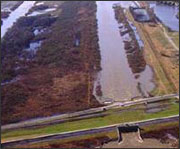
Since the 1930s, twenty-percent of Louisiana’s wetlands have been lost. The culprits are a trifecta of sediment starvation caused by dams and dikes, land subsidence caused by oil drilling, and river channelization that causes remaining river sediments to dump into the gulf instead of being deposited in the marches. Wetland loss is undesirable because the marshes are important to gulf fisheries, migratory birds, and the people and property that they protect from storms. Because of the importance of wetlands the Coastal Wetland Protection, Planning and Restoration Act of 1990 was created to facilitate their restoration. It was thought that by diverting freshwater to the marches, salinity would be decreased, sediments would be increased, and therefore marsh-building plants would thrive. However, after evaluating Landsat imagery of three water diversion projects, Kearney has found that the projects have made the marshes more vulnerable to erosion and have feed unwanted algae.
Of the three freshwater diversions evaluated by Kearney, Caernarvon, the site closest to Katrina’s storm path, lost a staggering 54 square miles of marsh following the 2005 hurricanes—approximately a third of its overall area—and its recovery has been hindered in comparison to non-restoration areas even closer to the storm path.
A new study has been commissioned to revisit plans for future freshwater diversion restoration projects. While such projects have been shown to be successful in other locations, the number of variables involved makes the process far from foolproof.
Further Information:
+ Kearney, M., Riter, J. & Turner, R. E. Geophys. Res. Lett. doi:10.1029/2011GL047847 (2011).
+NatureNews: Wetlands not aided by Mississippi diversions [external link]

Landsat & LCLUC: Science Meeting Highlights
Outreach specialists from the Landsat Communications and Public Engagement team participated in community engagement efforts at the joint NASA and University of Maryland Land Cover Land Use Change (LCLUC) meeting.


