Landsat's Role in Understanding Climate Change
Long-term weather patterns averaged over 30 years or more make up our climate. Human well-being—our infrastructure and agriculture—depend on a reliable climate. This reliability allows farmers to plant seeds in the spring with confidence that temperatures and rainfall will sustain crops in the coming months. It allows communities to build and maintain roads, buildings, and drainage systems best suited to local conditions. Earth’s climate is controlled by the amount of energy that flows through the atmosphere, oceans, and land. By adding heat-trapping gases to the atmosphere—primarily carbon dioxide—people are increasing the amount of energy in the Earth system that would otherwise escape to space. This increase in energy is changing Earth’s climate, and consequently, the weather patterns that people rely on are shifting. Changes in long-term weather patterns have wide-ranging impacts on ecosystems and peoples’ lives. Designed to observe land and coastal ecosystems, Landsat instruments provide an unparalleled space-based record of the impact of climate change on Earth’s landscapes, the growth and loss of carbon- storing.
![Location of Glacier Bay National Park.](https://landsat.gsfc.nasa.gov/wp-content/uploads/2019/12/LamplughGlacierLandslide_43ppt_anno_print-768x576-1.jpg)
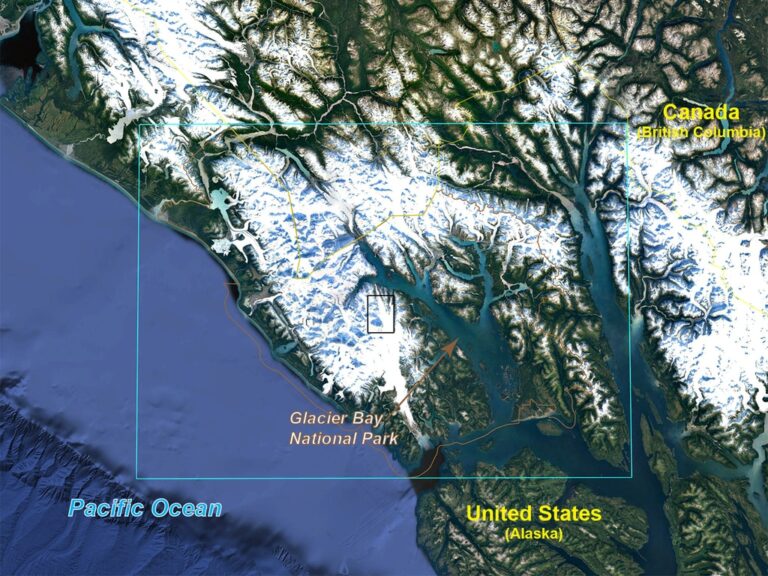
Watching Glacier Bay National Park Change
December 11, 2019 • Dr. Christopher Shuman is a glaciologist with NASA Goddard Space Flight Center and the University of Maryland at Baltimore County. Here is what Chris shared with us
![A gage house](https://landsat.gsfc.nasa.gov/wp-content/uploads/2019/12/AGU19-USGSgagestation-westhopeND-768x576-1.jpg)
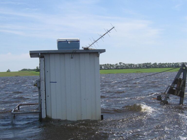
Mapping Past Floods to Help Predict Future Ones
Landsat has enabled a more thorough understanding of how the Central Valley landscape is impacted by floods.
![Meltwater lakes](https://landsat.gsfc.nasa.gov/wp-content/uploads/2019/12/petermann-2019-06-30-crop-legend-1.png)
Ice in Motion: Satellites Capture Decades of Change
New time-lapse videos of Earth’s glaciers and ice sheets as seen from space are providing scientists with new insights into how the planet’s frozen regions are changing.
![A false color Landsat image showing a small portion of Australia's Gulf of Carpentaria](https://landsat.gsfc.nasa.gov/wp-content/uploads/2019/12/Gulf-of-Carpentaria-fc-768x272-1.png)
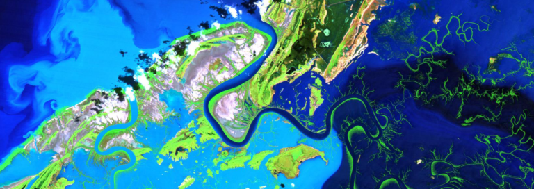
Mapping the Mighty Mangrove
A new longitudinal study from Australia has harnessed thirty years of NASA/USGS Landsat data to map the nationwide movement and migration of mangrove forests.
![Glaciers in southeastern Greenland](https://landsat.gsfc.nasa.gov/wp-content/uploads/2019/08/schweizerland_sept1972_landsat1_mss740.png)
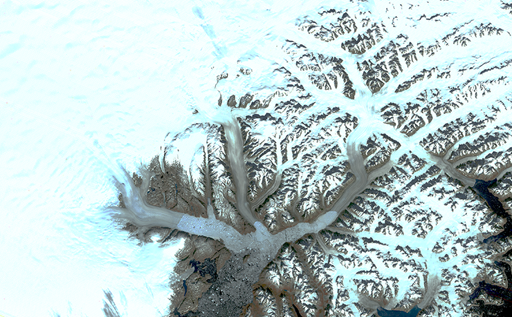
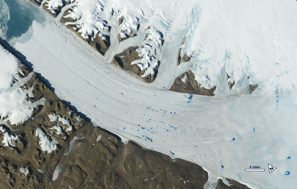
Landsat Illustrates Five Decades of Change to Greenland Glaciers
The branching network of glaciers that empty into Greenland’s Sermilik Fjord has changed significantly in the last half century.
![The plaque that was placed where Okjökull Glacier once stood](https://landsat.gsfc.nasa.gov/wp-content/uploads/2019/08/Ok-plaque-1.jpg)
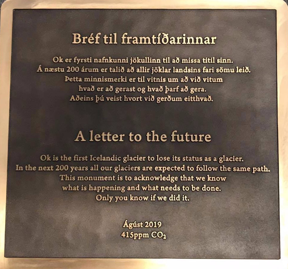
Tribute to a Glacier That Is No More
A memorial was placed on top of the volcano where Okjökull Glacier’s ice once flowed.