
Data in Harmony: NASA’s Harmonized Landsat and Sentinel-2 Project
NASA’s Harmonized Landsat and Sentinel-2 (HLS) project is a groundbreaking initiative that combines data from Landsats 8 & 9 with the European Space Agency’s Sentinel-2A & 2B satellites.
ExtraDimensional—The Fusion of Landsat & GEDI
When Landsat’s vast decades-long archive is combined with data from other instruments it can provide amazing insight into how our world is evolving with us and around us. Here are some of the ways Landsat and GEDI data are being harnessed to help us better understand the complex relationship between humanity and nature.
From Orbit to A.I.—Harnessing Machine Learning with Landsat Data
Over the past few years, machine learning techniques have been increasingly used to analyze the vast amount of data collected by the Landsat mission, which has been circling the globe for over 50 years.
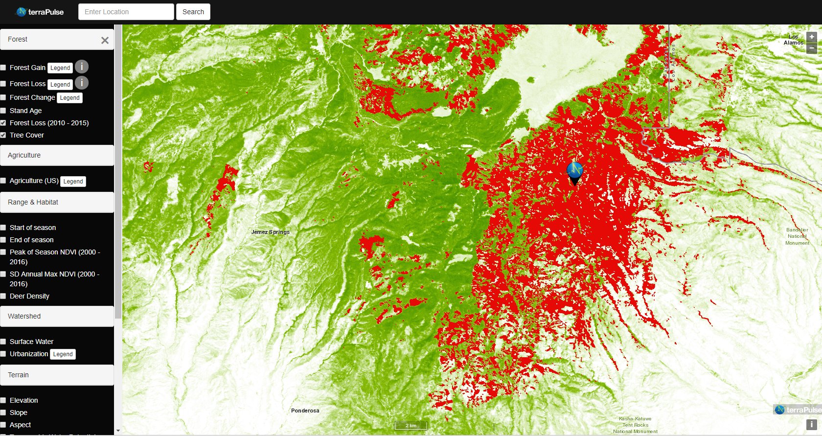
Taking the Pulse of Earth
Applying AI to Earth data—including Landsat—helps terraPulse reveal sustainable options for farming, reforestation, and land management.
NASA-Led Project Tracking Changes to Water, Ecosystems, Land Surface
Merging data from multiple satellites, OPERA can help government agencies, disaster responders, and the public access data about natural and human impacts to the land.

The Satellite Stewards of Glacier Bay
Nestled in the science-based information that park rangers share with visitors to Glacier Bay National Park and Preserve are insights from Landsat satellites and NASA climate scientists.
